


Frigid end to January ahead, temperature roller coaster to follow
INDIANAPOLIS (WISH) — We had an active start to the workweek with snow and mixed precip across central and southern Indiana for the first half of Monday. Now, our attention turns toward the coldest air of the year to close January. Temperatures are set to be up-and-down overall in this extended forecast.
Monday night: We’re in for a bitterly cold night under mostly cloudy skies as temperatures fall into the mid teens. Untreated roads from activity earlier in the day will remain slick. Wind chill values will fall into the single digits.


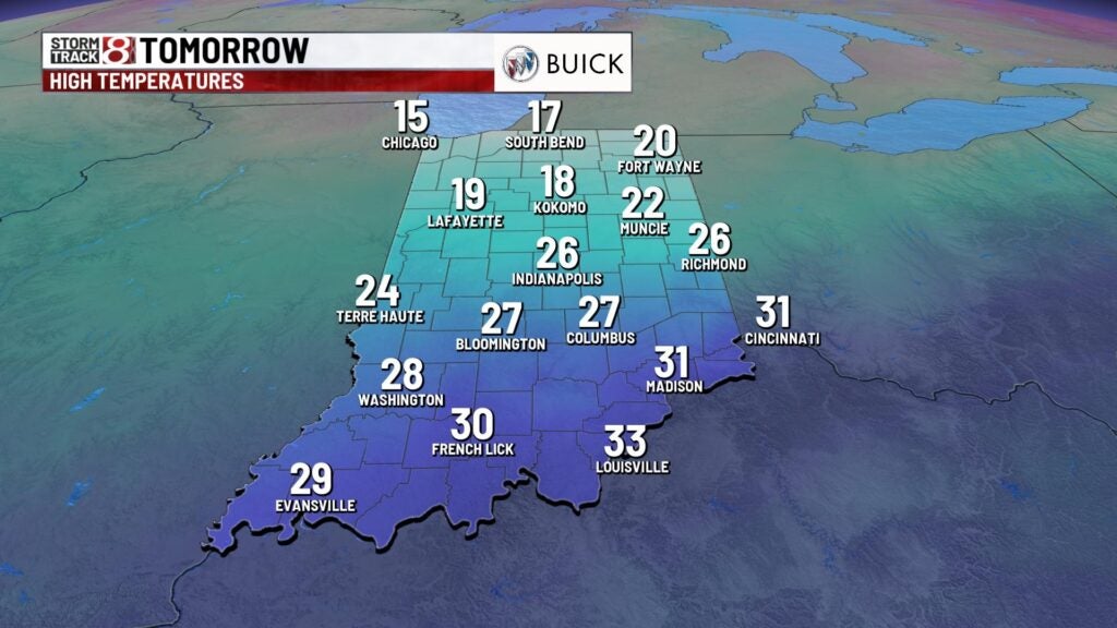
Tuesday: The coldest day of the year arrives for our Tuesday as we close out January. We are going to struggle to warm up during the day despite lots of sunshine around. Highs will only sneak into the low to mid 20s.


Wednesday: A slightly warmer, yet chilly, Wednesday will be on deck to start February. We will also keep dry air and abundant sunshine around. Highs look to rise into the upper 20s to low 30s.

8-Day Forecast: Thursday continues the warmup with highs pushing the upper 30s. However, we will practically go back to square one on Friday with highs retreating back into the mid to upper 20s. Then, we’ll go right back to a warming trend throughout the first weekend of February. Highs are set to get back into the 40s by Sunday. Much of this extended forecast is set to be dry.
