


Frigid for the remainder of the week
INDIANAPOLIS (WISH) — We started our Wednesday in the 40s before temperatures began to fall by sunrise. Much colder air will continue to slide into the state as we are looking at a bitter second half of the week.
Wednesday night: Temperatures will continue to tumble tonight as winds stay breezy. Active weather is going to stay in southern Indiana. A few flurries may take place into north central Indiana tonight as well.


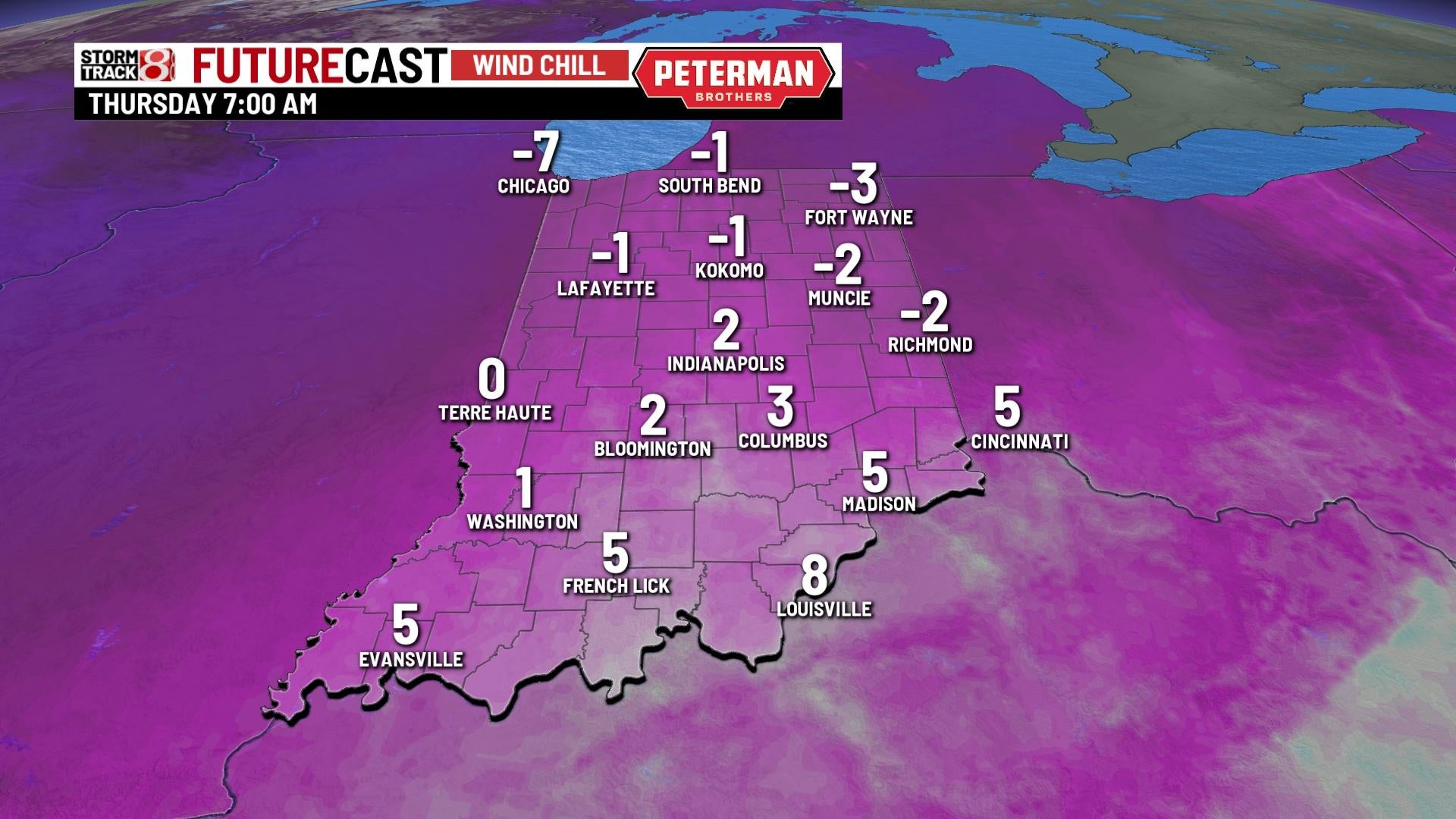
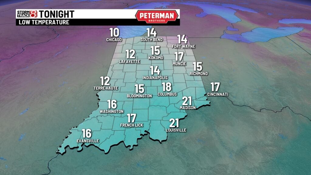
Lows are set to fall into the mid-teens. Some areas could encounter subzero wind chills by Thursday morning.

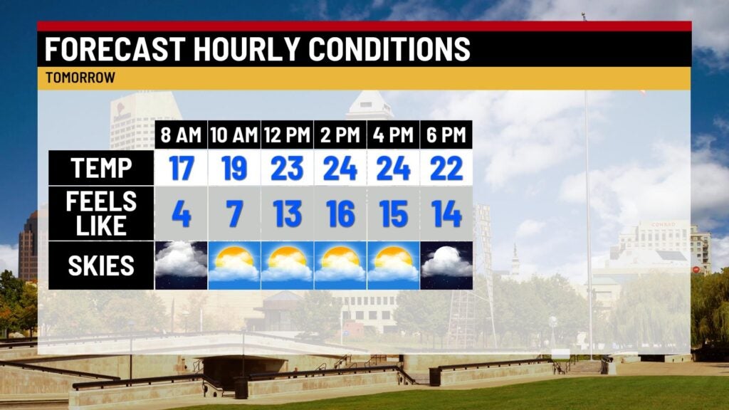
Thursday: Have the heavy winter coat ready to go for your Thursday. Although skies will be partly cloudy, we will struggle in the temperature department. Highs will only creep into the mid 20s.


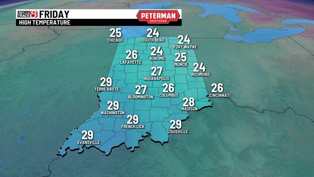
Friday: There is not going to be much improvement temperature wise for Friday. Below average numbers stick around as we bring in mainly clear skies. Highs will rise into the mid 20s.
8-Day Forecast: We will slightly rebound for Saturday with highs in the low 30s. Snow chances look to return by Sunday and linger into the beginning of next week. Temperatures will continue to stay below average through much of the extended forecast.
