Heat wave begins tomorrow
INDIANAPOLIS (WISH) — Rain chances are ending across much of central Indiana. Dangerous heat will now move in for next week.
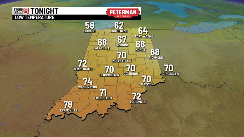
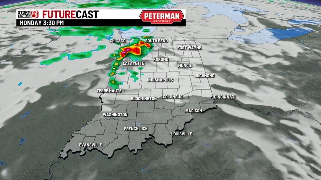
TONIGHT: An isolated storm is possible early on in the night, but most of central Indiana will remain dry. Clouds will then decrease through the early morning hours. However, we could see some patchy fog develop with the warmer above us. Low temperature around 70 degrees.
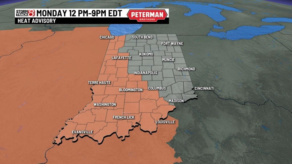
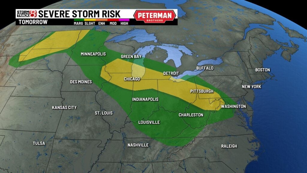
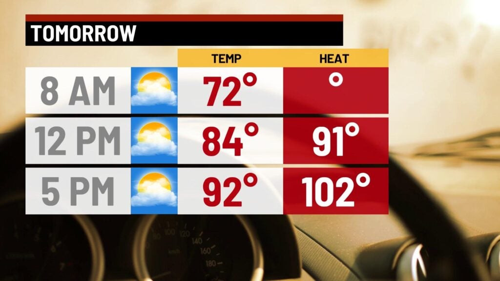
TOMORROW: Hot and humid. There is a heat advisory in place for parts of central Indiana. These spots will easily have heat index values eclipse 100 degrees. Isolated storms are also possible mainly north late in the day which is the reason for the slight (2/5) risk of severe weather. High temperatures in the low to mid 90s.
TUESDAY: This will likely be central Indiana’s hottest day of the week with plenty of sunshine. Dew points still remain in the 70s which means heat index values will once again be in the triple digits. High temperatures in the mid to upper 90s.
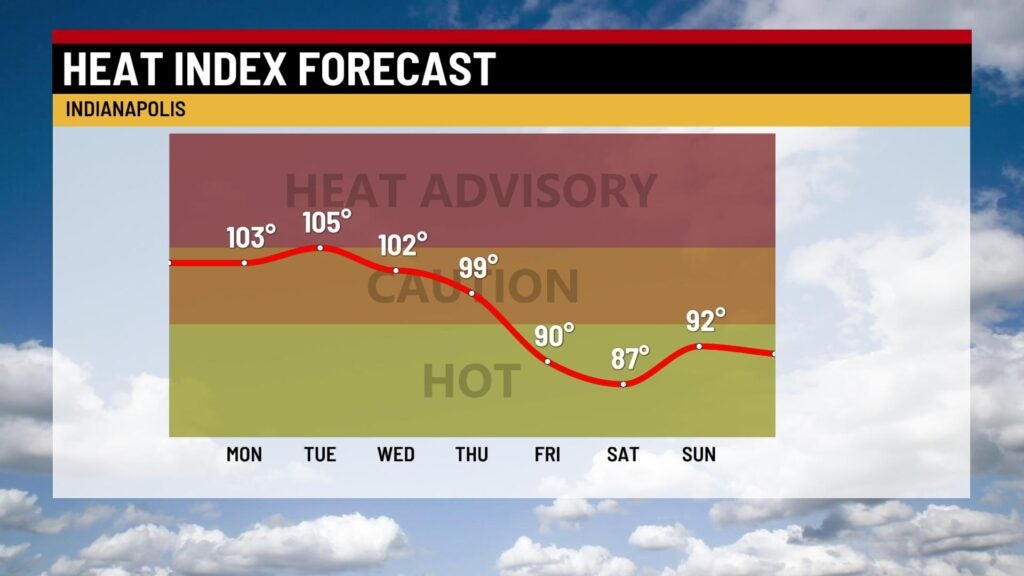
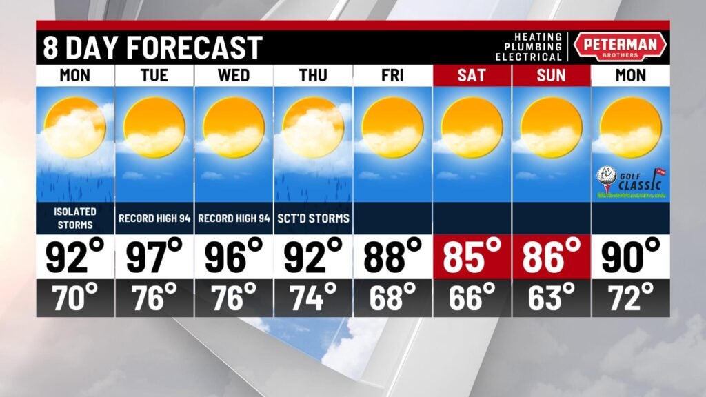
8-DAY FORECAST: A heat wave is likely next week which is considered 3+ days in a row of at least 90 degrees. We should be in the 90s from Monday-Thursday. There is a chance of a few storms on Thursday that could bring some relief along a weak cold front. Temperatures should be dipping back into the 80s by next weekend.