


Not as hot Thursday, but storm chances stick around
INDIANAPOLIS (WISH) — A hot and muggy Wednesday has led way to showers and storms moving into northwestern Indiana during the early afternoon hours. We’ll keep active weather around for the remainder of the week with slightly cooler temperatures.
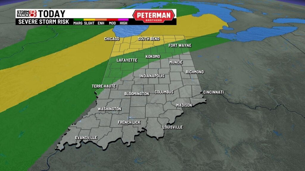
A Severe Thunderstorm Watch remains in effect until 9 PM EDT for portions of western and northern Indiana.

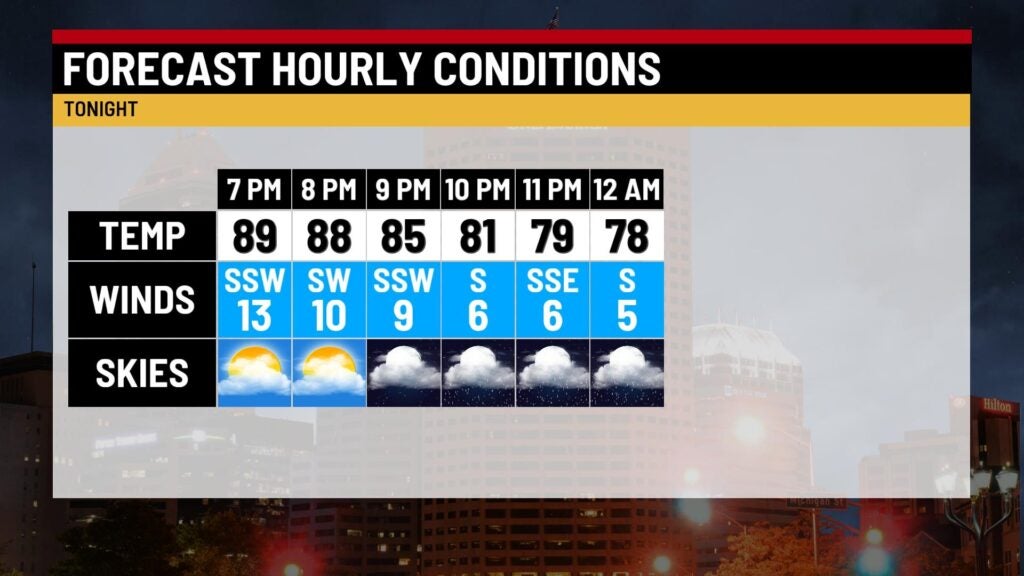
Wednesday night: Scattered showers and storms will continue to slide southward going into the evening and nighttime hours.
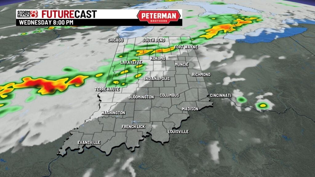

There is a threat for isolated strong to severe storms mainly for areas north and west of Indy until the nighttime hours. The primary concerns are damaging winds and isolated large hail. Torrential rainfall and frequent lightning will accompany any general storm.
Due to the active weather and increasing cloud cover, we’ll stay on the warm and muggy side tonight with lows only falling into the low to mid 70s. Winds will also die down a bit after having a breezy day.

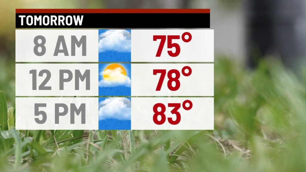
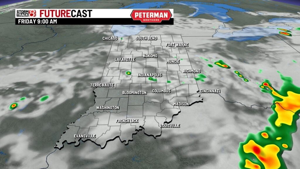
Thursday: Have the umbrella handy as on and off activity is expected throughout our Thursday.


We can’t rule out isolated strong to severe storms mainly southeast of a Rushville-Bedford line with damaging winds being the main threat.

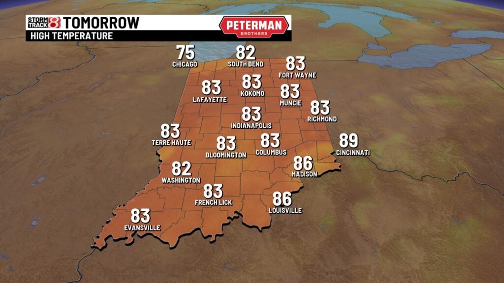
Highs look to fall back into the low to mid 80s, but it will still feel miserable due to higher humidity values.
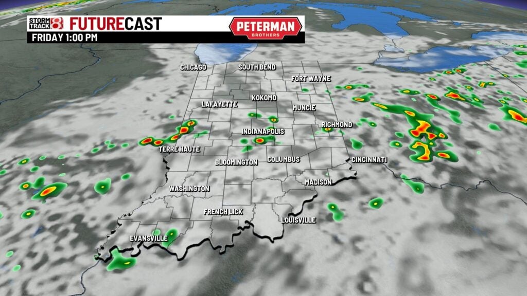
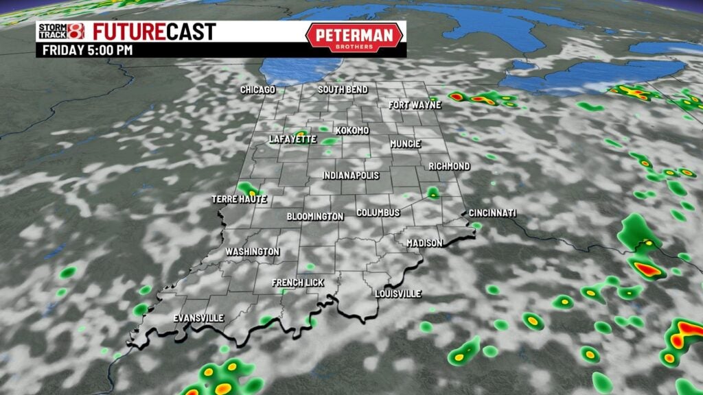
Friday: The end to our workweek is set to practically mimic Thursday’s forecast. On and off showers and storm chances with muggy air will be in place. Highs are set to rise into the mid 80s.

8-Day Forecast: Hot and muggy weather look to lock in for the upcoming weekend with highs close to the 90° mark. Chances for storms will also remain with us through the weekend and into early next week. Temps will then return to near normal numbers by next Monday.
