


One more nice afternoon, then big changes ahead
INDIANAPOLIS (WISH) — Cloud cover built in for our Tuesday as we had a mainly gloomy day across the state. Temperatures still managed to rise into the 60s for many locations. We have one more fantastic day ahead before a major pattern shift swings in starting on Thursday.
Tuesday night: After a mainly cloudy day, skies will gradually clear out during the nighttime hours. We can’t rule out scattered sprinkles after sunset. Lows will bottom out in the mid to upper 40s.


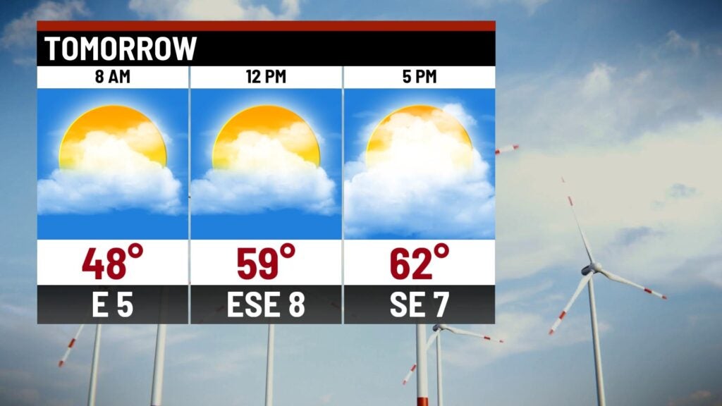
Wednesday: A brighter day will be in store for our Wednesday with a few passing clouds. Highs look to rise into the low to mid 60s for what will be another pleasant fall afternoon.

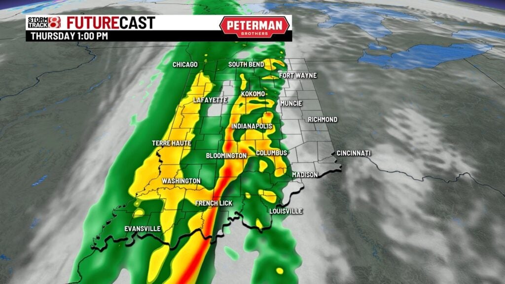
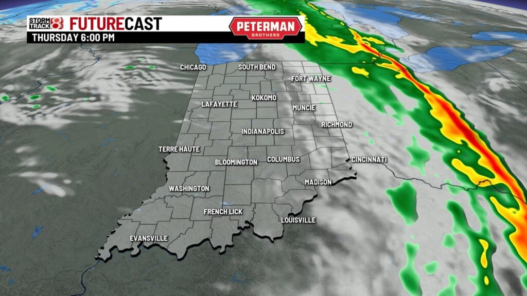
Thursday: Cloud cover is set to quickly build back in ahead of our next weather system. Prepare for a wet and windy day with rain showers likely throughout a good chunk of our Thursday.

Highs will struggle to get into the 60s.
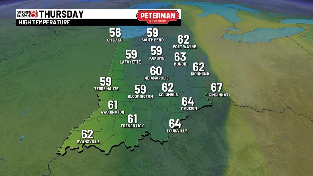
8-Day Forecast: We will continue to drastically drop our temperatures through Friday and into the upcoming weekend. There is the chance for a few rain and snow showers Friday with highs in the upper 40s. Highs will then struggle to get out of the 30s on Saturday and Sunday. Additional rain and snow shower chances are in place for Sunday before we gradually warm things back up.
