


Rain, storm chances continue into Thursday
INDIANAPOLIS (WISH) — We worked back in active weather for our Wednesday with on and off showers and storms. Along with the activity, we cranked up our humidity values as well. Rain and storm chances are set to stick with us over the next couple of days.
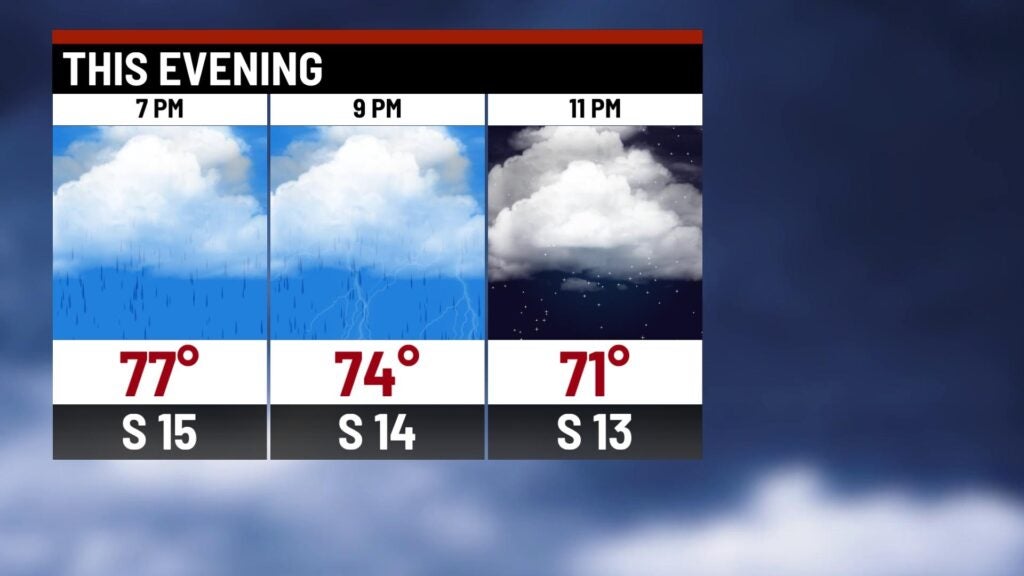
Wednesday night: On and off showers and storms stay with us going into tonight.
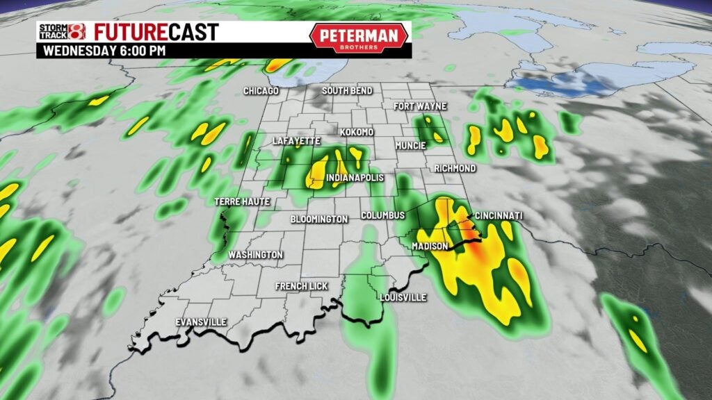


The threat for isolated strong to severe storms remains until sunset tonight as well. A Slight Risk (level 2/5) of severe weather is in place from Indy and points north. The remainder of the state sits in a Marginal Risk (level 1/5). Damaging winds are the primary threat, but isolated tornadoes are also possible with the greater tornado threat from interstate 70 north.

Lows are set to be mild with numbers dipping into the mid 60s.

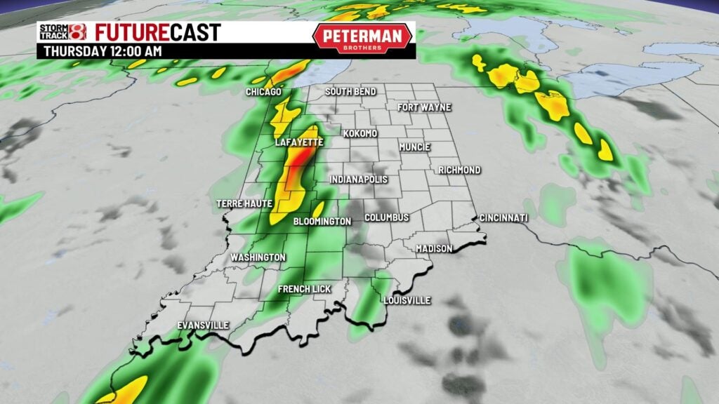
Thursday: Keep the rain gear on hand as we won’t stop the active weather train for our Thursday. Expect another active day with scattered showers and storms throughout the day.


There is a threat for isolated strong to severe storms with much of the state in a Marginal Risk (level 1/5) for severe weather. Damaging winds and hail are the main threats.

Highs look to rise into the mid 70s with higher humidity values sticking around.


Friday: Another round of showers and a few storms will roll in for Friday. Carb Day at IMS is set to take place on Friday as well, and the rain may affect some of the activities. You will want to keep an eye on radar if you have plans to go IMS.


It will be on the cooler side to end the week with highs only reaching the upper 60s.

8-Day Forecast: After an active end to the week, dry weather is set to finally return just in time for race weekend. Saturday is looking marvelous with highs in the mid 70s and plenty of sunshine. Race day on Sunday still looks to be on the warmer side with a little bit more humidity. By Memorial Day, the heat is set to come back with highs flirting around the 90° mark through midweek.
