Saturday Night Weather
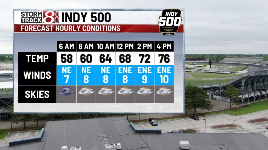
Some high thin clouds started to move into Indiana on Saturday. These clouds are connected to a weather system in the Southeast U.S. Sunday, the clouds will get thicker and could produce a few brief sprinkles. However, there should be little or no impact on the Indy 500. For the most part, we will see our warming trend roll on through the Memorial Day holiday. And there is a bonus, the warmer temps will come without much humidity increase until next week.
This evening – Mostly cloudy and dry with comfortable temperatures in the 70s.
Tonight – Cloudy, dry and not as cool. Low 58
Sunday – Mostly cloudy with a slight chance for a sprinkle. High 83
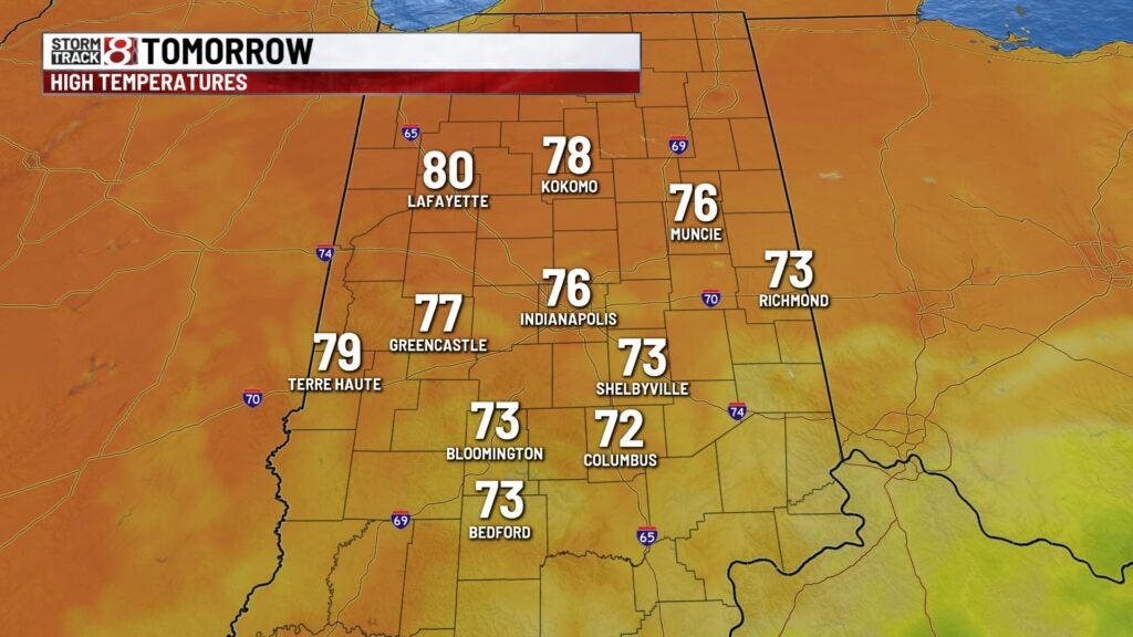
Memorial Day – Becoming partly cloudy and a little warmer. High 86.
Extended Outlook (Tue – Sun)
Gradually getting warmer with more humidity. High temperatures will be in the mid to upper 80s all week. there is a chance for some spotty showers on Friday.