


Severe storm threats diminish from earlier predictions; wind advisory Thursday
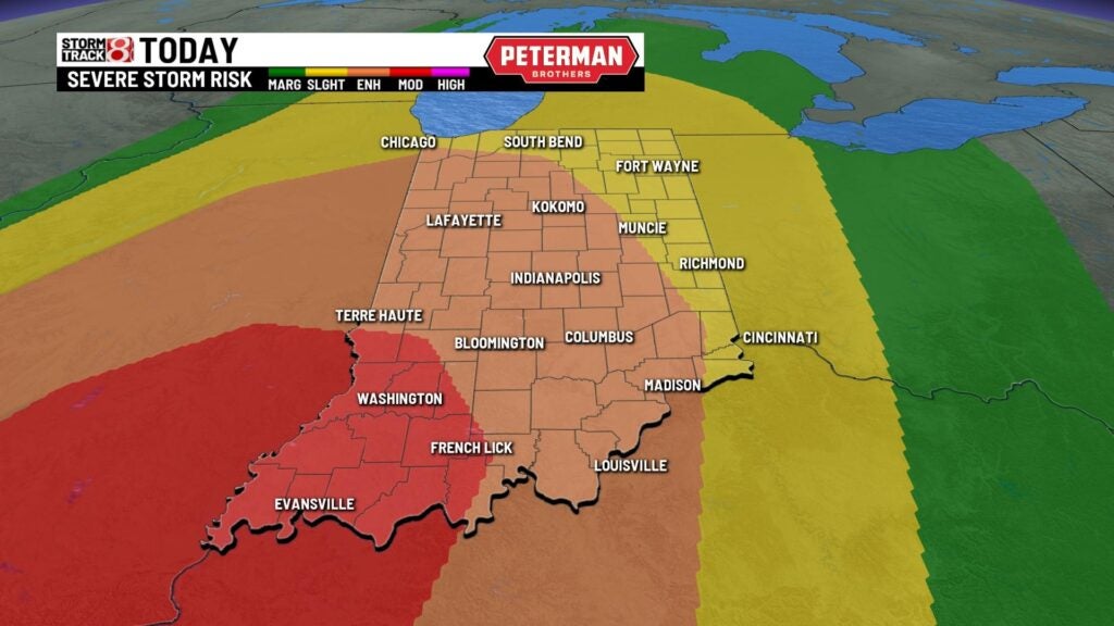
LATEST: The level of risk from Wednesday storm threats has diminished. However, a wind advisory has been issued for much of northern Indiana from 11 a.m. to 8 p.m. Thursday.


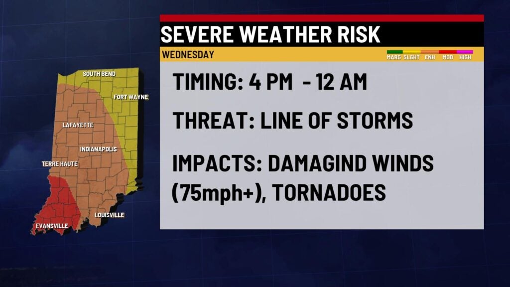
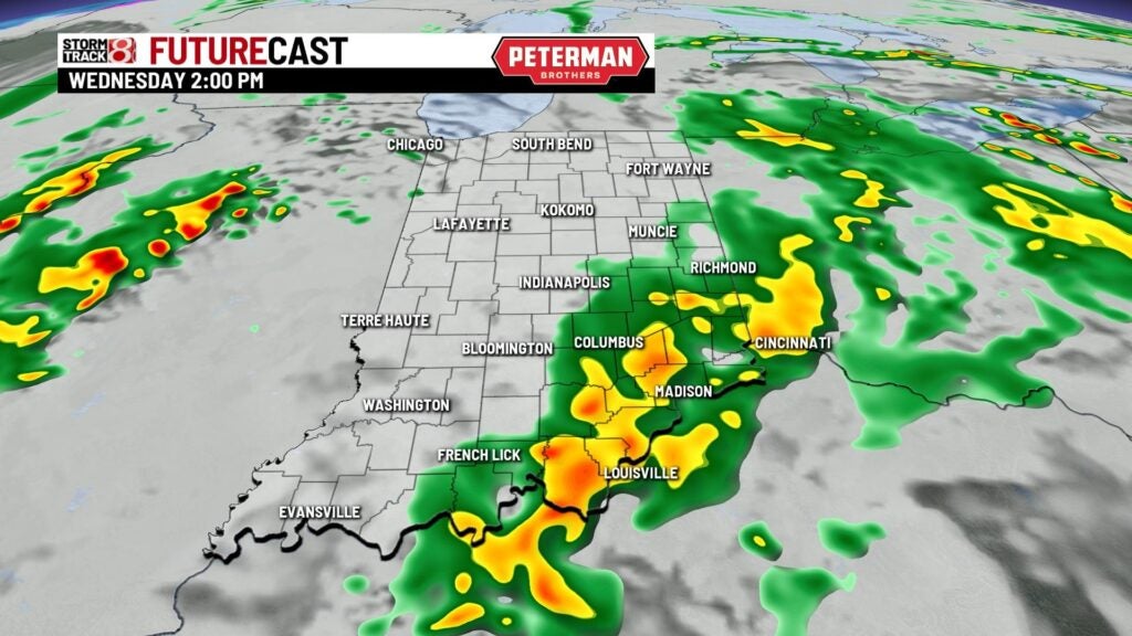
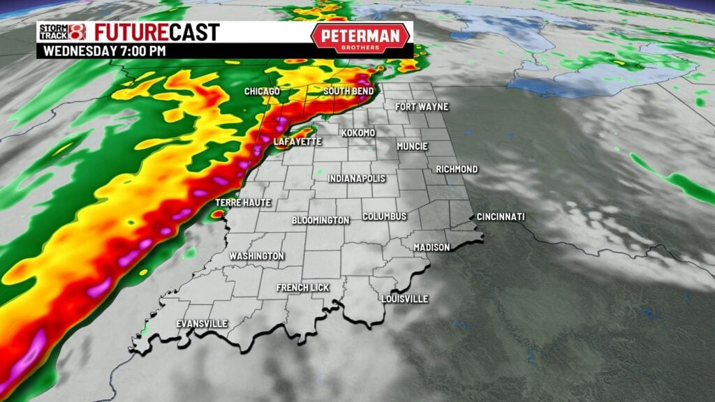
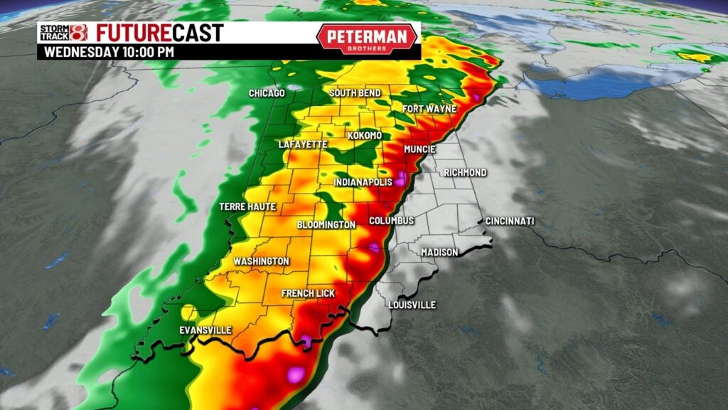
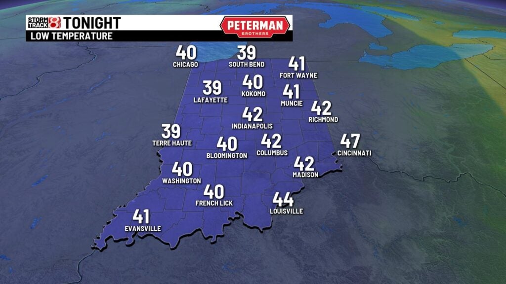
INDIANAPOLIS (WISH) — A quiet and warm start to the day with temperatures in the upper 60s to near 70°. There could be a few showers popping this morning. Not expecting anything severe this morning. The severe weather risk arrives late this afternoon and early evening. The line of storms moves in from 6 p.m. to 10 p.m. This line could bring damaging winds, tornadoes, and hail. Rain and storms should move out by midnight. Lows tonight will fall to the lower 40s.


Much cooler to end the week with highs Thursday and Friday with most spots in the upper 50s to lower 60s with a mix of sun and clouds.

Even cooler heading into this upcoming Easter weekend with highs continuing to cool to the lower to mid 50s with lots of sunshine! Cooler temperatures will trend through next week with highs Monday and Tuesday in the lower 50s. We near the mid 60s by mid week next week!
