Snow, gusty winds and falling temperatures
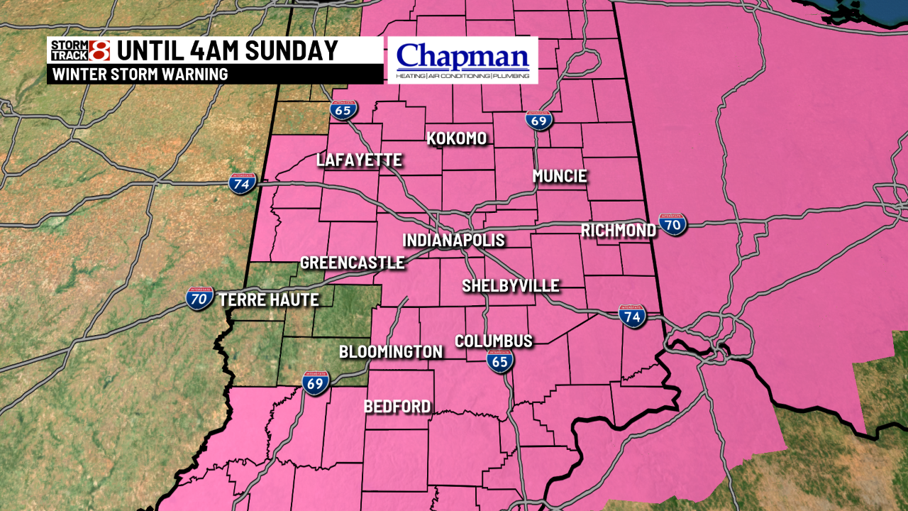
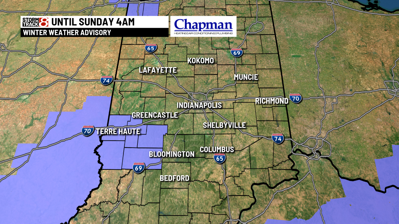
INDIANAPOLIS (WISH) — A Winter Storm Warning and Winter Weather Advisory is in effect for all of central Indiana until 4am Sunday.
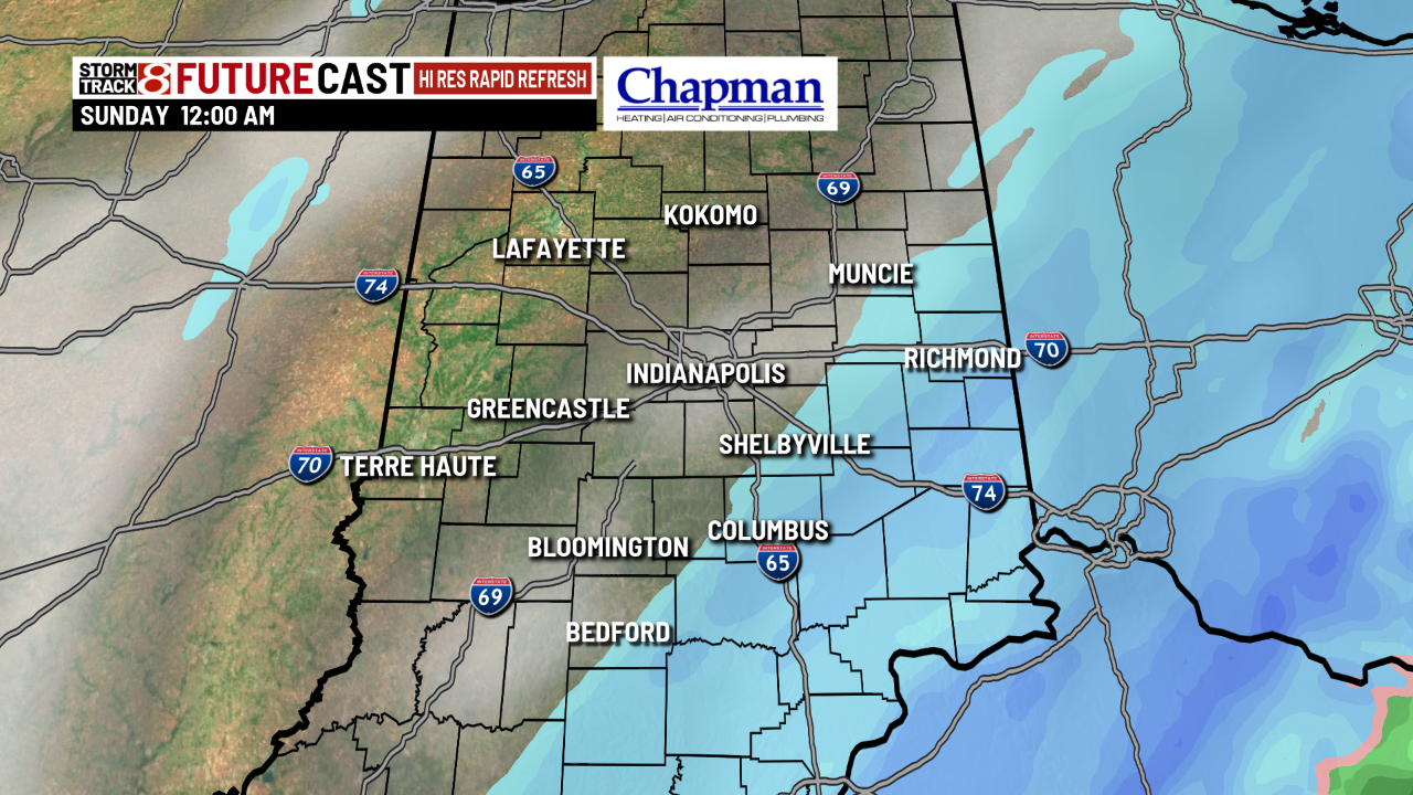
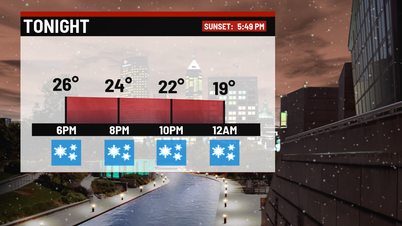
After starting out as rain and freezing rain the precipitation will change over to all snow tonight. The snow will be moderate to heavy at times with considerable blowing and drifting snow. The snow finally comes to an end around 2 or 3 a.m.
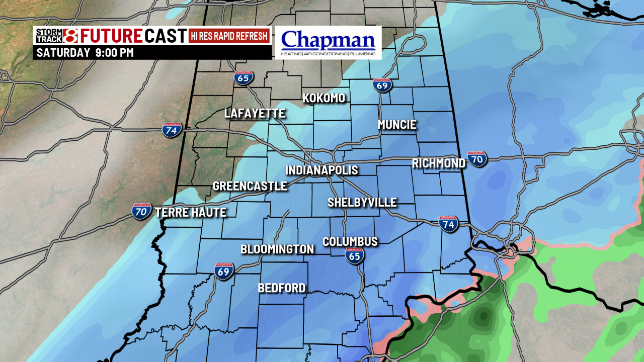
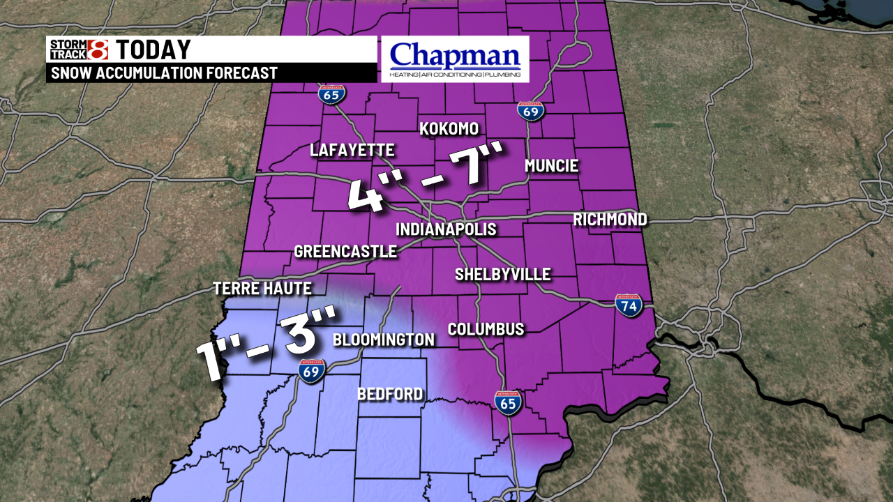
Total snowfall accumulations look to be in the 4-7″ range. While there may be some areas that pick up a little more the wind and falling temperatures will create a bigger impact than total snowfall accumulation.
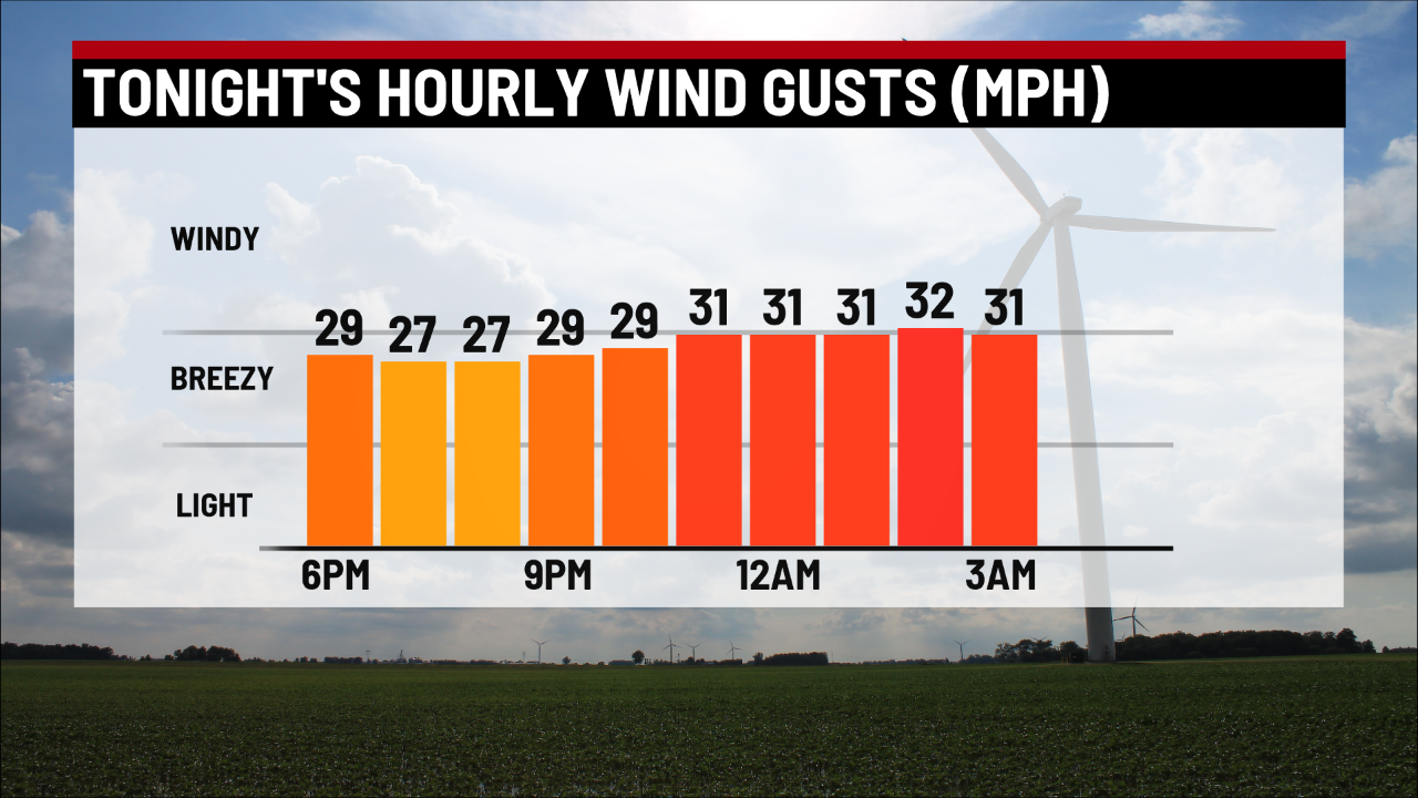
Winds will pick up and gust around 30 to 35 m.p.h at times. This will create blowing snow which will reduce visibility.
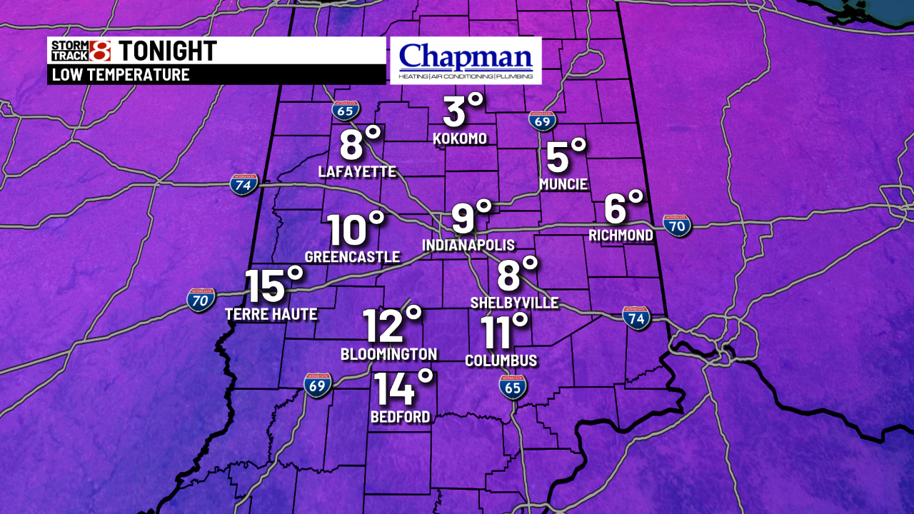
Temperatures crash tonight. Lows fall into the single digits in many spots. So any wet surfaces from the rain and snow this morning will likely freeze creating slick spots.
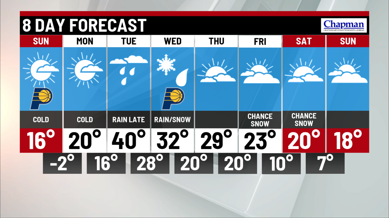
Skies become partly cloudy tomorrow. Some areas north of Indy may see a few lake effect snow showers.
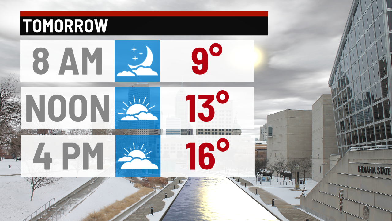
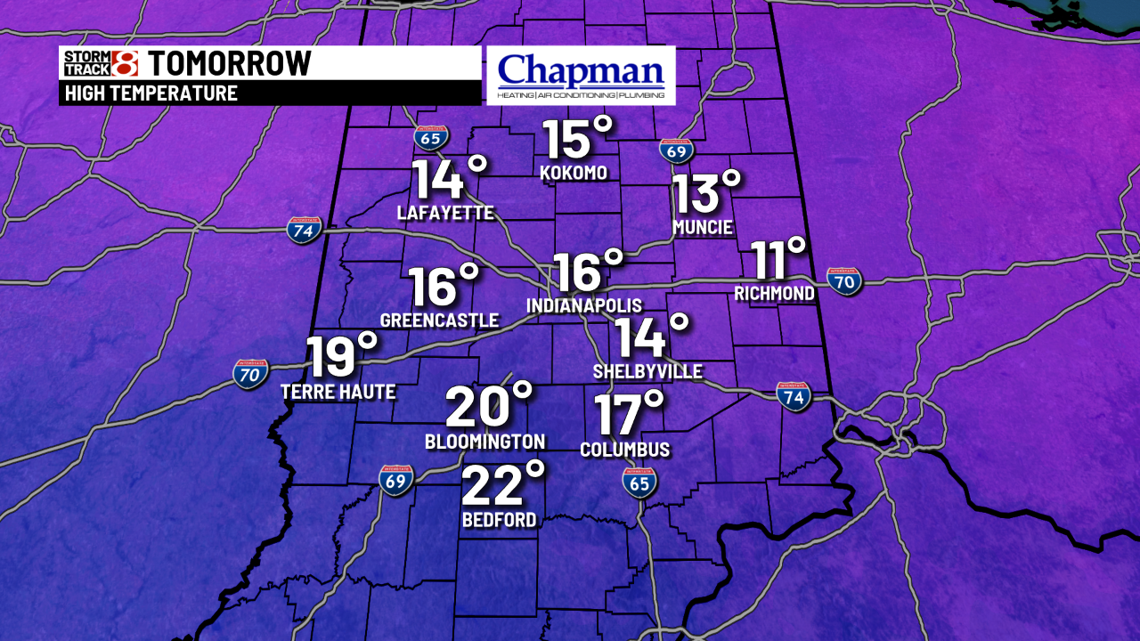
It’s going to be cold tomorrow. Highs will stay in the teens during most of the day.
Subzero lows are possible early Monday morning. Highs climb into the upper teens near 20 with mostly sunny skies. Temperatures warm a little Tuesday with rain possible. But temperatures drop again for the end of the work week.