


Snowy Saturday night
INDIANAPOLIS (WISH)–Moderate to heavy snow will continue through the night.
TONIGHT: Winter Storm Warnings and Winter Weather Advisories are in place across central and northern parts of Indiana through Sunday.
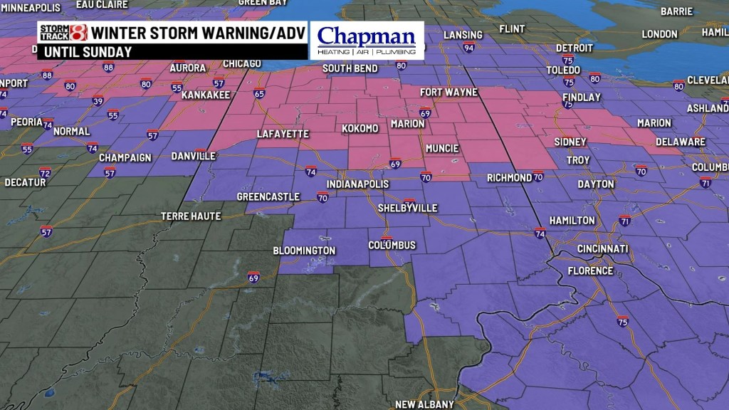
Moderate to heavy snow will continue through the evening and early overnight hours. It will be windy which may cause some blowing and drifting of the snow. Expect snow to be the heaviest in the northern part of the state, moderate along the I-74 corridor with southern Indiana picking up little to no snow at all. The snow eventually changes over to a few scattered rain showers after midnight in central Indiana while snow continues in the northern part of the state.


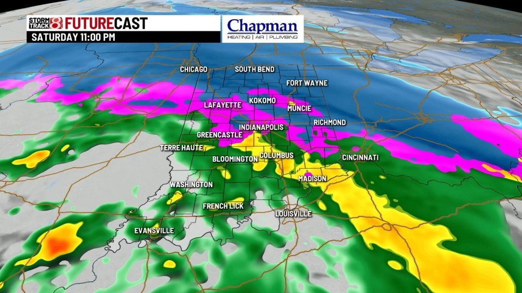
The rain/snow transition line will be right along the I-74 corridor. Snowfall in northern Indiana may reach 6-8″ while areas in central Indiana see 1-3″. Lows fall to 34.


SUNDAY: Scattered rain showers will be possible to start off Sunday morning while a few snow showers continue in northern Indiana. It will be breezy with highs in the upper 30s. Rain showers change over to a few snow showers late Sunday afternoon and evening.


SUNDAY NIGHT: Cloudy with a few scattered snow showers. It will be breezy with lows falling into the upper 20s.
MONDAY: A few lingering flurries will be possible on Monday. Look for mostly cloudy skies with highs climbing into the low 30s. Winds still may be breezy at times out of the west at 10-15 mph.
8DAY FORECAST: Quiet weather takes over with lots of sunshine on Tuesday and Wednesday. Highs stay in the middle 30s. Another system heads this way for the end of the week. This one may bring a good chance of rain to the area as temperatures climb into the lower 40s Thursday. A rain/snow mix is possible on Friday. Right now it looks like much colder air will filter into the area late in the weekend.
