Soggy Saturday ahead
INDIANAPOLIS (WISH) — Wet weather ushers in well below normal temperatures before we end the weekend.
Today:
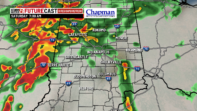
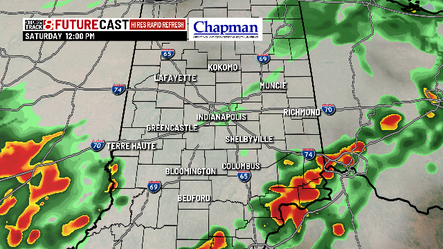

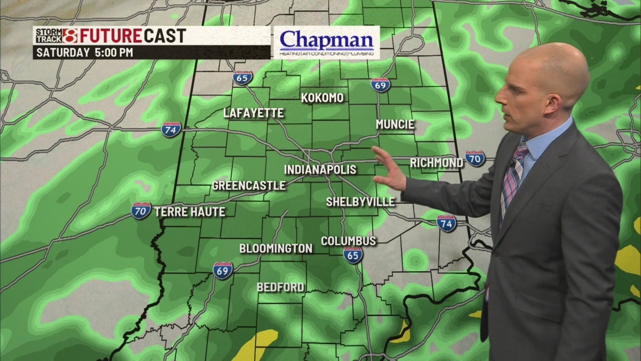
A slow moving cold front will continue to push rain into central Indiana today. Expect scattered showers across much of the area this morning, with a brief lull in the action around midday. Another wave of rain, and possibly a few thunderstorms will work into the area this afternoon into the early evening. Rainfall amounts range between 0.50″-1.0″.

Temperatures will gradually fall through the day, with highs in the middle 50s this morning, falling to the 40s this afternoon.

Tonight:
Precipitation will continue to push through the area, and with colder air rushing in, we could see some light snow showers mixing in with rain for the early evening hours. Precipitation should exit by mid to late evening.

Lows fall to the middle 20s overnight.

Sunday:
Much colder day on tap to wrap up the work week. Expect partly cloudy conditions, with highs in the upper 30s and lower 40s.

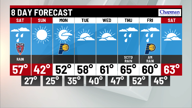
8-day forecast:
Temperatures will rebound nicely heading into the work week. Highs bounce back to the lower 50s on Monday and push to near 60 starting Tuesday. Next weather maker moves in Thursday and Friday, with showers possible to wrap up the work week.