Stifling heat and storm chances continue
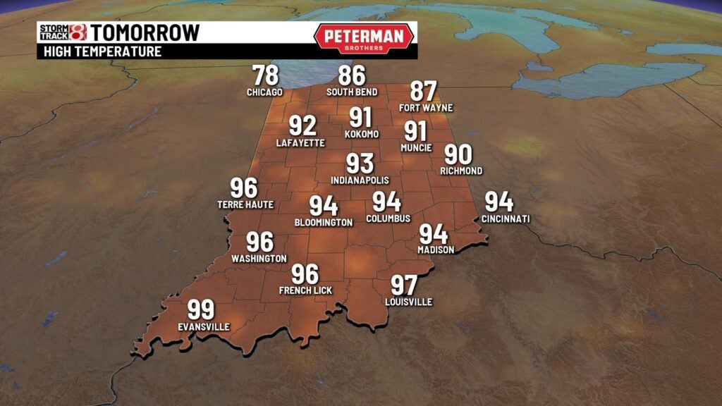
INDIANAPOLIS (WISH) — Today was officially the hottest day of the year with a high of 99°, and this was our hottest day since July 25, 2012. These warm temperatures and high humidity values will continue to bring several chances of showers and storms over the next few days.
A Heat Advisory remains in effect until 9 PM EDT Wednesday night.

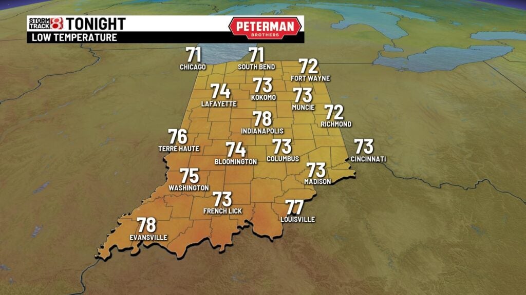
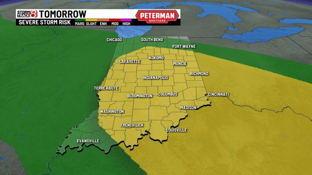
Tuesday night: Hot and humid conditions will last into the evening. Late storms will develop bringing the possibility of strong to severe thunderstorms. There is a Slight Risk (level 2/5) for severe weather for all of central Indiana with damaging winds as the primary threat. Flooding issues could become a concern, especially for those in northeastern Indiana. Immense cloud cover will remain overnight with lows only dipping into the mid to upper 70s.


Wednesday: The hot and humid trend will linger going into Wednesday. 90 degree temperatures will remain with us, and so will the chance for showers and storms. Isolated severe thunderstorms are once again possible with damaging winds being the main threat. Flooding will also continue to be a threat.

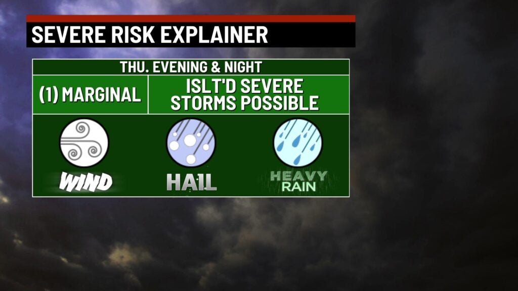
Thursday: Another 90-degree day will be added to this week of very hot weather. Scattered showers and storms are once again likely to develop throughout the day. There is a Marginal Risk (level 1/5) for isolated strong to severe storms with damaging wind being the main concern.

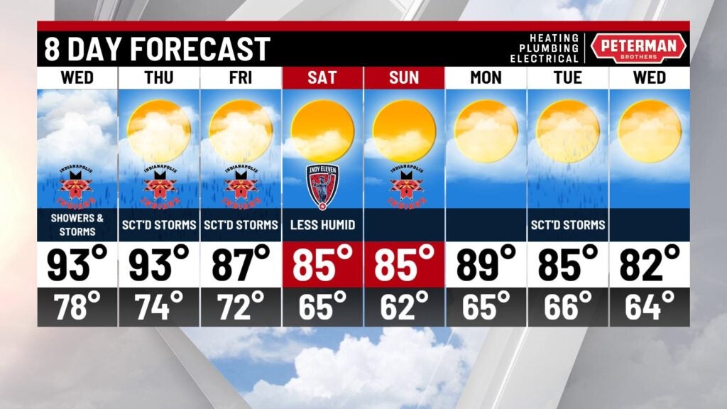
8-Day Forecast: Be sure you grab your umbrella when you leave the house Friday morning; showers and afternoon storms are likely. Temperatures will reach the upper 80s and clouds will decrease overnight. Rain chances will diminish going into Saturday. Conditions are ideal for any weekend plans. Enjoy dry and slightly cooler conditions Saturday and Sunday.