


Stormy Sunday
INDIANAPOLIS (WISH)–We’re in store for a soggy Sunday with showers and thunderstorms throughout the day and night.
TODAY: A warm front is going to lift northward throughout the state. This will produce showers and a few thunderstorms this morning and during the first part of the day. Once the warm front lifts north in the afternoon, we’ll get a lull in the precipitation. There’s going to be a wide range of highs in Indiana: 50s up north, 60s in Indianapolis and 70s in southern Indiana.


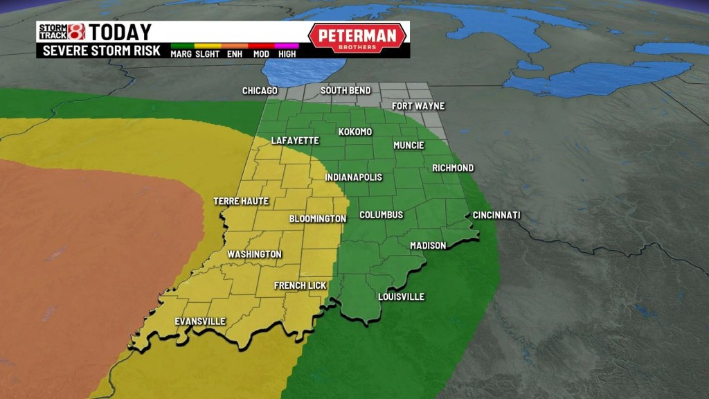
TONIGHT: A cold front approaches the area later tonight. This will allow a line of showers and storms to form and move east. Some of these storms may be on the stronger side with gusty winds, heavy rainfall and an isolated tornado. This line will move through after 10 p.m. A Flood Watch is in place for areas north of Indianapolis. Rainfall amounts may approach 1-3 inches.


MONDAY: Showers continue for the first part of the day Monday. It will be cloudy with highs early in the day around 60. Temperatures fall back into the 50s for the afternoon.


TUESDAY: We’ll see some sunshine with partly cloudy skies. It stays dry and temperatures drop a little into the upper 50s.
8DAY FORECAST: We’ll stay dry for much of the day on Wednesday with partly cloudy skies. A storm system approaches the area late Wednesday bringing a chance for some showers. Rain chances continue through the end of the week with highs dropping into the upper 50s near 60. It looks like right now we may see a dry Sunday for the Colts home game.
