


Strong storms possible Saturday evening
INDIANAPOLIS (WISH) — Strong thunderstorms are possible later this evening into the first part of the overnight hours.
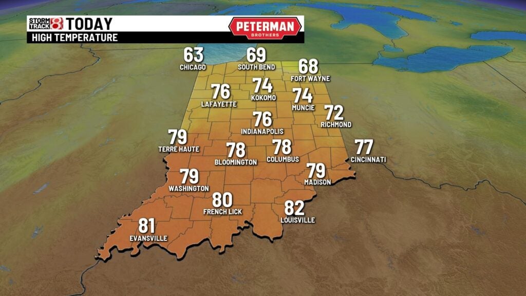
TODAY: It’s going to be a warm and breezy day. Skies stay mostly cloudy for the first part of the day. We may even see a few light showers across parts of the state this morning. If we see peeks of sunshine this afternoon that will provide enough warmth and destabilize the atmosphere fueling strong thunderstorms later tonight. If we see more cloud cover through the day the risk of these storms reaching severe limits decreases. Either way we’ll see see a chance for showers and thunderstorms this evening, but the severity depends on whether or not we see sunshine. Highs today climb into the middle and upper 70s. Winds will gust out of the south near 20 and 25 mph.


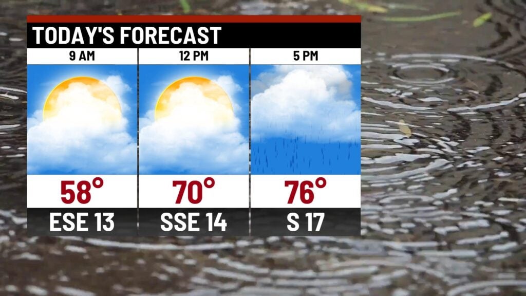
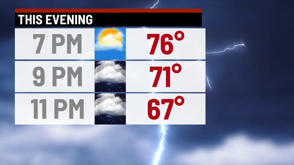
TONIGHT: A cold front sparks off the chance for showers and storms. Some of the storms could be on the stronger side. We have a slight risk in place for Indianapolis and western Indiana. This is a level 2 out of 5 for severe weather risk. All severe weather risks are in play tonight. Hail, damaging winds and an isolated tornado will be possible. The timing for seeing these thunderstorms will be between 7pm and midnight.


SUNDAY: A few showers/storms may linger into the first part of daybreak Sunday. Otherwise skies begin to clear and we’ll see a nice end to the weekend. It will still be breezy with highs in the lower 70s.


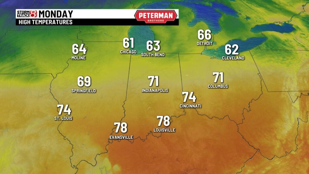
MONDAY: A dry start to the new workweek with partly cloudy skies and highs in the lower 70s.
8DAY FORECAST: Another system arrives on Tuesday producing the chance for more showers and thunderstorms. Highs climb into the lower 70s. Temperatures drop into the 60s for the middle of the week with more shower and thunderstorm chances into Thursday. Right now it looks dry but a little cooler for next weekend.
