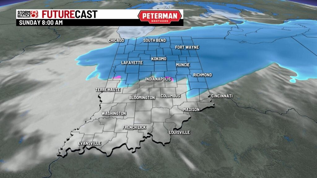
Sunday morning snow
INDIANAPOLIS (WISH) — Light snow is likely for the first part of the day. Accumulations will be light in the metro area with more snow farther north.
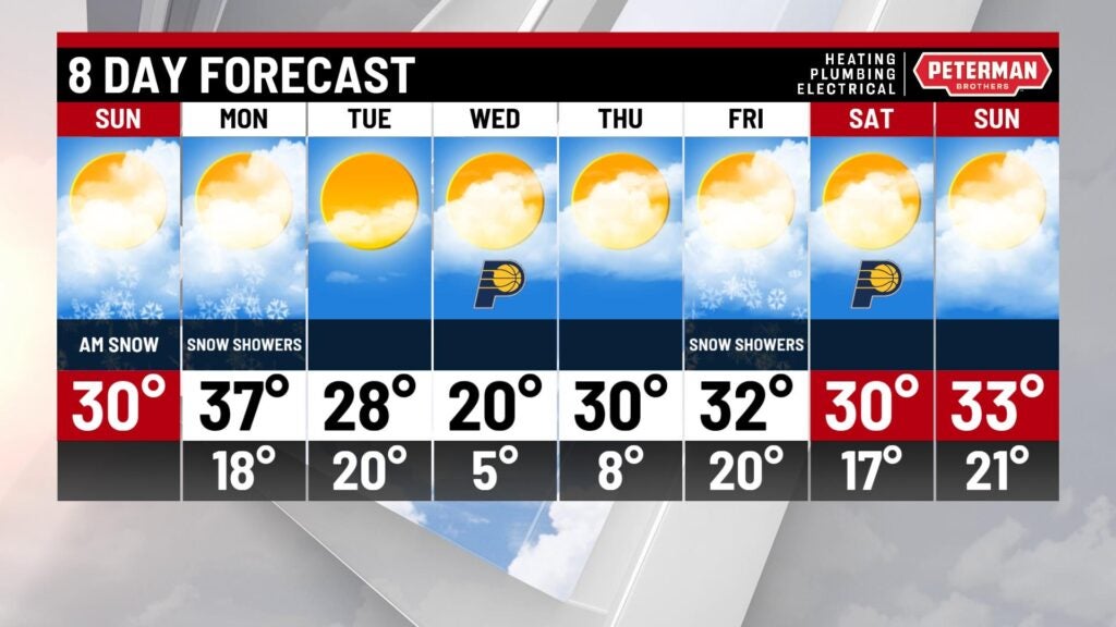
TODAY: A quick clipper system is going to bring some minor snow accumulations to the state. We have a Winter Weather Advisory in place for areas north of Indianapolis. These areas may see 1-3 inches of snowfall. Areas in northern Indiana may see up to 4 inches of snowfall. The snow will move in this morning and continue through about noon. Indianapolis and areas south of the city will likely see less than an inch of snow. Once the snow ends, we’ll see mostly cloudy skies with highs near 30.


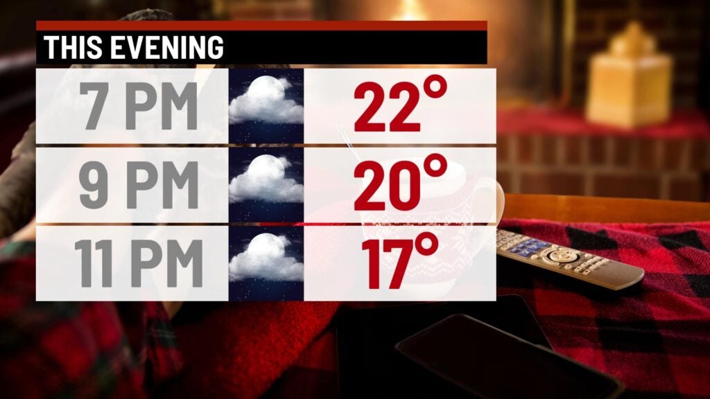
TONIGHT: Clouds break up a little and we’ll see skies become partly cloudy. It’s going to be chilly with lows falling into the upper teens.

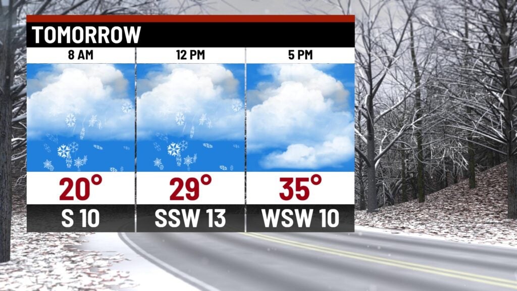
MONDAY: Another system drops down from Canada on Monday. This brings the state another chance for some light snow. It looks like once again the northern part of the state will see the best chance for additional snowfall accumulation. However, Indianapolis may see a few snow showers as well. Temperatures climb into the middle and upper 30s on Monday.

TUESDAY: Once the system passes, colder air moves into the state. We’ll see partly cloudy skies on Tuesday with highs in the upper 20s.
8DAY FORECAST: A cold blast of air moves into the area late Tuesday night. Temperatures fall into the single digits. Look for lots of sunshine on Wednesday but it will be cold. Highs stay close to 20. A few snow showers are possible on Friday with highs staying close to freezing for the end of the week and next weekend.