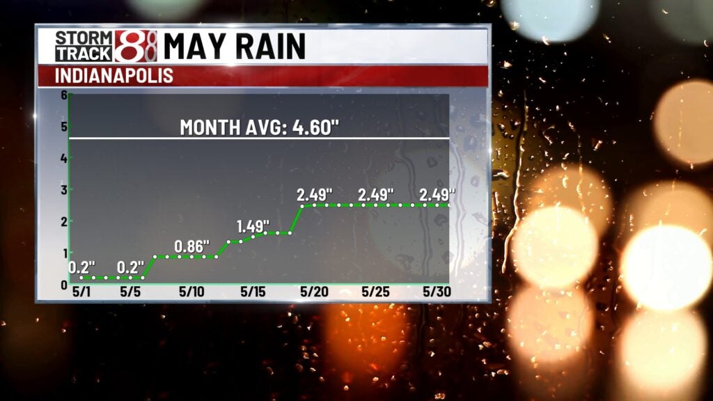
Toasty end to May, building rain deficit as well
INDIANAPOLIS (WISH) — The heat and humidity will continue to build going into June with 90s ahead in the near term forecast.
Tuesday night: Mild and mostly clear conditions are expected for tonight with lows in the mid 60s.


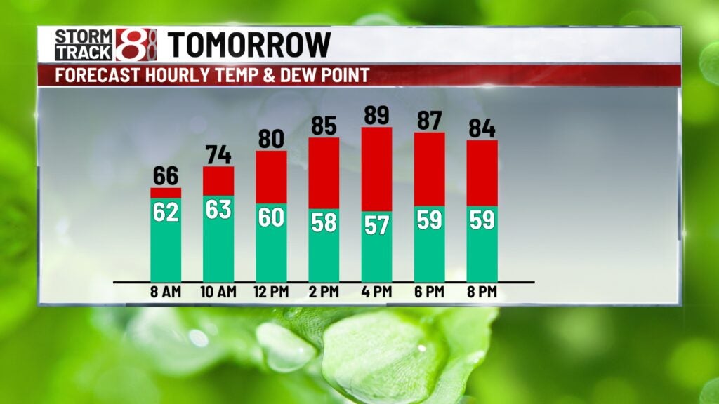
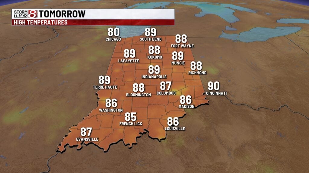
Wednesday: We’re in for a hot close to May on Wednesday. Higher humidity and plenty of sunshine will remained locked into place. There is potential for pop-up showers and storms during the afternoon hours as well. Highs will rise into the upper 80s.
Thursday: Rinse and repeat weather from Wednesday will be in store for Thursday to open the month of June. Expect another afternoon in the upper 80s with the chance for spotty showers and storms.

8-Day Forecast: Even though we will see a slight decrease in the muggy meter going into the weekend, this will allow for temperatures to sneak into the low 90s. Friday and Saturday look to be two of the hottest days of the year with temps in the 90s. By early next week, we’ll watch for a cooldown with additional rain and storm chances. Due to the lack of rain as of the past 10 or so days, there is potential for a rapid onset drought over the next several days.