Tracking a winter storm going into Wednesday
INDIANAPOLIS (WISH) — We are tracking our first big winter system this year with the potential for snow accumulation.
Mixed precipitation will also get involved as well, which will all lead way to a messy Wednesday.
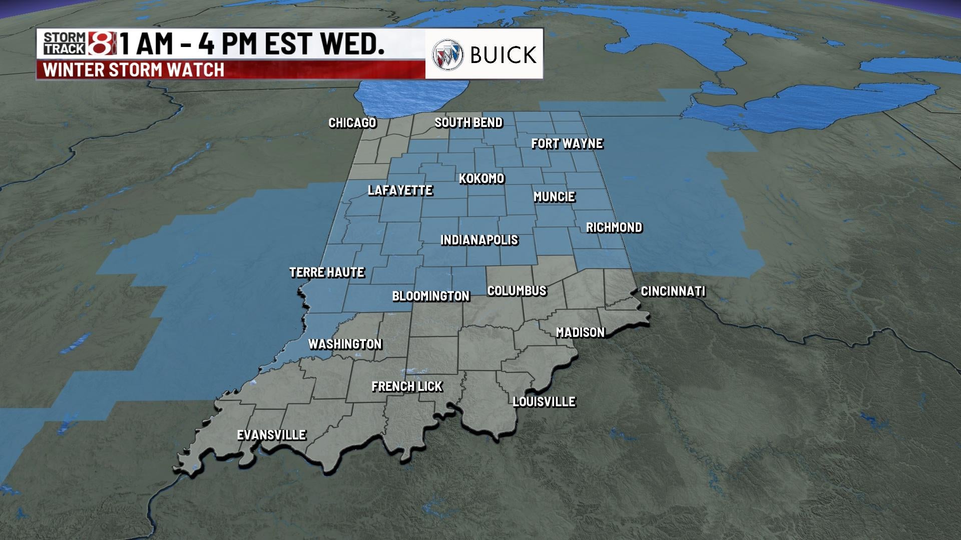
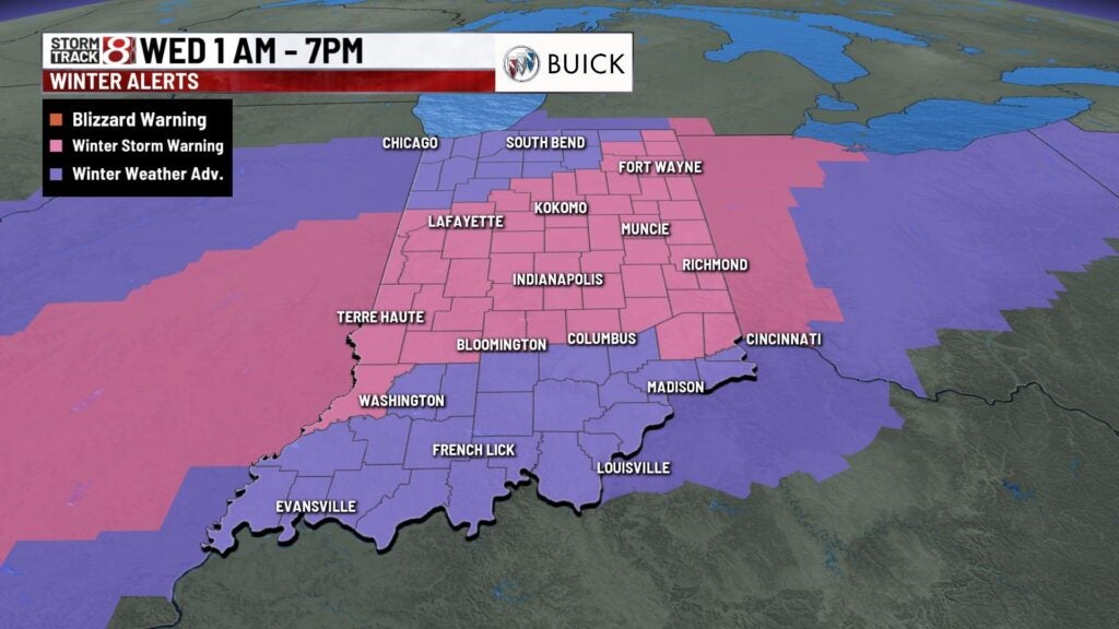
Winter storm warnings are set to be in effect from 1 a.m. to 7 p.m. Wednesday.
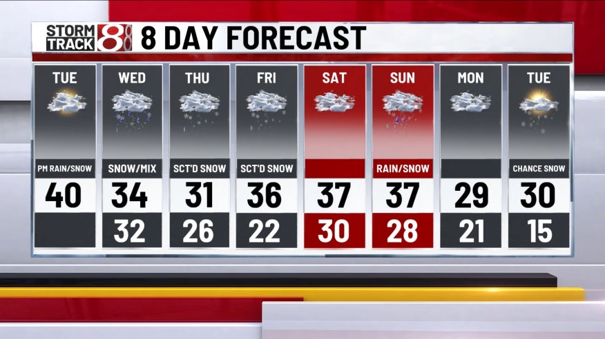
Tuesday: We look to work in peeks of sunshine with warmer temperatures before our next system arrives by the nighttime hours. Highs will top out in the upper 30s to low 40s.


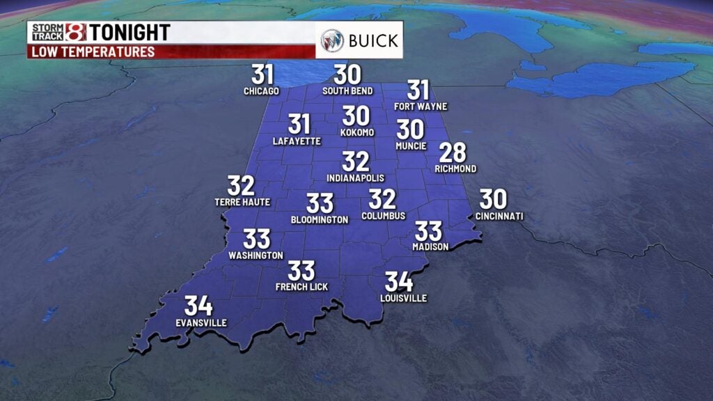
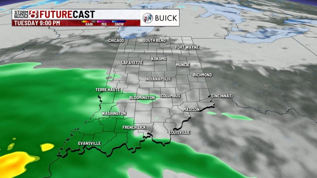
Tuesday night: Cloud cover and winds will increase after sunset with precipitation moving in by Tuesday night. It will appear as a mix of rain and snow as it slides in. A switchover to all snow will occur by the overnight hours. Snow will be heavy at times.
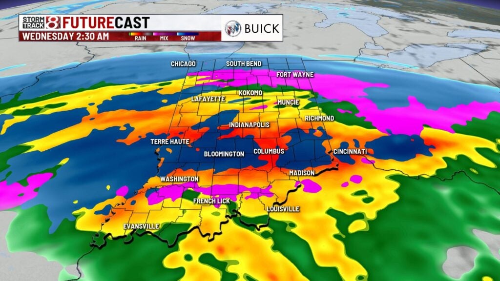
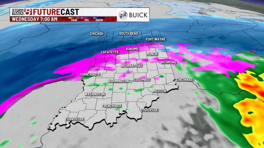
Wednesday: Prepare for a dicey morning commute as snow (heavy at times) and a wintry mix will persist through daybreak Wednesday. As we get toward the afternoon hours, the bulk of the activity is set to exit the state. Lingering rain-snow showers will be possible for the remainder of the day.


SNOW TOTALS: Not much has changed with our thinking on potential snow accumulation with central Indiana possibly receiving from 4-8 inches. It must be remembered though that a slight shift in the track of the rain-snow line can significantly alter who gets what.


Overall, Wednesday will be a messy day with breezy winds and chilly temperatures. Highs only top out in the low to mid 30s.
8-Day Forecast: Scattered snow chances will stay in place for the remainder of the workweek. Highs will rise into the mid to upper 30s for Friday through Sunday before another system rolls in with additional rain-snow mix chances.