Tracking snow, rain and warmer temperatures
INDIANAPOLIS (WISH) — It was a bitterly cold Tuesday as we had dominant cloud cover across the state and temperatures only in the 20s. We are tracking a busy forecast ahead with snow, rain and warmer air all on the way over the next few days.
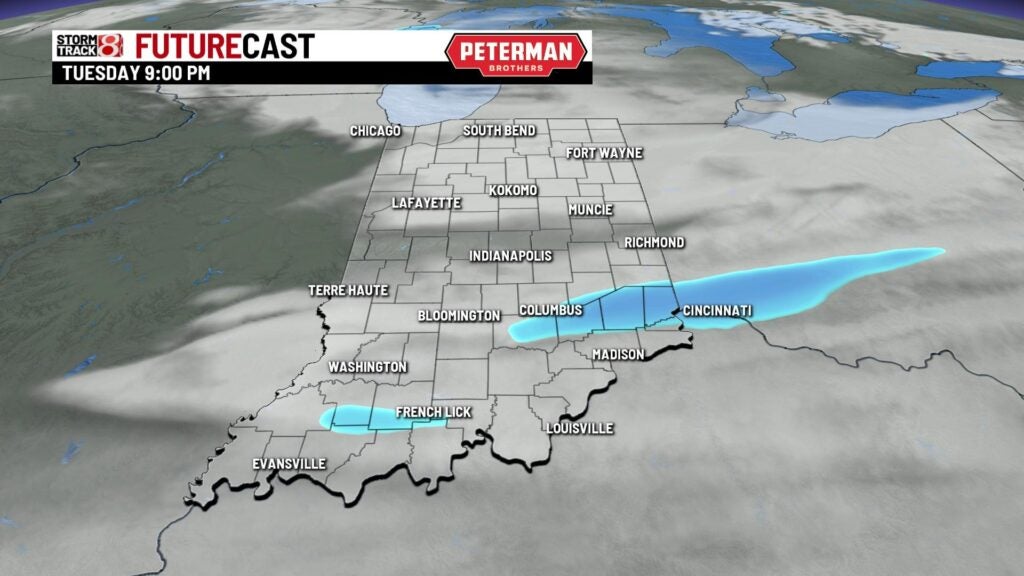
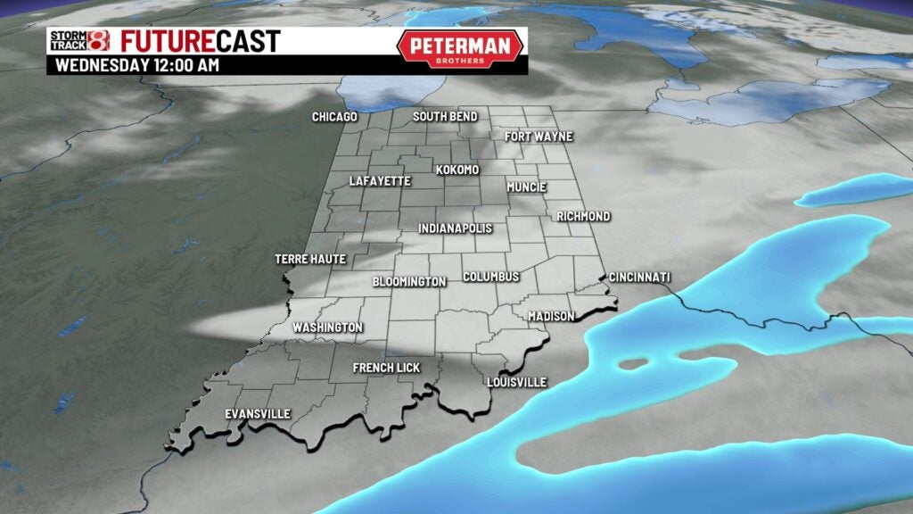
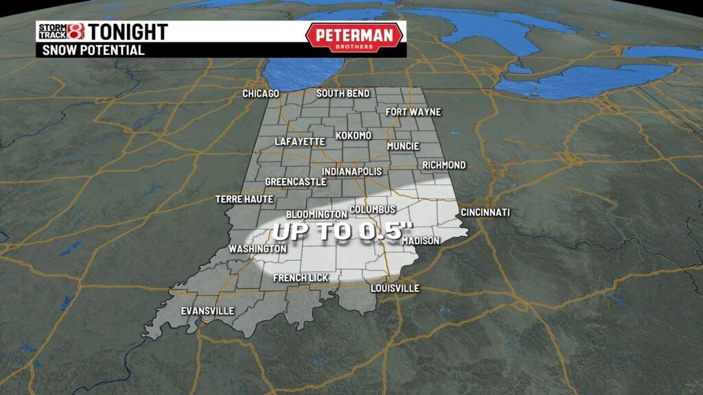
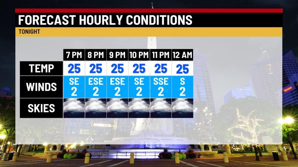
Tuesday night: Flurries to light snow showers will continue through part of the nighttime hours. Light accumulations of half an inch to one inch are possible. This will lead way for some slick spots on the roads Wednesday morning.
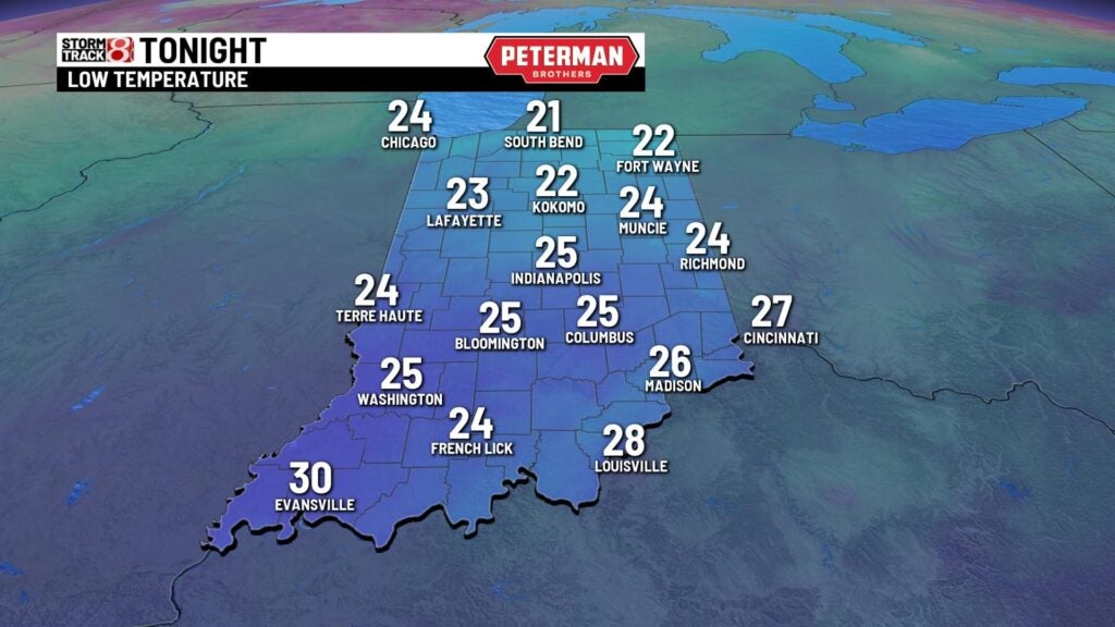
Lows will bottom out in the low to mid 20s.
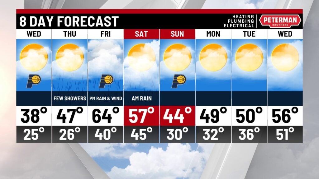
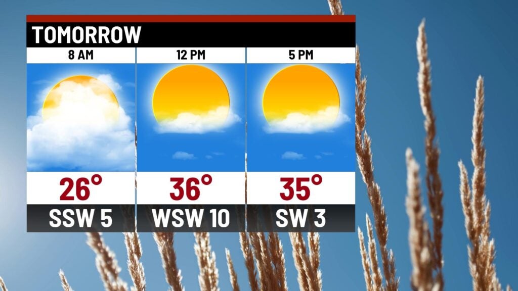
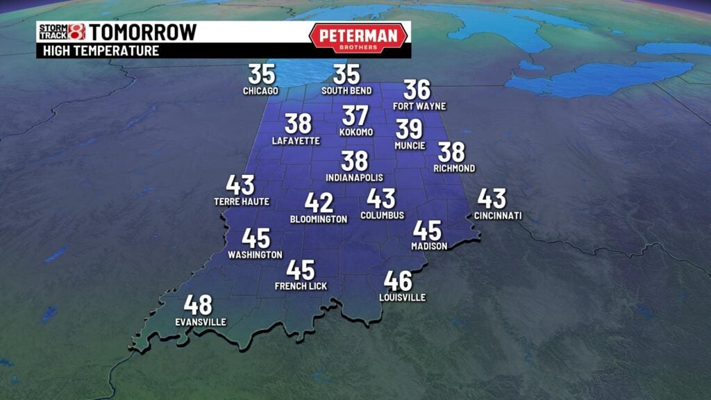
Wednesday: A cloudy start to our Wednesday will be on deck before a mix of sun and clouds enter the picture. Temperatures will return to the upper 30s to low 40s.
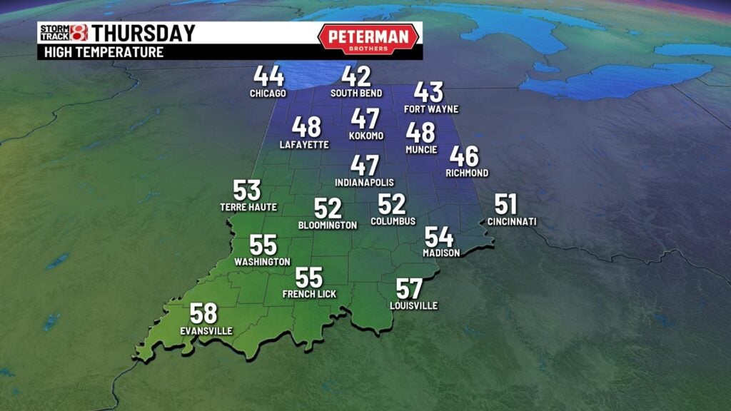
Thursday: The warming trend will continue into our Thursday under mostly cloudy skies. A few showers are possible Thursday evening. Highs look to scoot into the upper 40s to low 50s.
8-Day Forecast: We will launch into the 60s for Friday, and it is worth noting we will be near record-high numbers. The record high in Indy for Friday is 66°. However, this mild air will bring wet and windy weather for Friday and into early Saturday. Rain is likely during our Friday with the chance for thunderstorms in the nighttime hours. There is even the chance for a brief rain/snow mix late Saturday. Temperatures look to tumble back into the 40s by Sunday before rebounding into the 50s next week.