


Tracking weekend snow
INDIANAPOLIS (WISH) — It’s a cold start for Saturday with snow arriving overnight through the first part of Sunday.
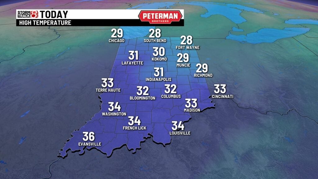
TODAY: We have a cold start across the state today. Look for partly cloudy skies as a weak system moves throughout Indiana. Temperatures climb close to 30 for the afternoon. Winds will be a bit breezy out of the south and southwest.

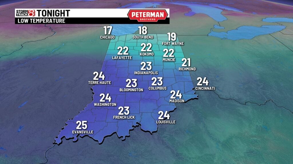
TONIGHT: Skies become mostly cloudy overnight ahead of our next system. This one brings a chance of snow during the overnight hours. Lows fall near 20.


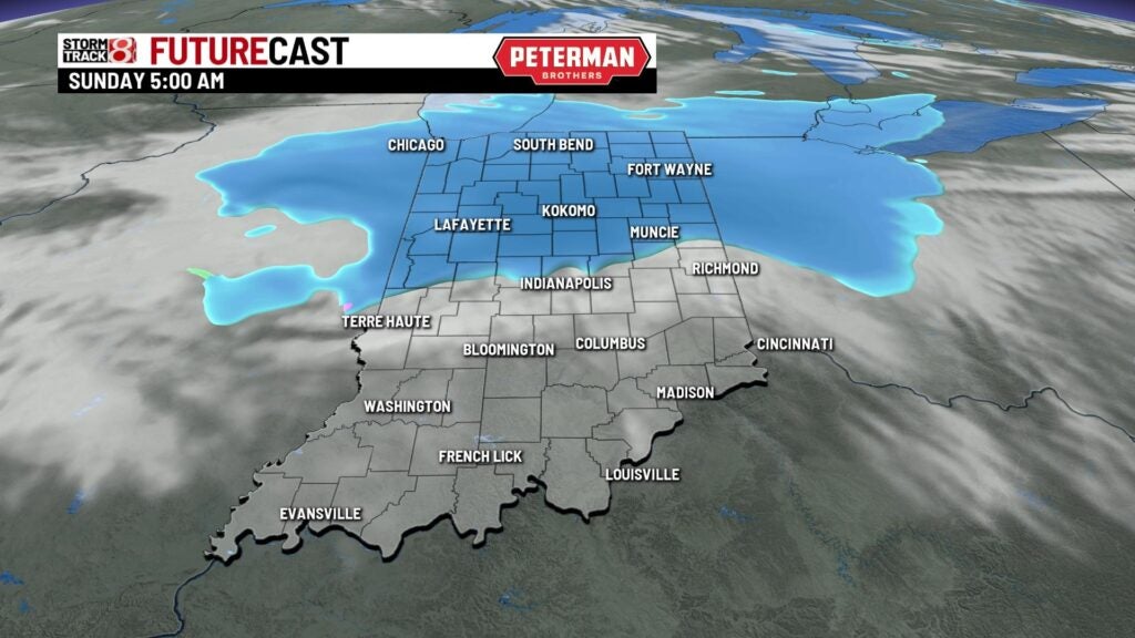
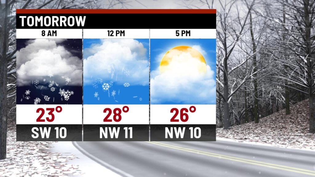
SUNDAY: Look for light snow to start the day Sunday. It will continue for the first part of the day and come to an end around noon. Total accumulations from the event will be around 1-2 inches. Areas south of Indianapolis will pick up less than an inch while areas north of the city will see 1-2 inches. Some spots in northern Indiana may see 2-3 inches. Look for mostly cloudy skies for the rest of the day with highs near 30.


MONDAY: Another quick moving system moves across the northern part of the state Monday. This brings more cloud cover and a chance for a few snow showers. Highs climb close to 40.

8DAY FORECAST: The middle part of the week looks quiet with partly cloudy skies and temperatures below normal. Temperatures fall into the upper 20s for highs on Wednesday. We may see another chance for a few snow showers on Friday with highs near freezing.
