


Tracking weekend snow chances
INDIANAPOLIS (WISH) — The bitter cold stuck around for our Friday as temperatures once again only managed to sneak into the mid 20s. We are tracking a slight temperature rebound for the weekend with chances for accumulating snow.
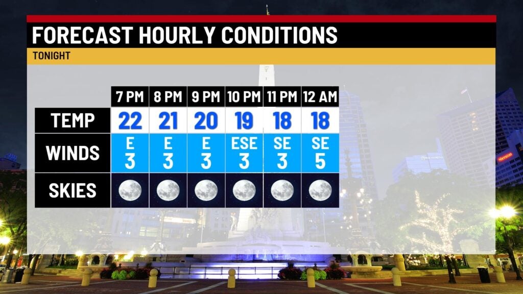
Friday night: Another frigid and mostly clear night is ahead with light and variable winds. Lows will fall into the low teens.

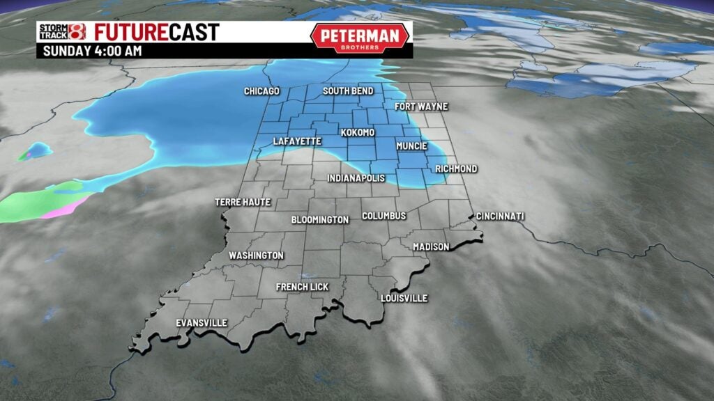
Saturday: Clouds are set to increase as we become partly cloudy by the afternoon hours. Winds will also become breezy at times. This increase in cloud cover will lead way to our next chance for snow. There could be a few flurries earlier in the day for Saturday before more snow showers slide into the state by very early Sunday morning.


Highs look to warm into the low 30s.


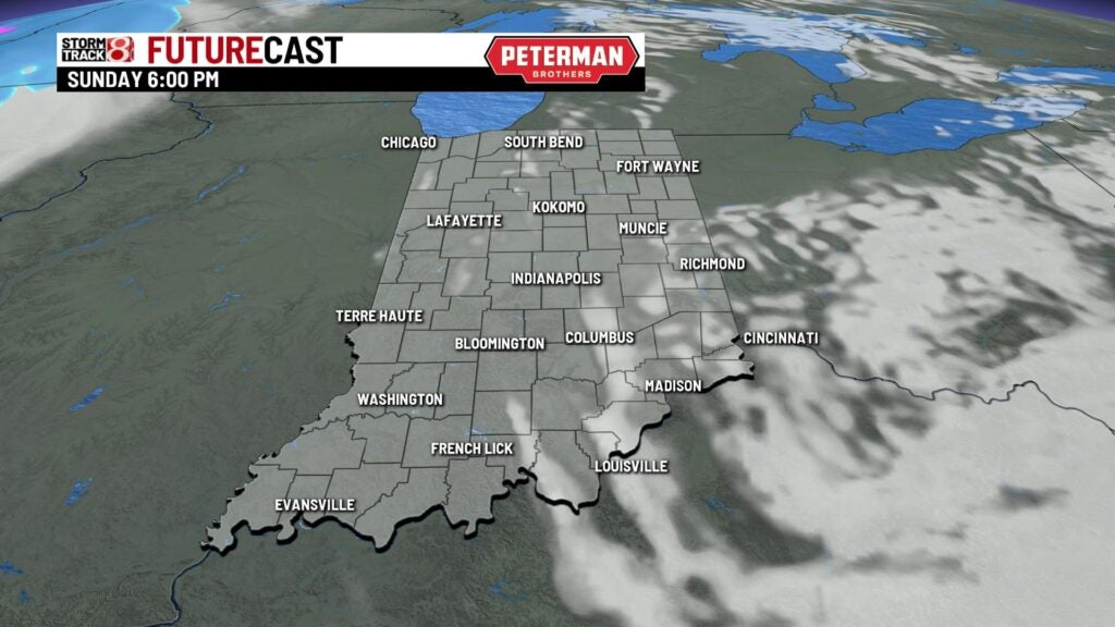
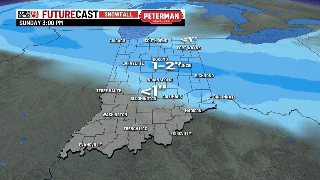
Sunday: Snow shower activity will likely be ongoing to start our Sunday. The snow is set to move out of the state mainly by the afternoon hours with decreasing cloud cover.
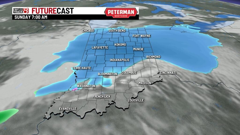


There is the possibility for snow accumulation across central and northern Indiana. At this time, the best chance for higher amounts of one to two inches lie in the northern half of the state.
Highs will top out in the upper 20s to low 30s.

8-Day Forecast: Another quick warmup looks to move in to kickoff next week with highs in the low 40s. Then, additional snow chances are possible for Tuesday with much cooler air to follow. Highs are set to stay mainly below average for much of the extended forecast.
