


Warm and active Saturday ahead
INDIANAPOLIS (WISH) — Additional rain and storm chances are on the way as we go into our weekend. There is even the potential for stronger storms on Saturday as well.
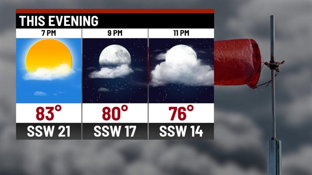
Friday night: Cloud cover is set to increase tonight as we watch showers and storms slowly move in from the northwest. Coverage will gradually increase throughout the overnight hours.
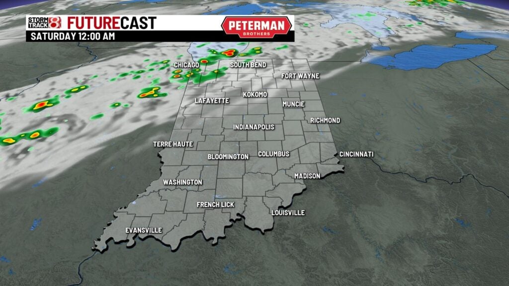


An isolated strong to severe threat is in play for mainly the overnight hours into early Saturday morning. Damaging winds and hail are the main threats.
Expect a rather warm and humid night with lows only dipping into the mid 60s to low 70s.

Saturday: A few morning showers and storms are possible before we briefly dry things out going into the afternoon hours.

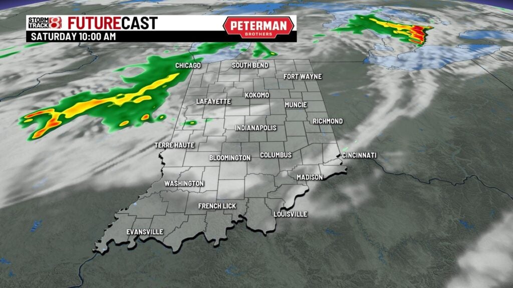
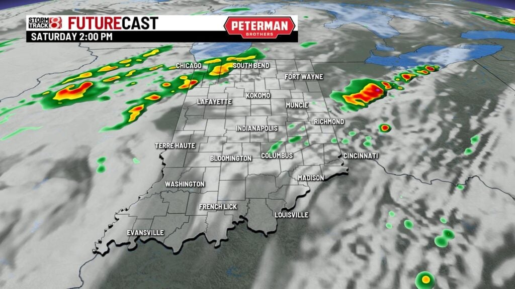
Then, another round of rain and storms will slide into the state by mid-afternoon Saturday. Rain chances will stay with us through Saturday night.

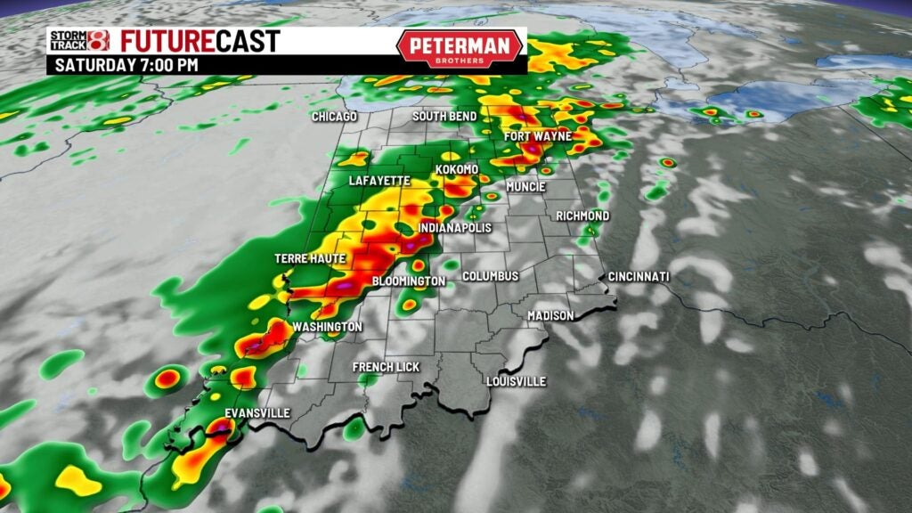
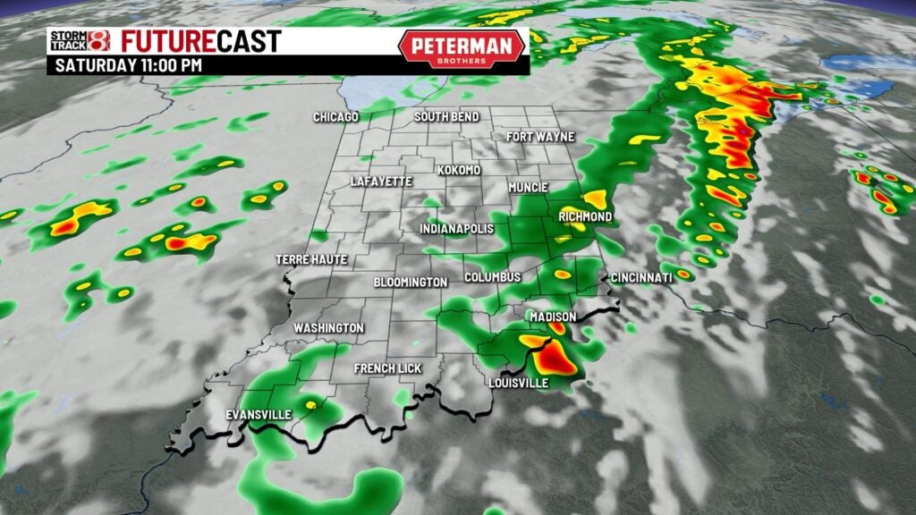

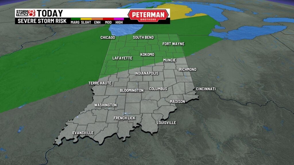
During the afternoon and evening hours, isolated strong to severe storms will be possible. A Slight Risk (level 2/5) of severe weather covers much of the state. Damaging winds and hail will once again be the primary threats, but an isolated tornado cannot be ruled out. Flooding concerns may also arise due to the heavy rain.


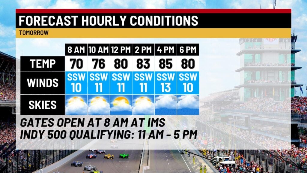
Highs look to rise into the low to upper 80s. If you are planning on heading out to watch Indy 500 qualifying, the start time has been bumped up one hour due to the afternoon activity.

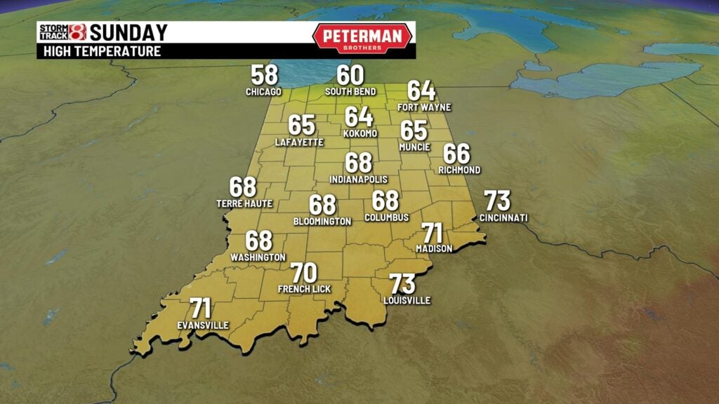
Sunday: Isolated showers are possible Sunday morning before the remainder of the day features dry conditions. A much cooler day is expected as a wind shift will take place as winds are set to come out of the northwest. Highs will only top out in the mid to upper 60s.
8-Day Forecast: The start to the new workweek will be comfortable before temperatures warm-up slightly for Tuesday and Wednesday. This small warmup will trigger more rain and storm chances for Wednesday and Thursday. As we head into Indy 500 race weekend, an early look at the forecast for then shows fairly nice weather.
