Warm weekend ahead; rain chances for some, Monday

INDIANAPOLIS (WISH) — The remnants of Florence work close to central Indiana for the start of the work week.
Tonight:
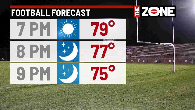
Great night for high school football across the area, with kickoff temperatures in the upper 70s across the region.
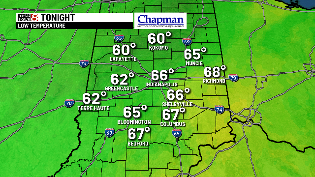
Should stay mainly clear overnight, with lows in the middle 60s.
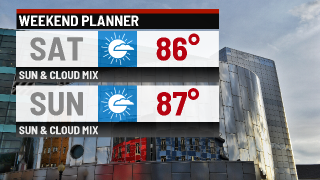
Weekend:
No major problems for both Saturday and Sunday. Expect mostly sunny conditions on Saturday, with some clouds building ahead of the remnants of Florence on Sunday. Highs top out in the middle and upper 80s.
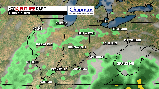
There is a chance for a few spotty showers in southeastern Indiana late Sunday afternoon into the evening, as Florence works into the eastern Midwest.
Hurricane Florence update:
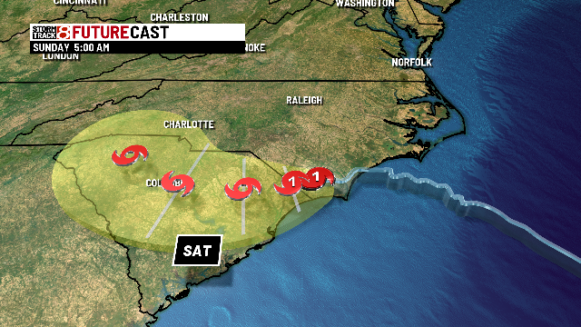
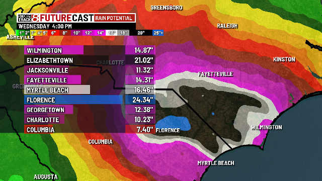
Florence made landfall this morning as a Category 1 storm, with many reports of gusts over 100 mph along the North Carolina shoreline. Flooding has been and will remain the primary concern for the duration of this event for the weekend. Some areas are well over a foot in terms of rainfall measurement, and those same areas may see an addition 1′ of rainfall or more, before Florence moves out by the end of the weekend.
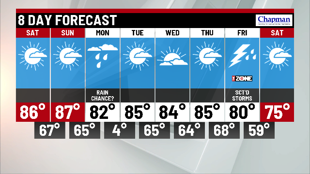
8-day forecast:
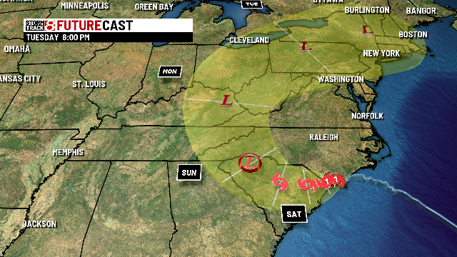
Still some questions on where Florence goes exactly as we head into Sunday night and Monday. Models hint that a few showers will be possible for eastern potions of the state on Monday. If that track shifts west a bit, more of our area could see rain, while if the track shifts west, we look to remain dry to open the work week. Regardless, rainfall impacts will be minimal for those that see it in central Indiana.
The rest of the week looks pretty quiet and warm. Highs hold in the middle 80s. Friday, as cold front works into the state, sparking showers and storms. Cooler temps will follow next weekend.