


Warmer Tuesday; rain with a few storms possible Tuesday night
INDIANAPOLIS (WISH) — After a near-average late-November day, we’re in for a much warmer Tuesday.
However, this will pave way to another round of active weather by Tuesday night with showers and storm chances. There is even the threat for stronger storms as well.
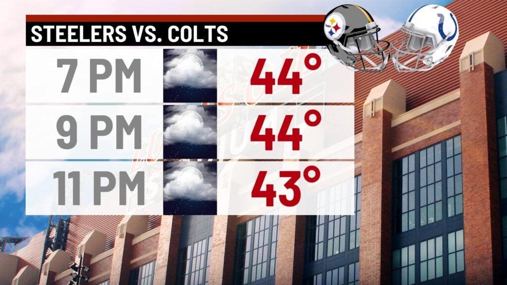
Monday night: We’re in for a mainly cloudy and chilly night with temperatures hovering in the mid 40s for much of the night. You will want to grab a warm jacket if you have plans to be at the Colts game for Monday night football.

Tuesday: A warmer and active day will be on deck for us. Going throughout the day, winds are set to increase with gusts eventually getting up to 35-40 mph by the latter half of the day. Along with increasing winds, another system will move in and bring the chance for showers and a few storms at night. There is even the possibility for severe weather after sunset as well.
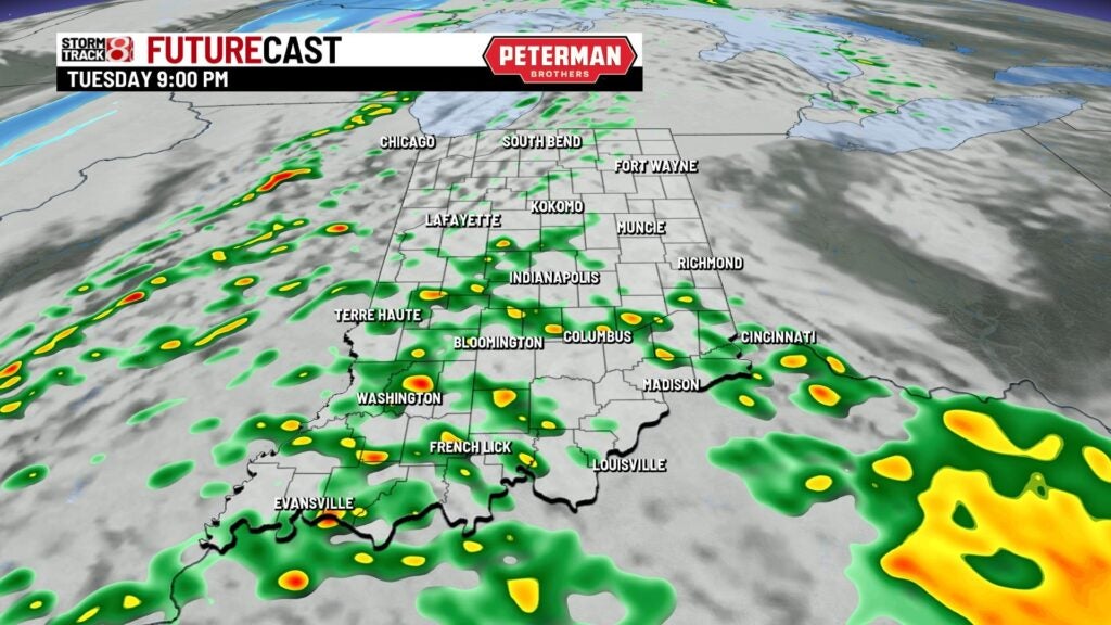
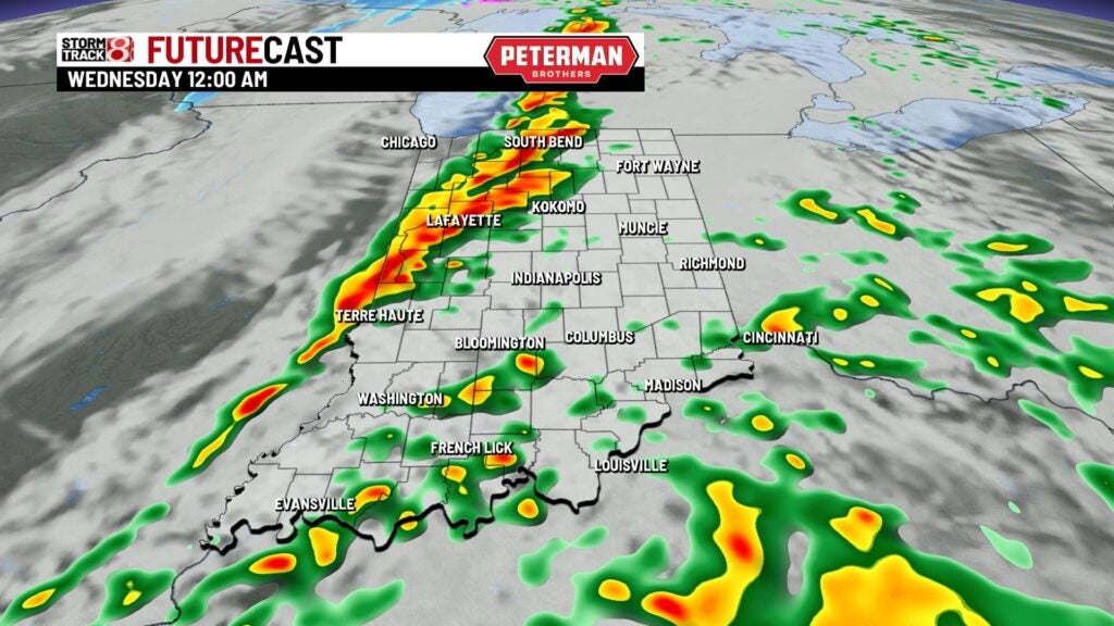

A Marginal Risk (level 1/5) risk is in place for areas southwest of Indy. The primary threat is damaging winds, but there is also an isolated tornado threat in play.


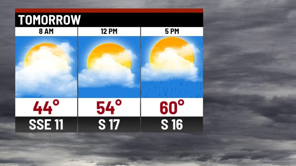
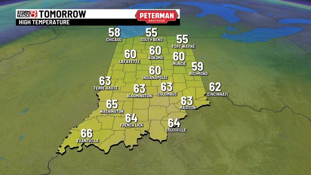
Highs look to rise into the low to mid 60s.
Wednesday: Rain will be well out of our state by sunrise. However, be ready for much colder temperatures as we’ll go from the upper 50s just after midnight to the 30s by daybreak. In addition to the cold air, strong winds will also stick around with gusts up to 30-35 mph at times. These winds will lead way to wind chill values in the 20s. Overall, expect a cold and blustery day with highs only in the mid 30s to low 40s.

8-Day Forecast: Below-normal temperatures continue through Thursday with highs only in the mid 30s. This trend won’t last long as we quickly rebound into the upper 40s to end the workweek. Then, we look to be in the low 50s this weekend with additional rain chances.
