


Windy with a rain/snow mix
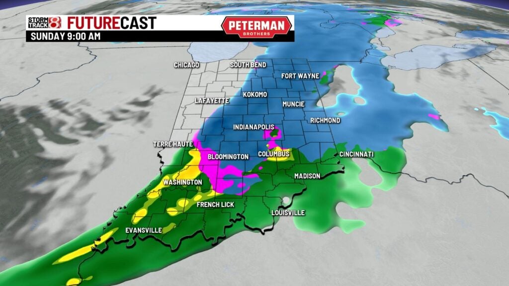
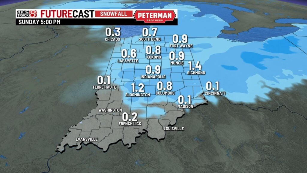
INDIANAPOLIS (WISH)–Snow is possible with light accumulations today as a cold front moves through the state.
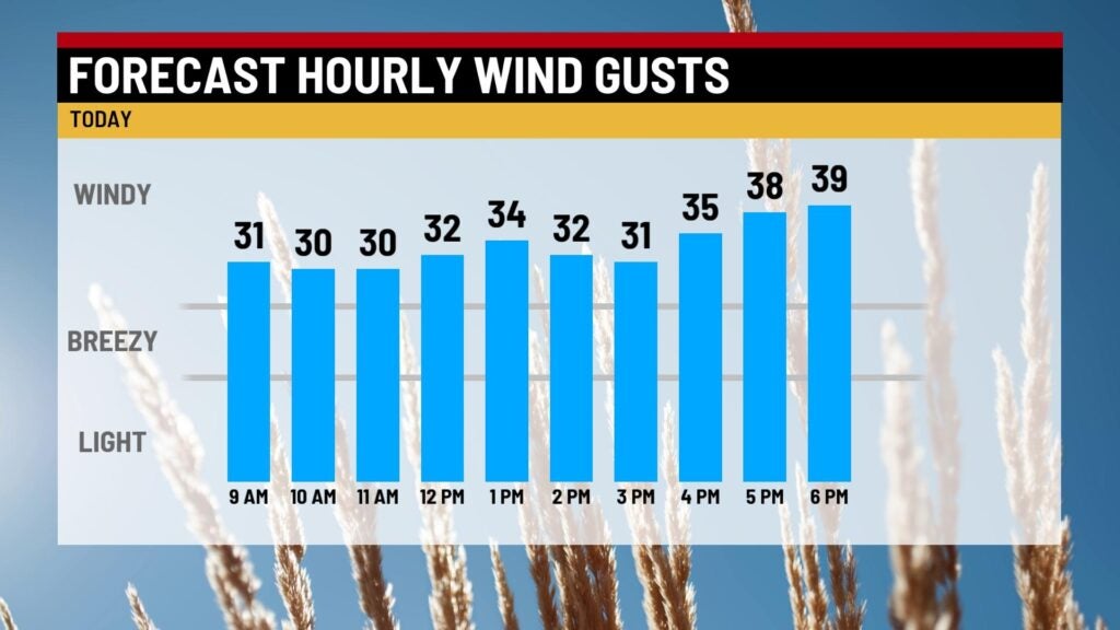
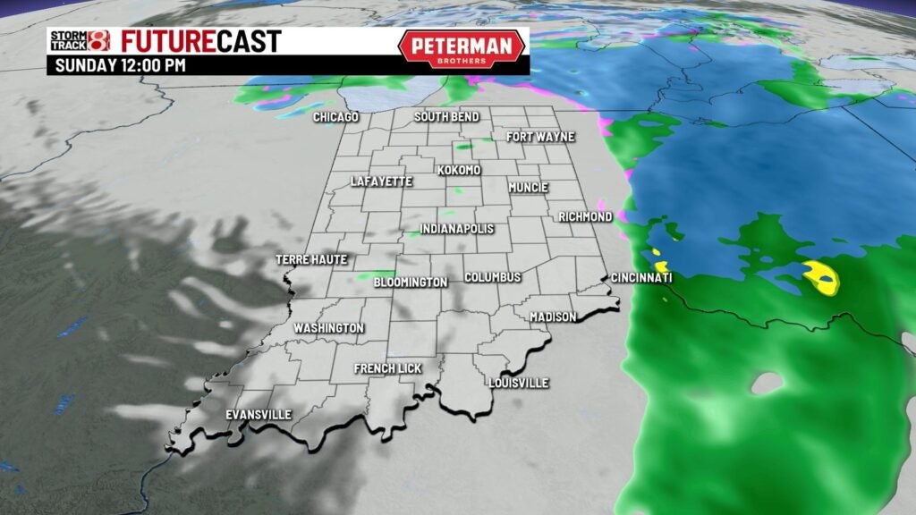
TODAY: It’s going to look and feel a little more like winter across Indiana today. Look for mostly cloudy skies with some light snow moving through the area this morning. There may be a light dusting to minor accumulations on grassy surfaces. Most of the roadways should be just wet as pavement temperatures are a little warm. Winds pick up as the cold front gets closer to us. Winds may gust near 30 mph at times this afternoon. The snow may change over to rain at times once temperatures warm up a little. Highs climb close to 40.

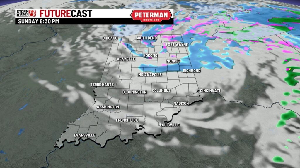
TONIGHT: A few scattered flurries will be possible on the back side of the storm system. It’s going to be cloudy and chilly with lows falling near 28.


MONDAY: The winds ease a bit for the start of the new workweek. We’ll see partly cloudy skies. There’s a chance for a spotty sprinkle or light flurry into the afternoon. Highs reach 42.

TUESDAY: Temperatures climb ahead of our next system. Look for highs near 60 on Tuesday under partly to mostly sunny skies.
8DAY FORECAST: A front moves through on Wednesday bringing us a good chance for rain. Highs climb close to 60 once again. A few showers may linger into the first part of Thursday. Temperatures fall closer to normal for the end of the workweek and into next weekend.
