Dangerous storm surge possible with Hurricane Ian
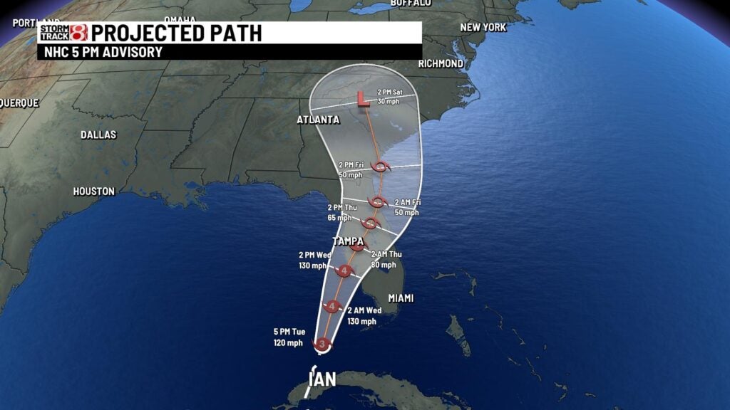
INDIANAPOLIS (WISH) – Hurricane Ian by Tuesday had entered the eastern Gulf of Mexico and was strengthening once again after its encounter with Cuba.
As of 5 p.m. Tuesday, the storm was a Category 3 hurricane with maximum winds up to 120 mph.
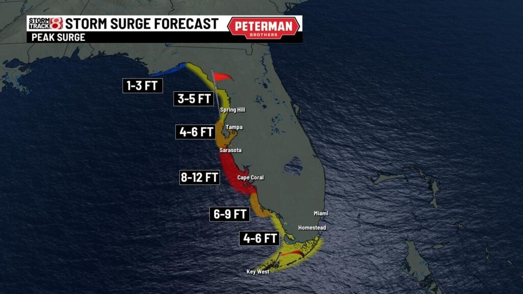
On Wednesday, the storm was expected to make landfall along the western Florida coastline. Life-threatening storm surge will be one of the main focuses of the storm.

Storm surge is the abnormal rise of water caused by a storm over the predicted astronomical tides. Onshore flow from the strongest winds within hurricanes often produces the largest storm surge.

Multiple tracks are still possible with Ian before it makes landfall and the slightest change in path can dramatically effect storm surge. A left side track would result in more devastating surge in the Tampa area. Meanwhile, a more easterly track brings stronger surge into Fort Myers. An easterly track will also result in a stronger hurricane. This is because shear and dry air will weaken the system the further north is gets.


Regardless, it seems devastating surge up to 12 feet will be possible somewhere along western Florida. Torrential rain is also expected with Ian as it slows down and weakens further inland.