


Much-needed rainfall finally hits Indy metro area
INDIANAPOLIS (WISH) — Thunderstorms on Wednesday morning was a welcomed sound and sight across some spots of central Indiana.
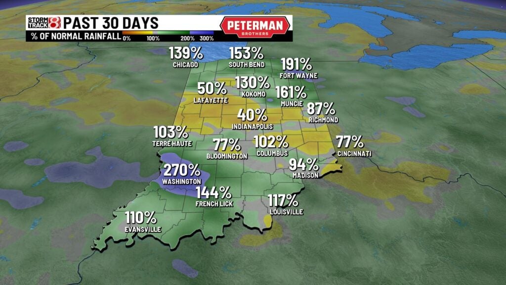
Indianapolis and surrounding metro areas have been missing out on several batches of rain over the last week.

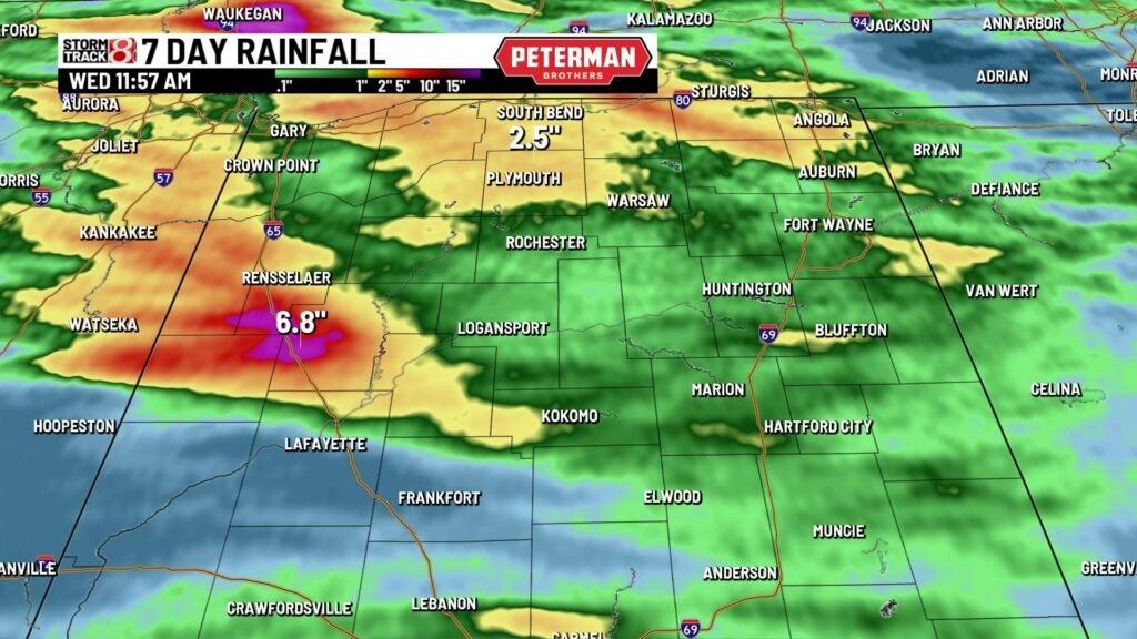
While much of the state has been picking up rain, a slim corridor near Indianapolis has received very little precipitation. During the last week heavy rain has fallen from Vincennes to as far north as Bloomington and Bedford. Areas around Vincennes and Jasper picked up from 6-7 inches of rainfall. Parts of Lawrence County received almost 4 inches. Last weekend, areas between Lafayette and Rensselaer measured from 5-6 inches as thunderstorms developed over the same location. Northern Indiana also saw several rounds of rain with areas around South Bend receiving from 2-3 inches.

As of noon Wednesday, Indianapolis International Airport had picked up 0.91 of an inch of rainfall. This brings the July total to 3.10 inches, which is still a little below normal, but it’s starting to eat into the deficit we’ve been feeling all month. Right now, we are just less than an inch below normal.

Here’s a look at the Drought Monitor from last week. It shows Indianapolis and areas north and west of the city under a moderate drought. Some locations near Lafayette and southern Indiana will likely see an improvement. Don’t be surprised if Indianapolis is still in some sort of moderate or abnormally dry category in the next Drought Monitor map. Each week, the newest Drought Monitor is released on Thursday morning. However the data cutoff for the new map is Tuesday. Any precipitation that falls on Tuesday or Wednesday will not be included in the new map.
