


Storm Track 8 blog: Storm activity exits Indiana

INDIANAPOLIS (WISH) — Temperatures in the 90s and storms were in Indiana on Wednesday. Here’s the latest from the Storm Track 8 meteorologists and the National Weather Service.
- Check the Storm Track 8 radar | See the Interactive Radar | Get the free Storm Track 8 weather app from the App Store | Get the free Storm Track 8 weather app from Google Play
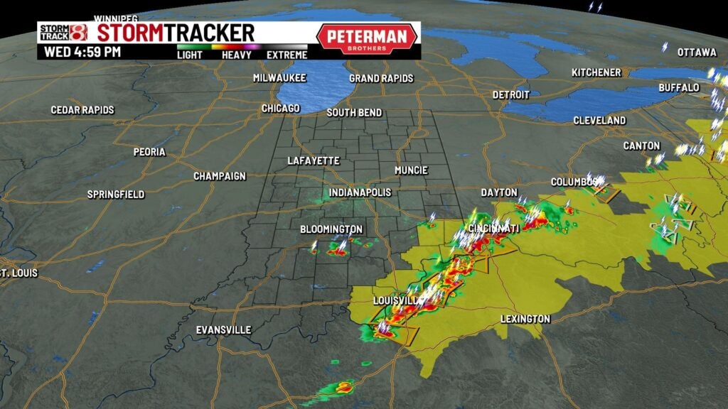
5:00 p.m.
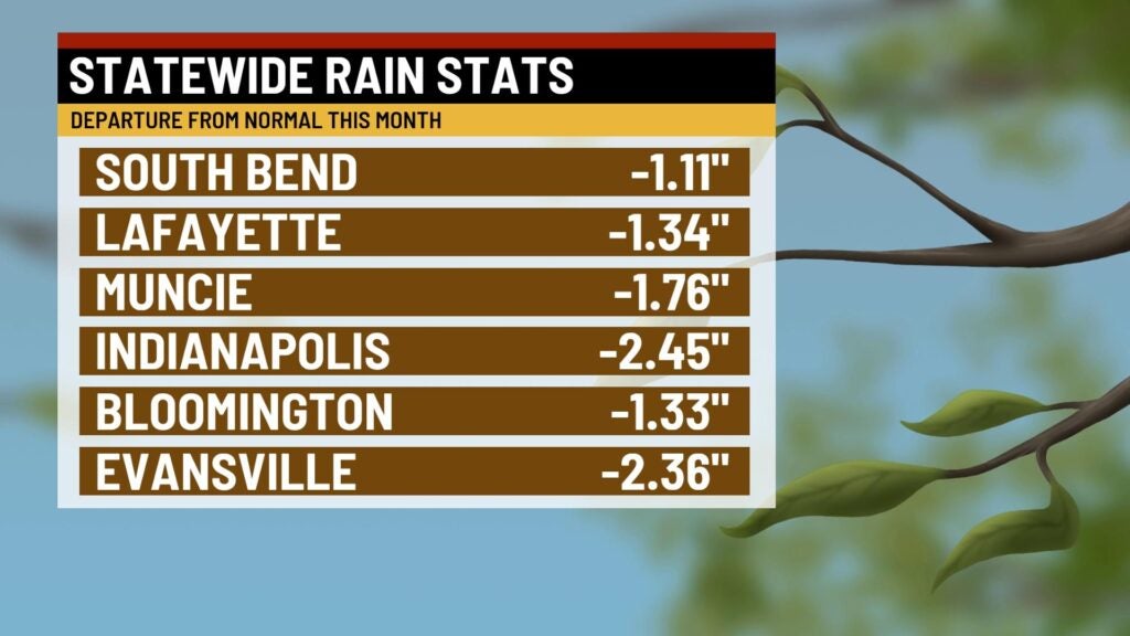
Storm Track 8 says activity for the most part has left the state. Storms near Bedford and Versailles are still underway. Areas mainly south of I-70 were able to work in a little bit of rain, bit it wasn’t a whole lot. Much of the state has a rainfall deficit this month right now.
4:34 p.m.
The National Weather Service tweeted counties south of I-70 could see isolated rain showers continuing into sunset today. However, a clearing trend takes over tonight, brining a sunny end to the week with highs in he upper 80s. The chance for storms creeps back up Saturday night.

4:31 p.m.
A severe thunderstorm warning has been issued for Clark, Floyd, and Harrison counties until 5 p.m. Main threats are 60 mph winds and 1-inch-diameter hail.
4:13 p.m.
A severe thunderstorm warning has been issued for Clark, Floyd, Harrison counties and two counties in Kentucky until 4:45 p.m. Main threats are 60 mph winds and 1-inch-diamter hail.

3:54 p.m.
A sever thunderstorm warning has been issued for Clark, Floyd, and Scott counties until 4:30 p.m. Main threats are 60 mph winds and 1-inch-diameter hail.

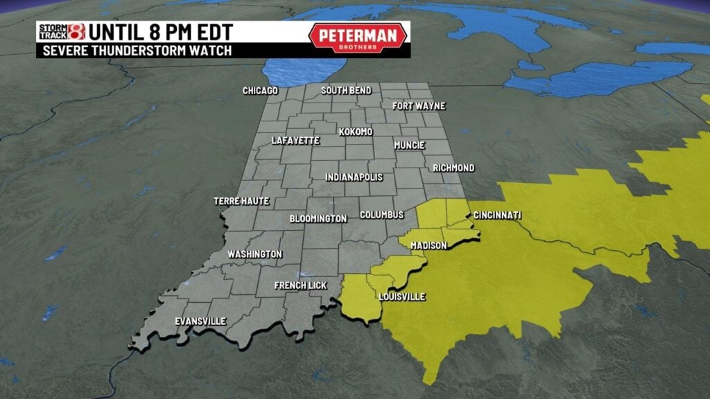
3:54 p.m.
A sever thunderstorm watch has been issued for Clark, Floyd, Harrison, and Jefferson Indiana until 8 p.m.
3:51 p.m.
A severe thunderstorm warning has been issued for Clark and Jefferson counties in Indiana and a county in Kentucky until 4:15 p.m. Main threats are 60 mph winds and 1-inch-diameter hail.
3:47 p.m.
A strong thunderstorm will impact portions of southwestern Jefferson, Clark, southeastern Scott and a county in Kentucky through 4:15 p.m. Main threats are 40 mph winds and 0.50-inch-diameter hail.
3:46 p.m.
A strong thunderstorm will impact portions of east central Jennings County through 4 p.m. Main threats are 55 mph winds and 0.75-inch-diameter hail.
3:22 p.m.
Heat index values from 100-105 are expected through 7 p.m. CDT for these Indiana counties: Gibson, Pike, Posey, Spencer, Vanderburgh, and Warrick.
3:15 p.m.
The National Weather Service has issued a severe thunderstorm warning for Fayette and Franklin counties until 4 p.m. Main threats are 60 mph winds and 1-inch-diameter hail. NOTE: The severe thunderstorm warning for Fayette and Franklin counties was canceled at 3:34 p.m.
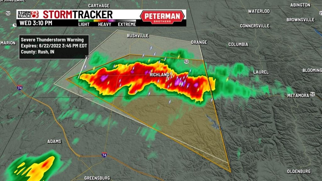
3:09 p.m.
The National Weather Service has issued a severe thunderstorm warning for Decatur and Rush counites until 3:45 p.m. Main threats are 60 mph winds and 1-inch-diameter hail. NOTE: The severe thunderstorm warning for Decatur and Rush counties expired at 3:40 p.m.
2:33 p.m.
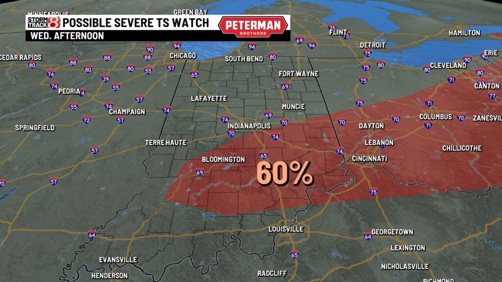
Storm Track 8 meteorologist Ryan Morse says there’s a 60% chance of a severe thunderstorm watch being issued Wednesday afternoon for areas mainly south of Indianapolis.
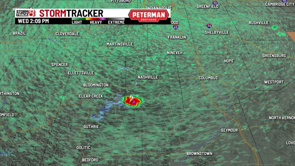
2:10 p.m.
A thunderstorm has popped up in southern Brown County.
2:03 p.m.
Indianapolis hit 92 degrees, says Storm Track 8 meteorologist Tara Hastings.
