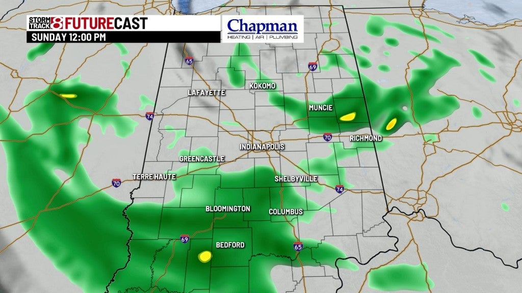
Wet and cooler Sunday
INDIANAPOLIS (WISH) — Scattered showers and cloudy skies will make for a much cooler afternoon to wrap up the weekend.
Sunday:
Upper-level low continues to slowly work through the Midwest. Expect scattered showers on and off through much of the day Sunday. Additional rainfall amounts could get up to an additional 0.5″ in some areas.


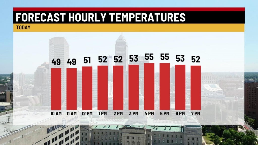
Breezy conditions and much cooler highs in the mid 50s will make for a very raw day.

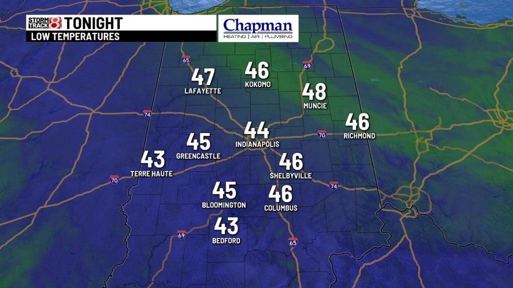
Sunday night:
Rain will gradually end as the low pulls away from the area. Should see mostly cloudy skies, keeping temperatures in check across most of the state. Lows will fall to the mid 40s.
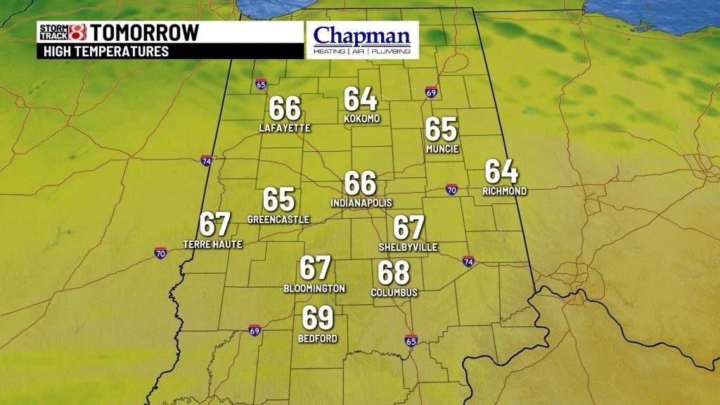
Monday:
Sunshine returns for much of the day, with much warmer temperatures. Highs are set to top out in the mid 60s.

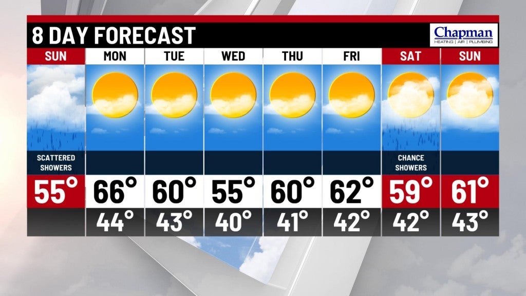
8 day forecast:
A long-term cool begins on Tuesday. Highs for much of the week will struggle to reach 60, with a few overnights, especially Wednesday night, leading to possible frost development. A quiet weather pattern for the work week is expected, with a low chance for showers returning to kick off next weekend.