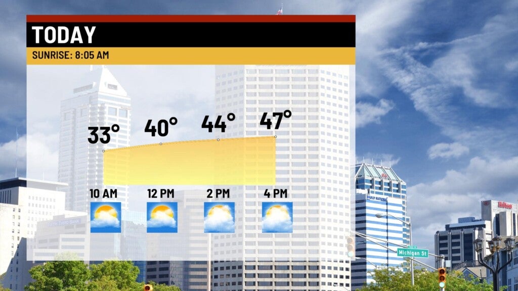
Windy and warmer Sunday
INDIANAPOLIS (WISH) — Warmer temperatures on tap to wrap up the holiday weekend. Showers make a return Sunday night.
Sunday:
Approaching cold front will bring in warmer temperatures and gusty winds up to 30 mph for the afternoon. Clouds will gradually increase throughout the day. Highs top out in the middle and upper 40s.

Sunday night:
A cold front will march through the state, sparking a brief shot of rain showers for the early to mid-evening hours. Rain should move out sometime around midnight. Rainfall amounts should be less than 0.10″.

Temperatures will quickly fall behind the front, with lows dipping to the upper 20s.

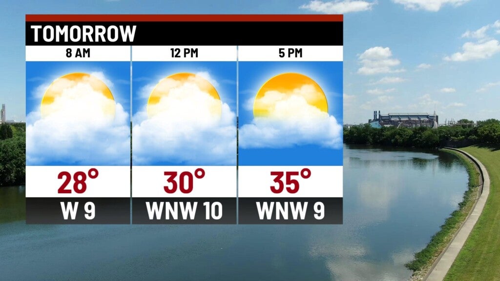
Monday:
Highs pressure settles in, breaking clouds through the day with slightly colder temperatures for the afternoon. Highs top out in the middle 30s.

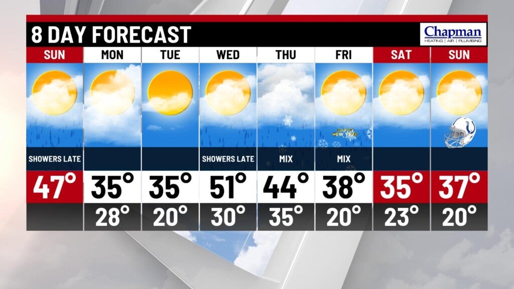
8 day forecast:
Tuesday will remain quiet before a more robust system arrives for the second half of the week. Warmer temperatures with widespread rain is set to arrive Wednesday afternoon and evening – possibly up to one inch of rainfall. Scattered showers continue into Thursday, with the possibility of a changeover to snow on Friday, with some snowfall accumulation possible to kick off the new year. Seasonable temperatures hang around heading into next weekend.