Wintry precip tonight, dry and cold Friday
INDIANAPOLIS (WISH) — After a quiet first half of our Thursday, wintry weather moved into the state during the early afternoon hours. We are tracking accumulating snow and ice through tonight before the activity moves out by early Friday.
A Winter Weather Advisory remains in effect until 4 AM EST Friday morning for central Indiana.

Thursday night: A wintry mix of rain, sleet, freezing rain, and snow will all continue to be in play going into the nighttime hours. Precip will stay mainly snow in northern Indiana with areas receiving mainly rain south. Roads are expected to be fairly slick, so travel with exceptional caution.


Snow and ice totals will stay on the lighter end of the spectrum. Mainly one to two inches of snow are possible from just north of interstate 70 towards north central Indiana. Isolated higher amounts can’t be ruled out. Ice accumulations of up to 0.10″-0.15″ are possible along and near interstate 70.


Lows are set to bottom out in the mid 20s.


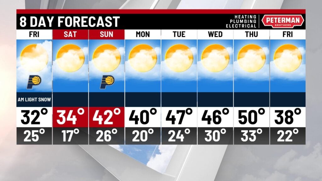
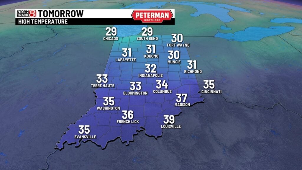
Friday: Isolated snow showers are possible early Friday in the northern half of the state before we work in some sunshine and dry air. Highs will stay below average for this time of the year with numbers rising into the low to mid 30s.

Weekend: A slightly warmer afternoon looks to scoot in for our Saturday as more sunshine enters the picture. Highs will top out in the mid 30s with calm conditions. The warming trend continues into our Sunday as we make a return to the 40s.

8-Day Forecast: Temperatures look to eventually hop back above average by the time we start March on Tuesday. Highs will then return to the 50s by next Thursday with extended dry time.