


Muggy Sunday, 90’s returns this week
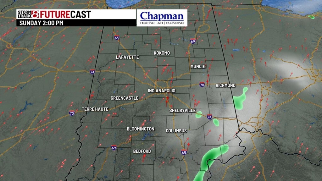
INDIANAPOLIS (WISH) — A few isolated showers will be possible in southeastern and eastern parts of the state later Sunday.
Sunday:
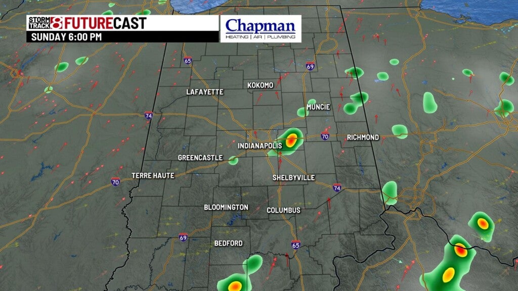
High pressure will slide off to the east this morning. As an upper-level wave moves through for the afternoon, we expect a few isolated showers to develop – mainly in southeastern and eastern portions of the state.
Indianapolis 500:
While the low rain chances look best east of the metro area, we can’t rule out a rogue shower around the track during the race this afternoon – but overall, look for a mostly quiet forecast with temps in the mid 80s through the race.

Highs will top out in the middle and upper 80s Sunday afternoon.

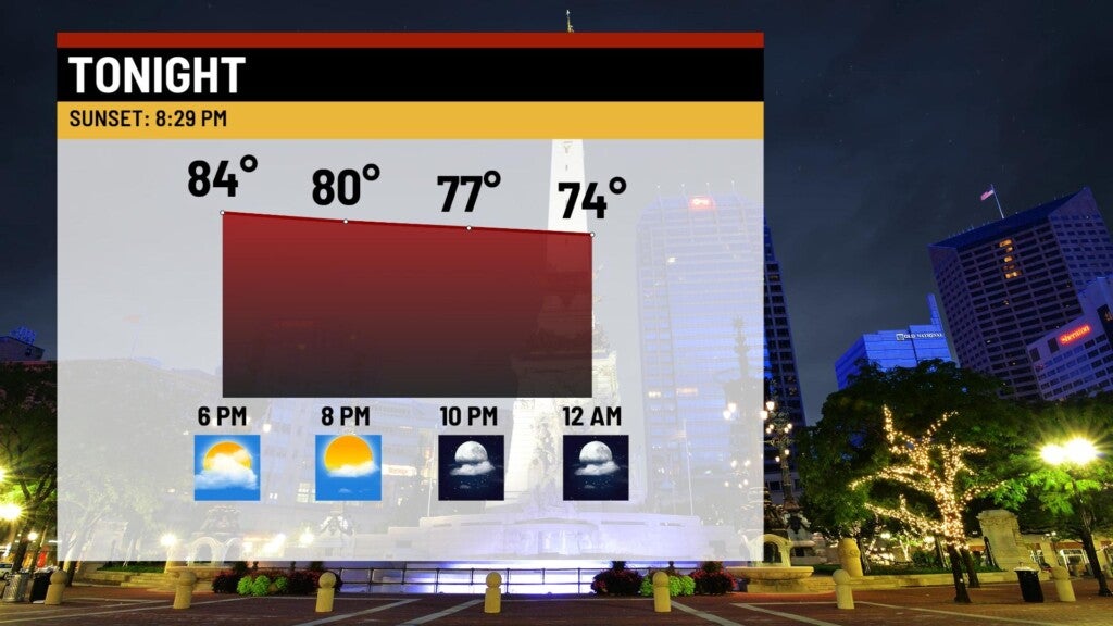
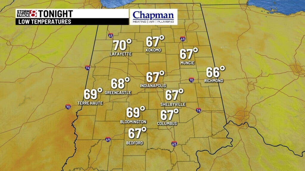
Sunday Night:
An upper-level wave moving through could provide a few showers across the area for the evening and overnight hours.
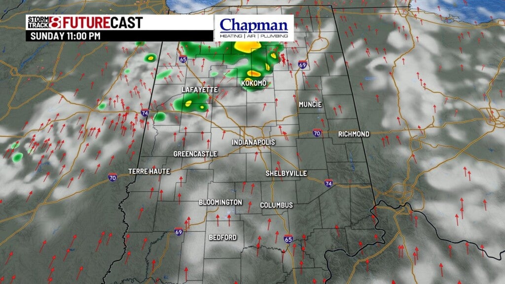
Otherwise, we’re partly cloudy with lows falling to the middle and upper 60s.
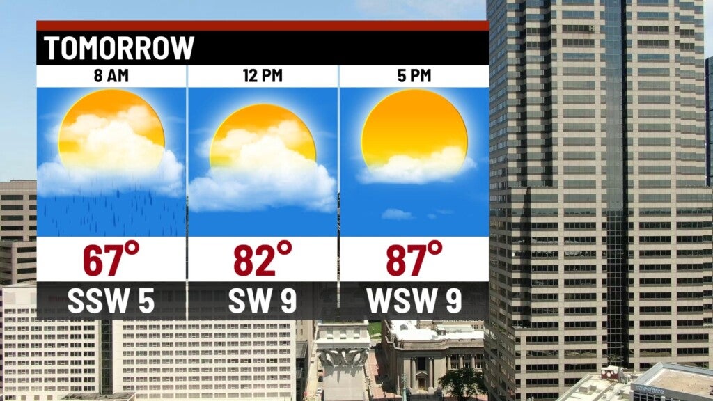
Monday:
Some leftover isolated showers will be around for the morning, but should clear out as we move into the afternoon hours.

Highs will top out in the upper 80s.

Tropical update:
Tropical storms Laura and Marco will continue their march toward the Gulf coast. Both storms are anticipated to reach Category 1 hurricane strength by later today or tomorrow.
As of now, it does not appear that the storms will meet, as Marco is anticipated to make landfall a good 36 to 48 hours before Laura. Marco is forecast to hit the Gulf coast anywhere between Houston to Mississippi by Monday evening.


Meanwhile, Laura will take aim on the same area by mid-week. Hurricane watches are in place along the coast in anticipation of the two storms.
8-day Forecast:
Hot and dry weather settles in for the first half of the work week. Look for highs to return to the lower and middle 90s for Tuesday and Wednesday. The remnants of tropical systems likely play a role in our forecast for Thursday through Saturday, with best rain chances on Friday. Temperatures look to cool off a bit heading into next weekend.
