


Rain for some areas Sunday
INDIANAPOLIS (WISH) — A storm complex could bring showers to the northern half of the state today. Humidity and rain chances will increase over the next few days.
Sunday:
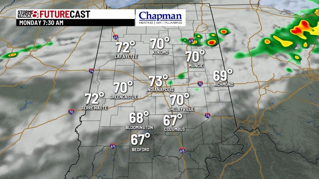
Complex of storms rolling through Illinois Sunday morning should continue to weaken as it moves into western Indiana by mid to late morning. Some showers are expected to hang on for the northern half of the state through the early afternoon.

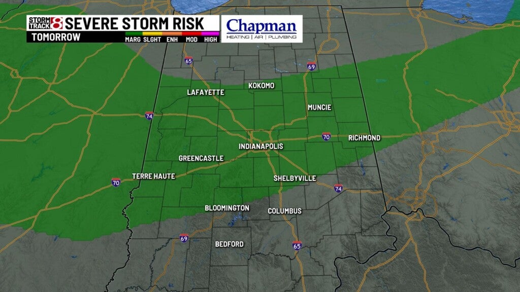
While severe storms should be limited, there could be a few strong storms with gusty winds. Northwestern portions of the area are under a marginal risk for severe storms Sunday.

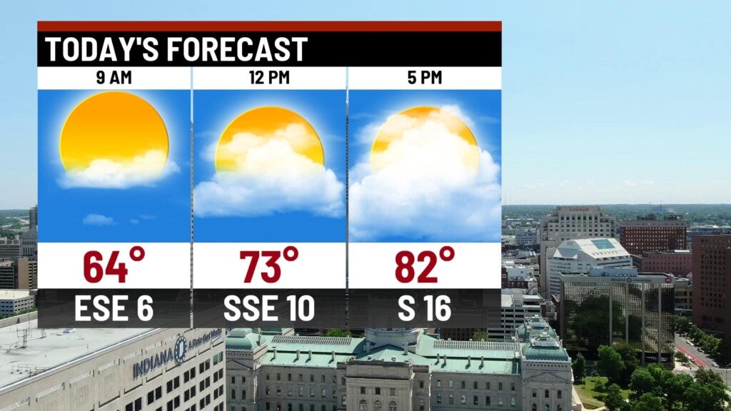
Otherwise, most of us are left with partly to mostly cloudy conditions and warm temperatures. Highs will top out into the lower to middle 80s this afternoon.

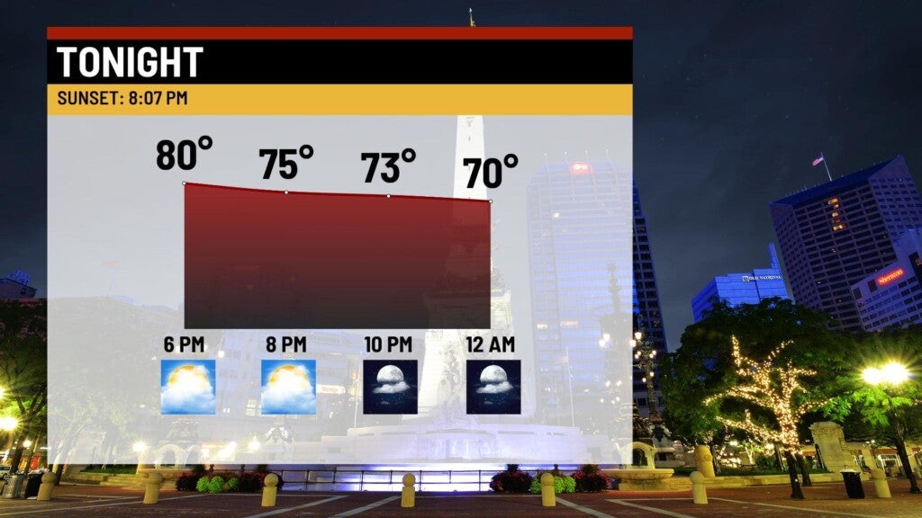
Sunday Night:
Conditions will be relatively quiet for the majority of the overnight. Lows will dip to the middle 60s.

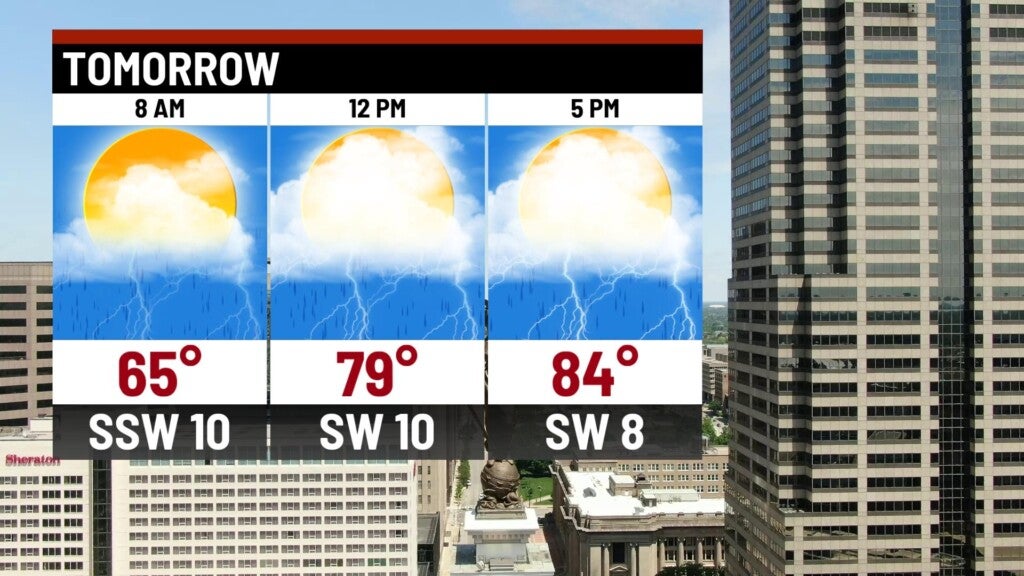
Labor Day:
A cold front will stall out over the state and bring another round of showers and storms to the area. Like Sunday, a few gusty storms could be possible. Most of central Indiana is under a marginal risk for severe storms.

Highs will hit the mid 80s.
8-Day Forecast:
The previously mentioned frontal boundary will stall out, leaving us with daily rain chances over the next several days. Hot and humid conditions will hang around through Wednesday afternoon before an upper level system brings cooler temps and rain chances for Thursday and Friday. Dry and comfortable air will settle in for next weekend, with highs in the lower 70s.
