Bitter cold this weekend, snow returns Sunday night
INDIANAPOLIS (WISH) — Very cold temperatures continue to settle in across the state this weekend. A potent winter system will take aim on the area to wrap up our Sunday.
Saturday:
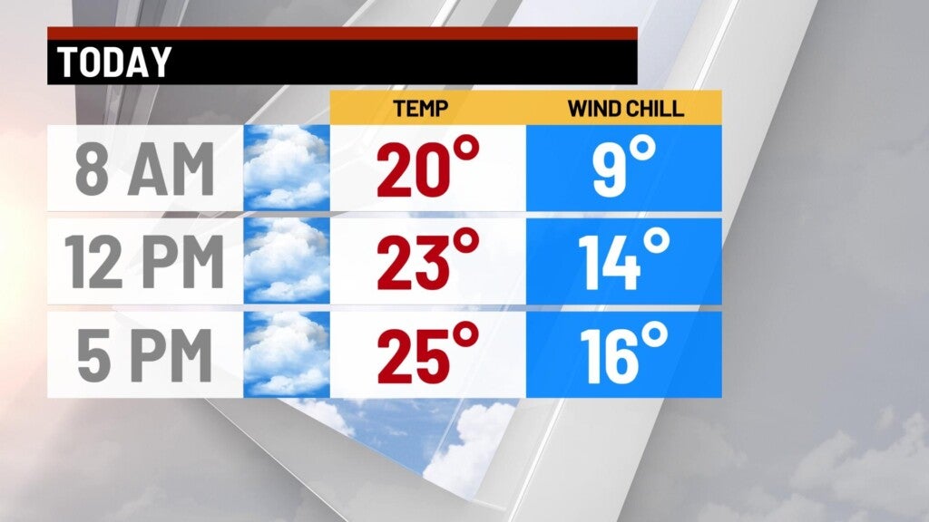
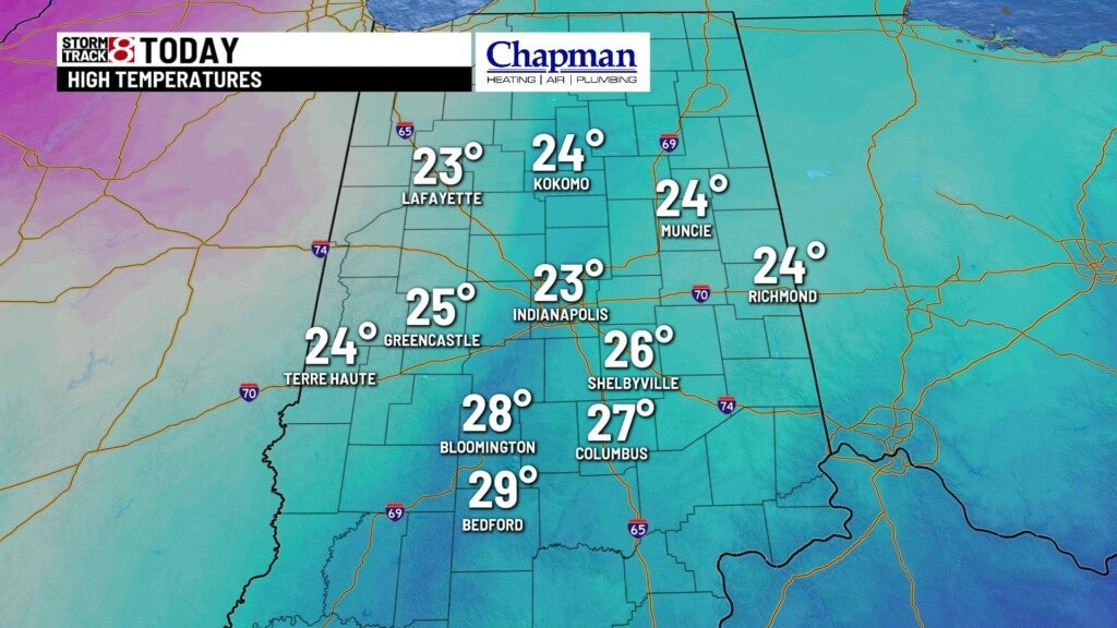
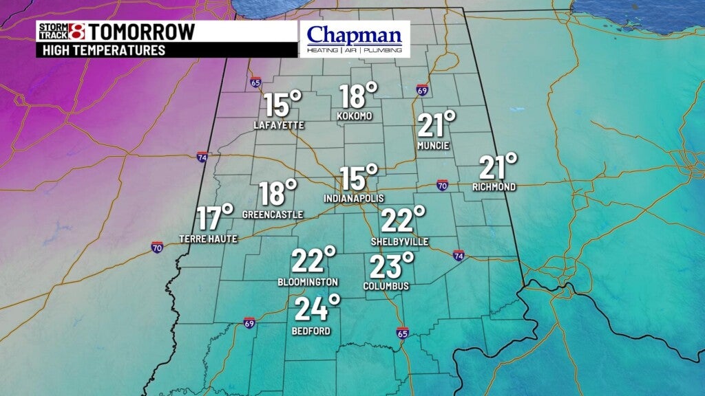
Mostly cloudy conditions across the state today. A few flurries will be possible throughout the day as well, especially for the northern half of the state. Highs top out in the lower to middle 20s.
Saturday night:
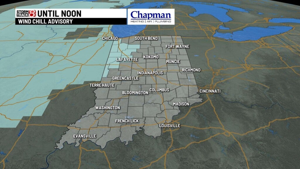
A Wind Chill Advisory will be in effect for northwestern portions of the area, as air temperatures fall to the single digits, wind chills will be well below zero, and in areas of the advisory, wind chills will be anywhere between -10° to -15° for much of the overnight.
Sunday:
Mostly cloudy conditions for much of the day, and very cold. Snow chance should hold off until late Sunday night. Highs top out in the lower 20s.
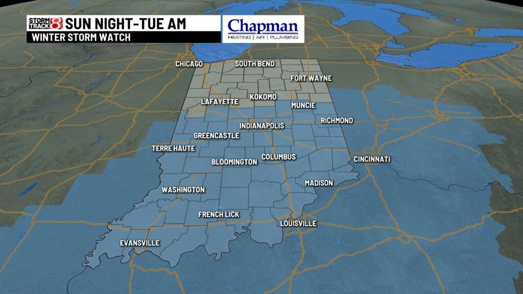
Winter Storm Watch:
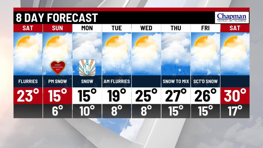
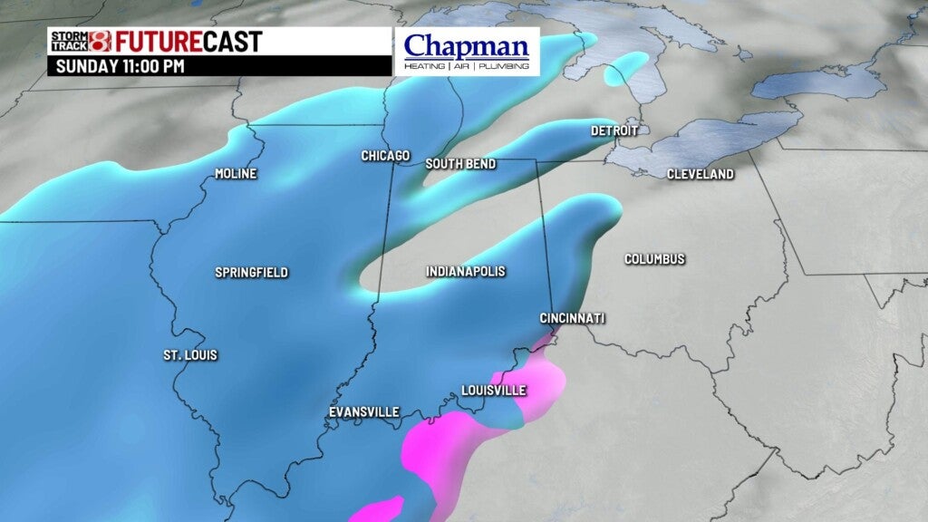
Much of central and southern Indiana is under a winter storm watch from Sunday night through Tuesday morning.
Timing:
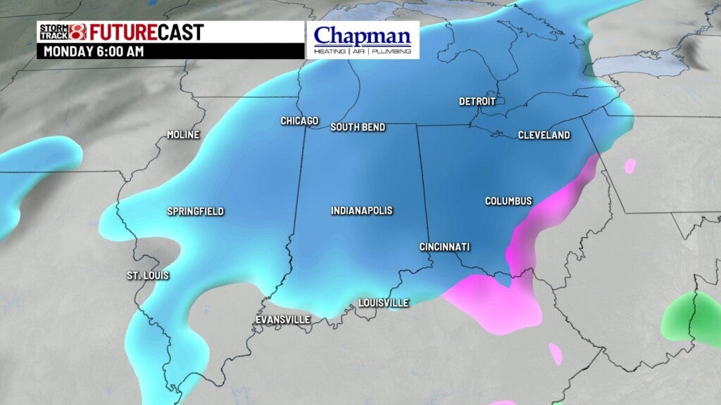
This system will come in two waves. The first will arrives late Sunday night through Monday morning. much of the state should pick up around 1″-2″ of snowfall through the first half of Monday.
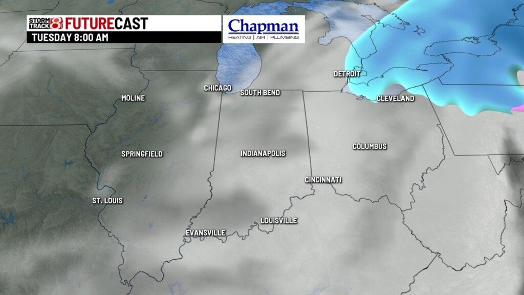
The second wave will be more significant, with the potential for heavy snow at times starting Monday afternoon. Heavy snow will be most likely in the southeastern portions of the state, but still very much packing a punch over central Indiana as well. The heaviest snow should move out for the overnight hours, leaving us with light snow/flurries Tuesday morning.
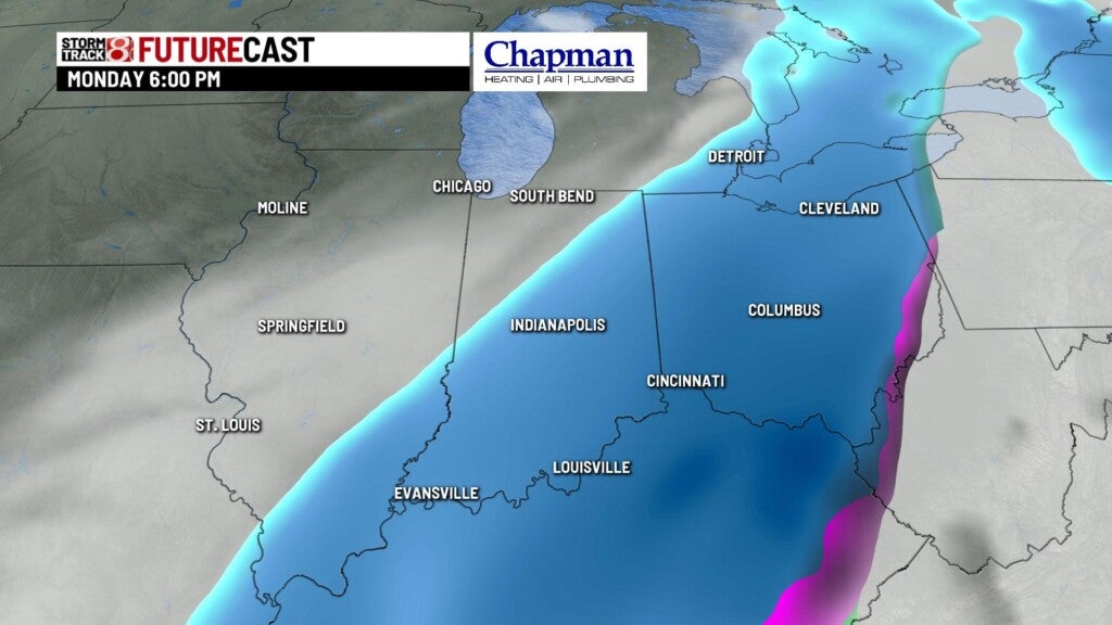
Early call on snowfall from Sunday night through Tuesday morning puts a broad brush of more than 2″ in northwestern Indiana, more than 4″ over central Indiana, and the potential for 6″+ over southern and southeast Indiana.
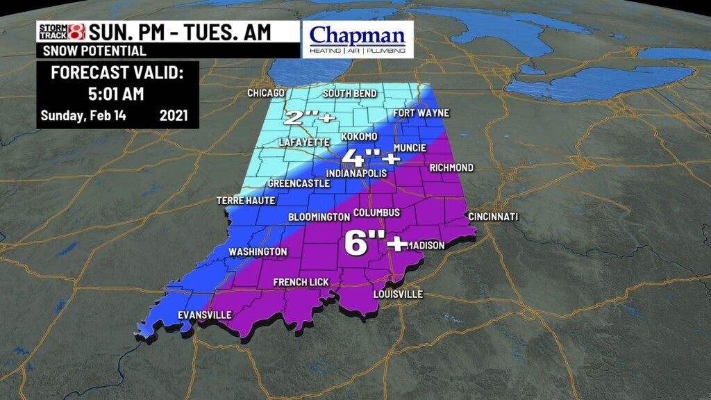
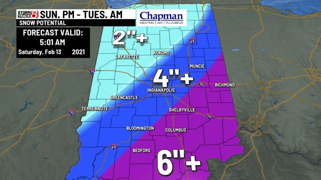
It’s important to note that the forecast is still in it’s early phase, meaning there will likely be shifts to the track over the next 48 hours, and that could impact snow totals either higher or lower as we move closer to the event. Bottom line, prepare for some very tough driving conditions for Monday, especially for the afternoon/evening commute.
8 day forecast:
We’re stuck in the chill over the extended, with well below average temperatures on tap through the next 8 days. Active pattern continues as well, with another potential snow maker moving in Thursday into Friday.