


Warmer day
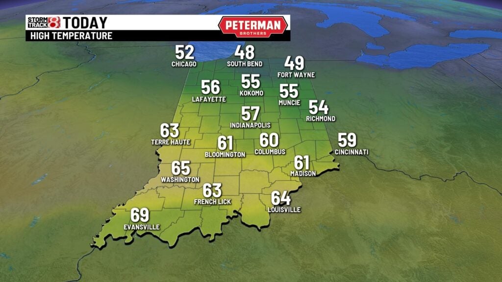
INDIANAPOLIS (WISH) – A dry and bright start to Tuesday morning with temperatures in the lower to mid-30s. Plenty of sunshine Tuesday with highs boosting to the upper 50s this afternoon!
Lows will hold steady overnight with lows in the lower 50s.
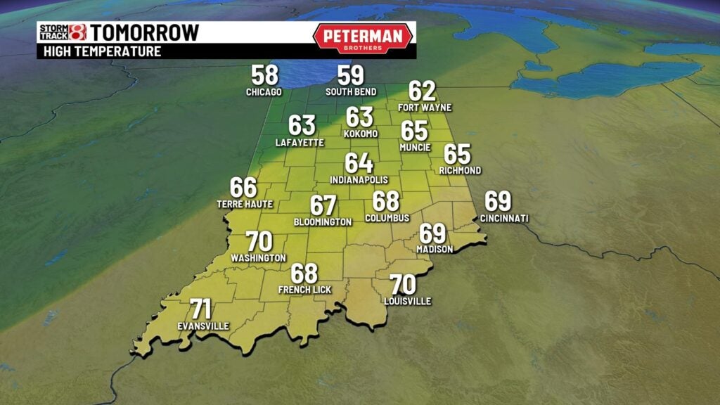
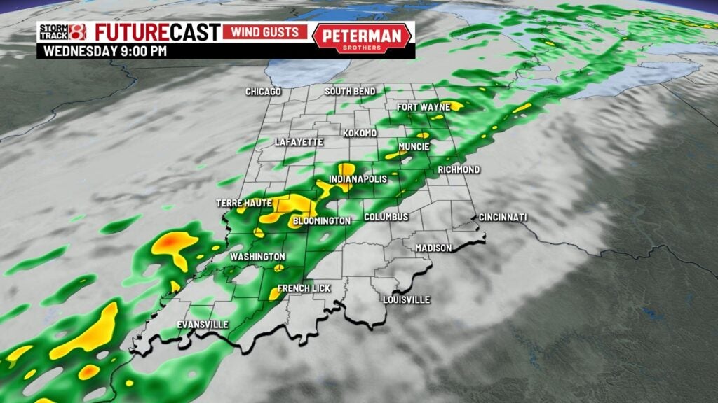
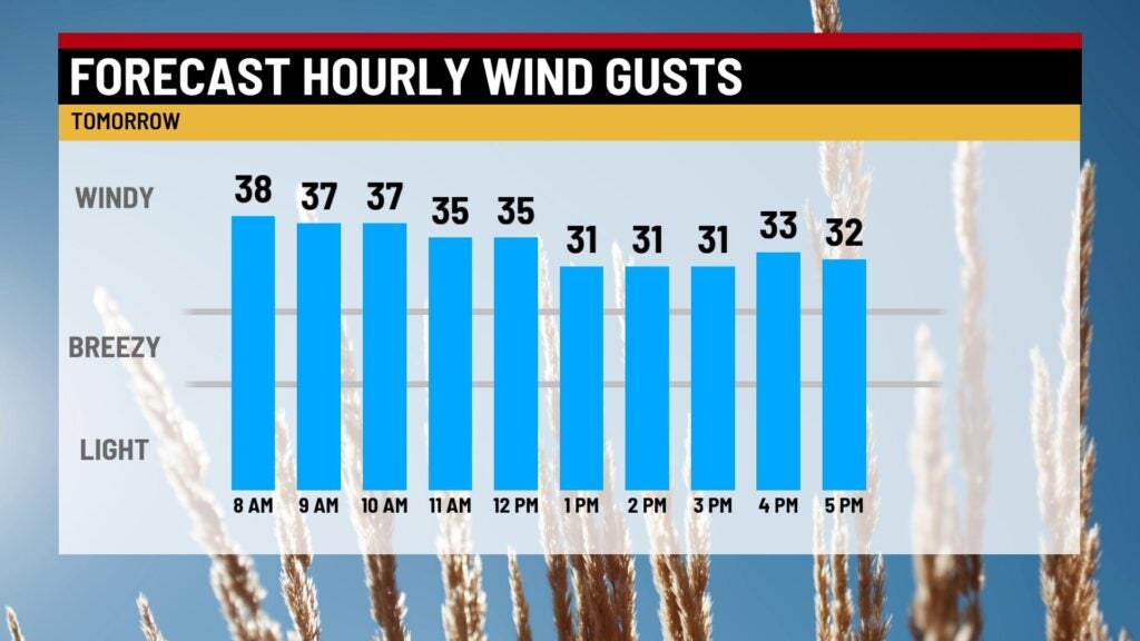
The next cold front will move in Wednesday and will bring in our next chance for rain! Showers should move in during the afternoon. Winds will also crank up anywhere between 20-25 mph during the day. Highs will also warm to the lower 60s through the afternoon.


Rain will stick around through early Thursday morning then as a cold front moves out, temperatures will drop and we should also clear out. Highs Thursday will top out in the lower 40s. It’ll be a chilly end to the week with highs in the lower 40s Friday with plenty of sunshine!
This weekend right now looks split! Saturday will be a dry and tolerable day with highs approaching 50°. The chance of showers returns Sunday with highs in the lower 50s. Light mix to start next week with highs falling to the mid-40s. Chilly next Tuesday with highs in the upper 30s.
