Windy Friday; several chances for rain ahead
INDIANAPOLIS (WISH) — After a cold start to December, we’ll warm up to end the workweek with winds turning quite breezy.
This warmup, however, will not last long with temperatures quickly encountering another cooldown. We’ll also track multiple chances for rain as well.
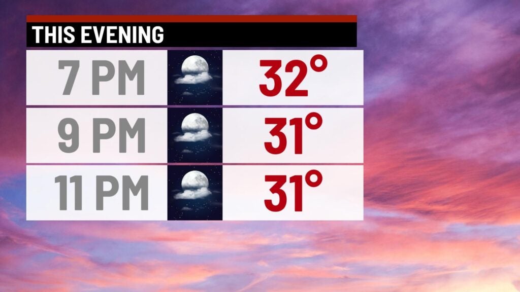
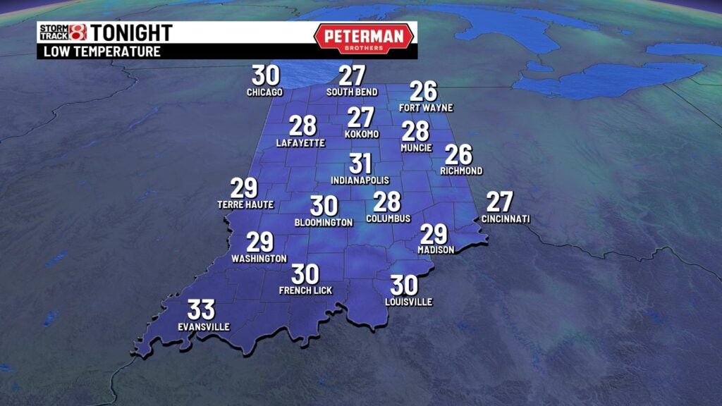
Thursday night: A warmer, albeit chilly, night will be on tap under partly cloudy skies. Lows look to fall into the low 30s.
Friday: We’re eyeing a blustery day with increasing cloud cover throughout the day. Winds are set to be strong enough in which wind advisories are being placed into effect from 3 p.m. Eastern Friday until 1 a.m. Eastern Saturday. Expect sustained winds from 15-20 mph, with gusts from 45-50 mph.
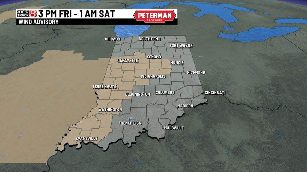
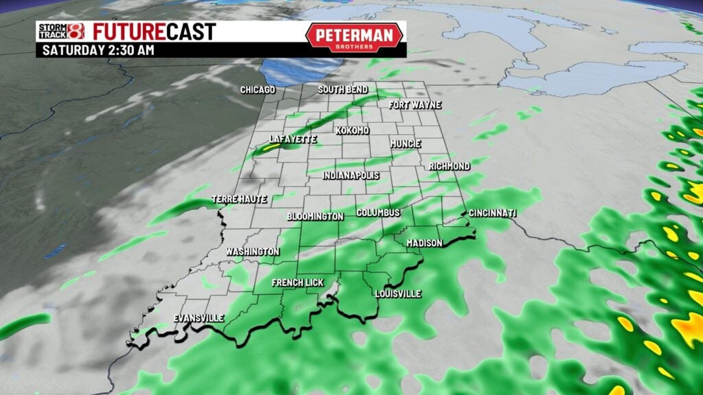
These breezy winds will be in association with another weather maker that will bring the chances for scattered showers Friday night.


Highs on Friday look to rise into the low 50s due to the help of these stronger winds from the south.
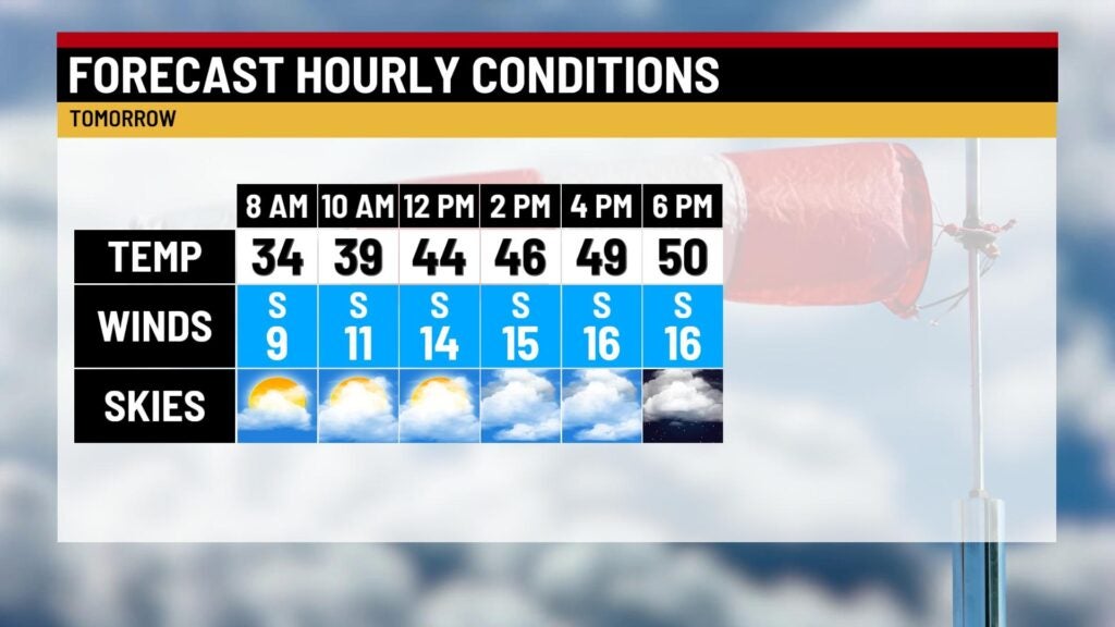
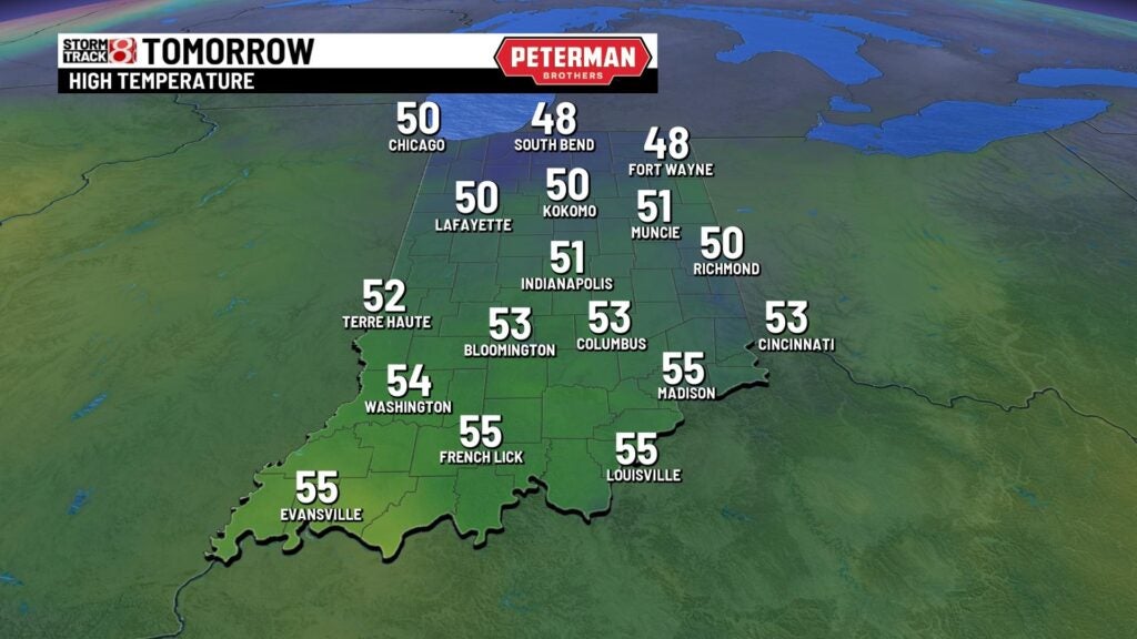
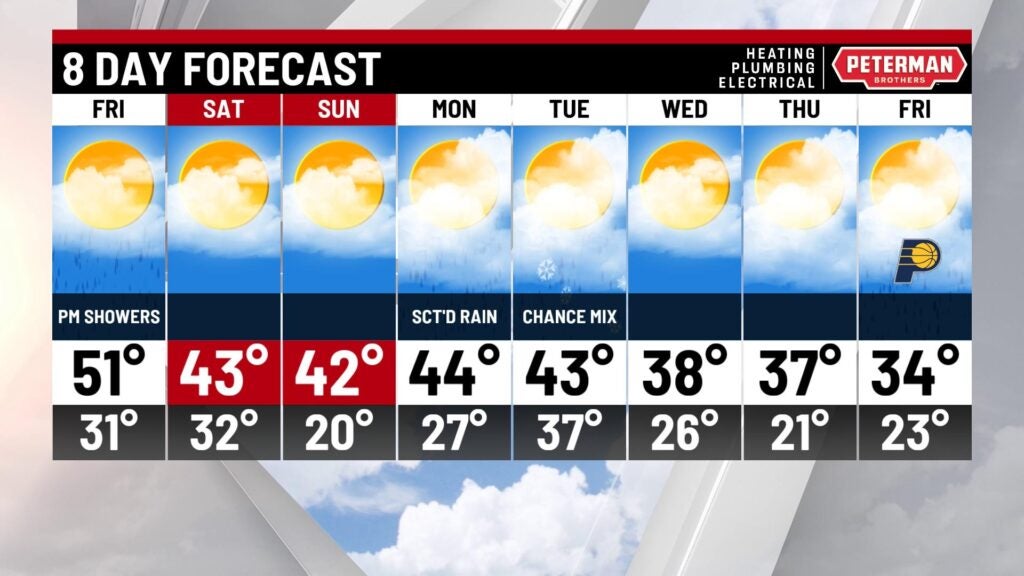
Weekend: Cloud cover and rain will disperse as we enter daybreak Saturday, and we’ll keep lots of sunshine around for the remainder of the day. Unfortunately, our temperatures are set to tumble through early Saturday morning. We won’t escape the mid 30s through Saturday afternoon, and winds will also stay breezy with gusts up to 35 mph at times. Sunday will be a little bit warmer with highs in the low 40s.

8-Day Forecast: Additional precipitation chances will roll in for much of next week. Prepare for near- to below-normal daily high temperatures through the end of next week as well.