


Winds damage drive-in theater, high school football scoreboard
- Storm Track 8 interactive radar | Get the WISH-TV weather app for iOS devices | Get the WISH-TV weather app for Android devices
- Tracking Monday night’s storms, cooler air ahead | A comparison of summer severe weather for 2021, 2022 in Indiana
INDIANAPOLIS (WISH) — Storm warnings also were issued Monday in many parts of Indiana, and reports of damage came into the National Weather Service offices in the state.
Storms in northwest Indiana had wind gusts up to 80 mph.
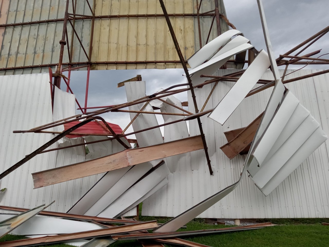
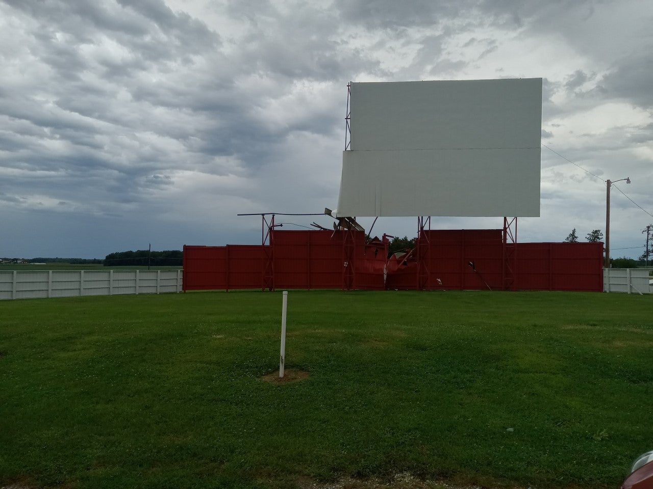
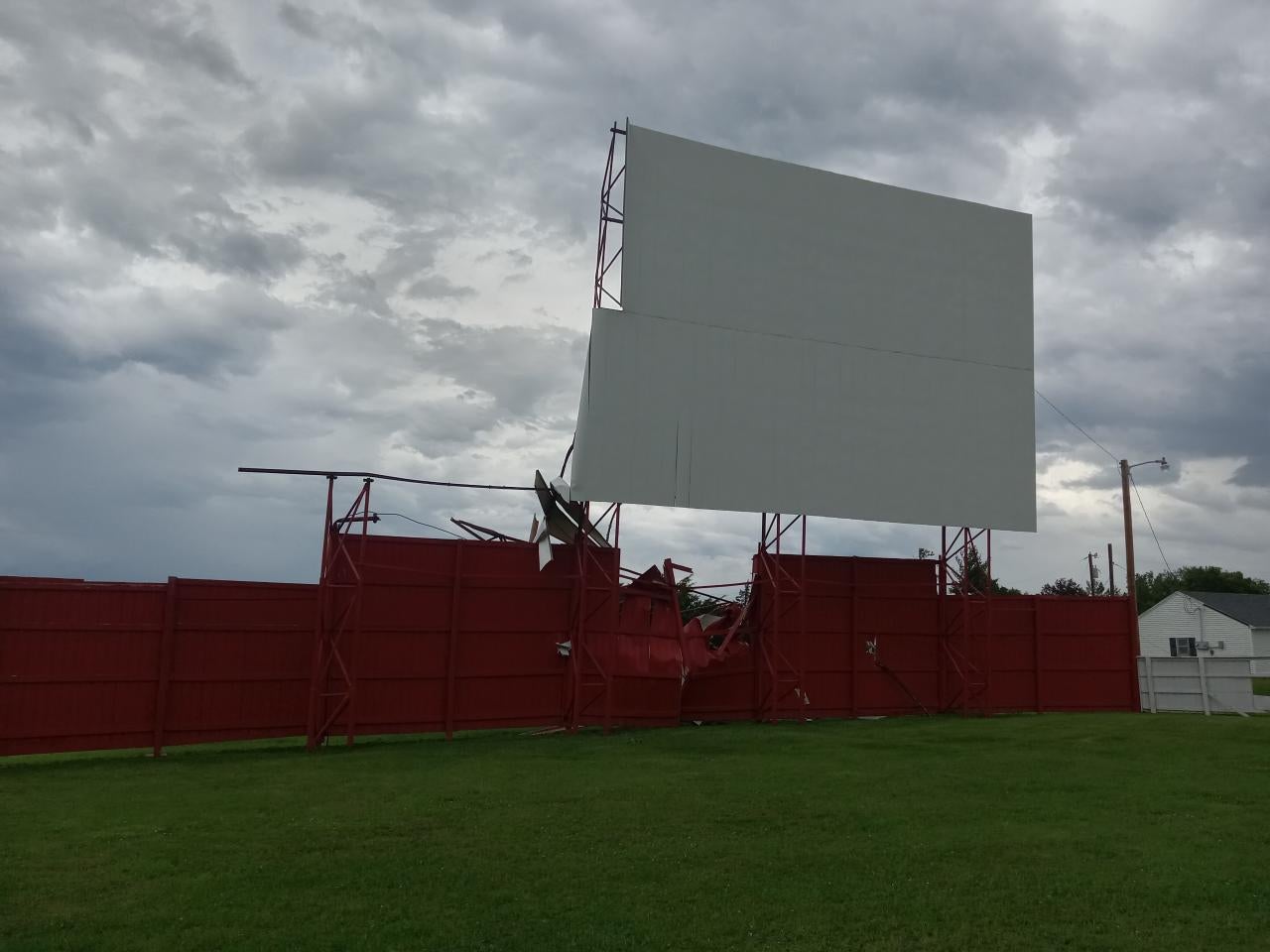
A trained weather spotter reported an outdoor movie theater’s screen was half “torn out” at 4:43 p.m. EST Monday near Garrett in northern Indiana. The owner of the Auburn Garrett Drive-in Theater, north of the city of Garrett, says, as a result, its 2022 season is done.

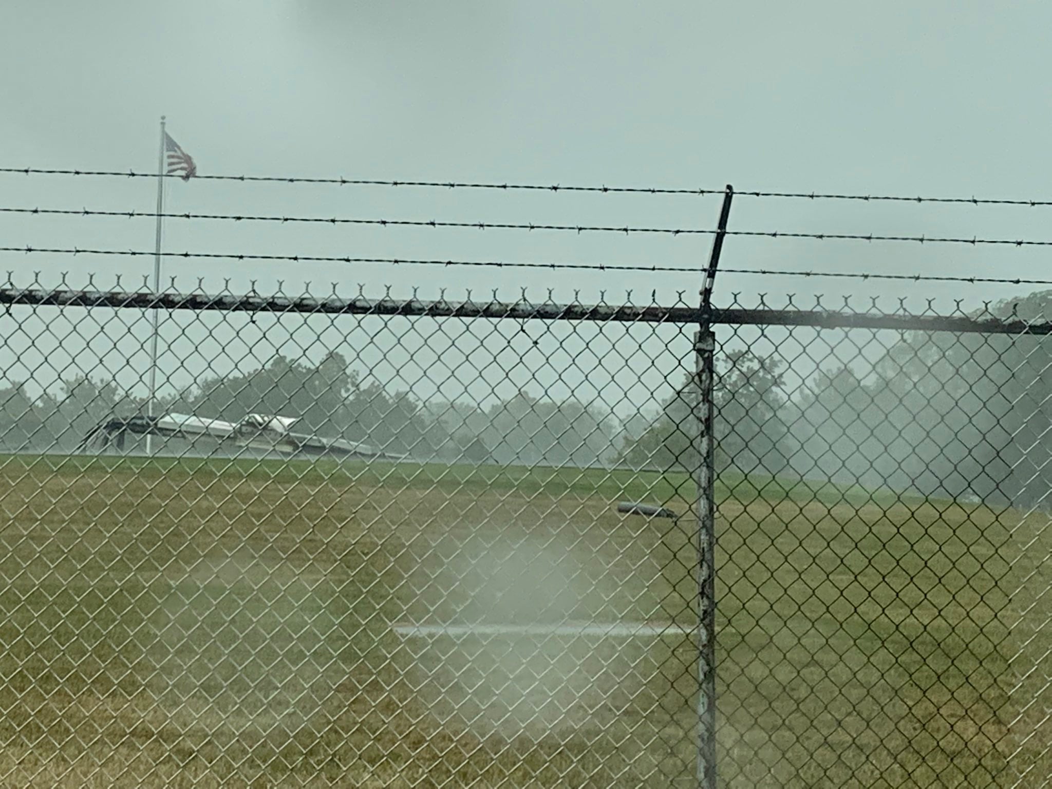
Winds bent to the ground a scoreboard on the football field of Rochester High School about 3:51 p.m. in Fulton County, the weather service reports. The scoreboard faces the west.

Storm Track 8 blog
Find more storm damage reports in our blog.
11:29 p.m.
A special weather statement has been issued for Indianapolis, Greenwood and Lawrence until midnight EDT Monday.

11:17 p.m.
11:09 p.m.
From the National Weather Service at Chicago: “The severe thunderstorm watch that had been in effect for portions of central Illinois and northwest Indiana has expired. While a few storms will continue late this evening south of a Rensselaer to Paxton line, no additional severe weather is expected.”
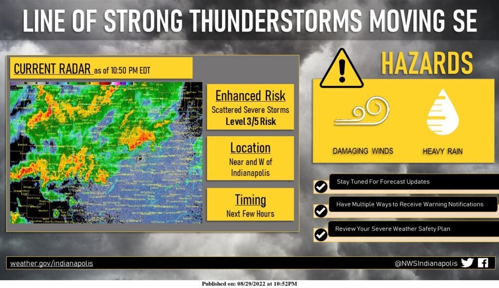
10:52 p.m.
From the National Weather Service at Indianapolis: “Scattered strong thunderstorms are moving southeast across portions of central Indiana, particularly near and west of Indianapolis. The strongest storms may produce wind gusts of 50-55 MPH at times and small hail, along with torrential rainfall and frequent lightning.”
10:35 p.m.
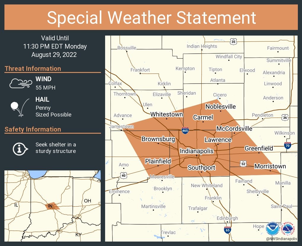
A special weather statement has been issued for Indianapolis, Carmel and Fishers until 11:30 p.m. EDT.
10:32 p.m.
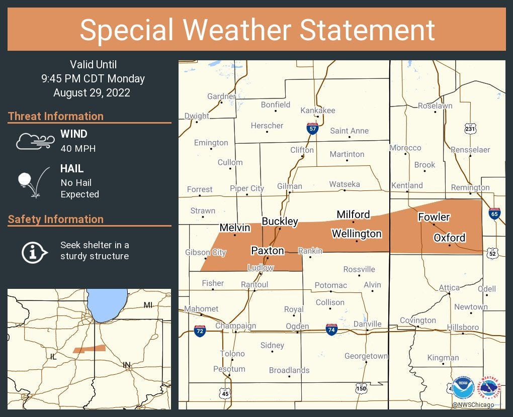
A special weather statement has been issued for Fowler, Indiana, and Paxton and Milford, Illinois, until 9:45 p.m. CDT.
10:18 p.m.
Central County Central Dispatch asks people to avoid the area of Main and Third streets in the town of Mulberry. A downed tree is blocking the road.
8:25 p.m.
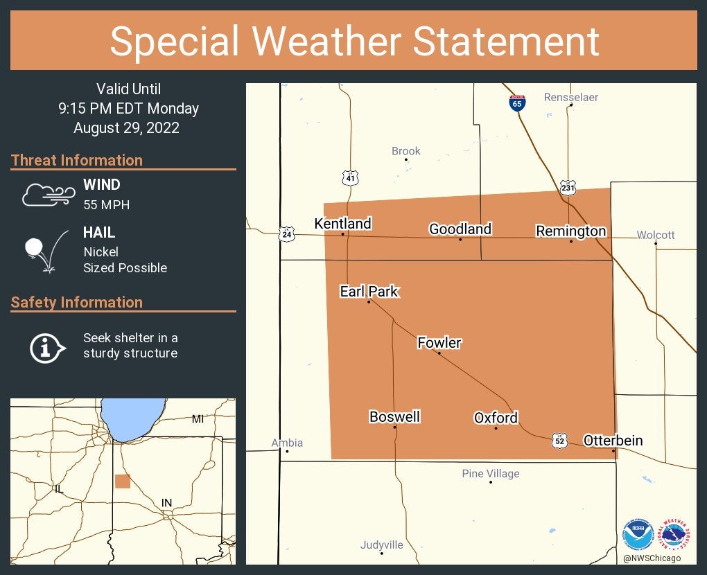
A special weather statement has been issued for Fowler, Kentland and Otterbein until 9:15 p.m. EDT.
8:23 p.m.
A special weather statement has been issued for Attica, Covington and Rockville until 9:15 p.m. EDT.

8:18 p.m.
From AES Indiana on Twitter: “A line of strong thunderstorms moved across our service territory earlier with strong wind and rain. Currently 591 customers remain w/o power. Our crews are working quickly and safely to restore power. Additional strong to severe storms are possible later tonight.”
8:12 p.m.
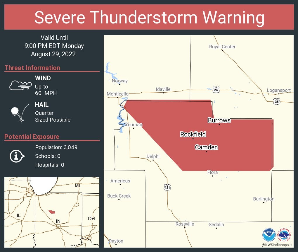
Severe thunderstorm warning including Camden, Burrows and Rockfield until 9 p.m EDT.
8:11 p.m.
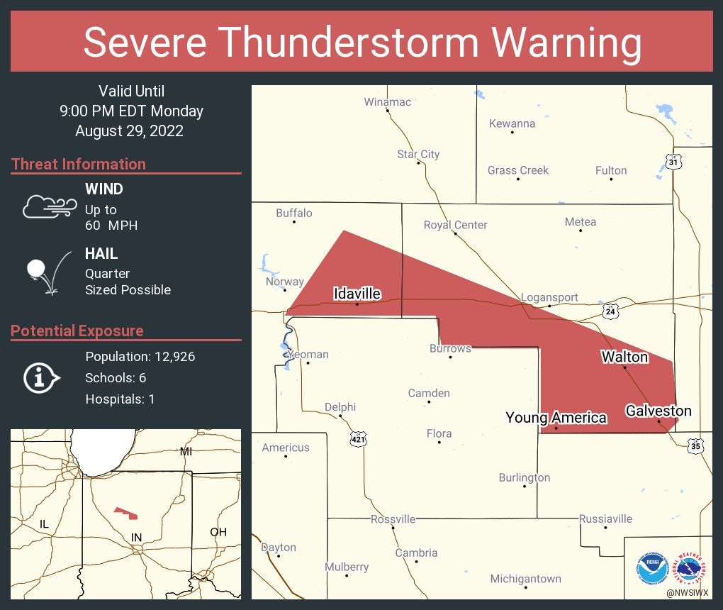
Severe Thunderstorm Warning including Galveston, Walton and Idaville until 9 p.m. EDT.
8:04 p.m.
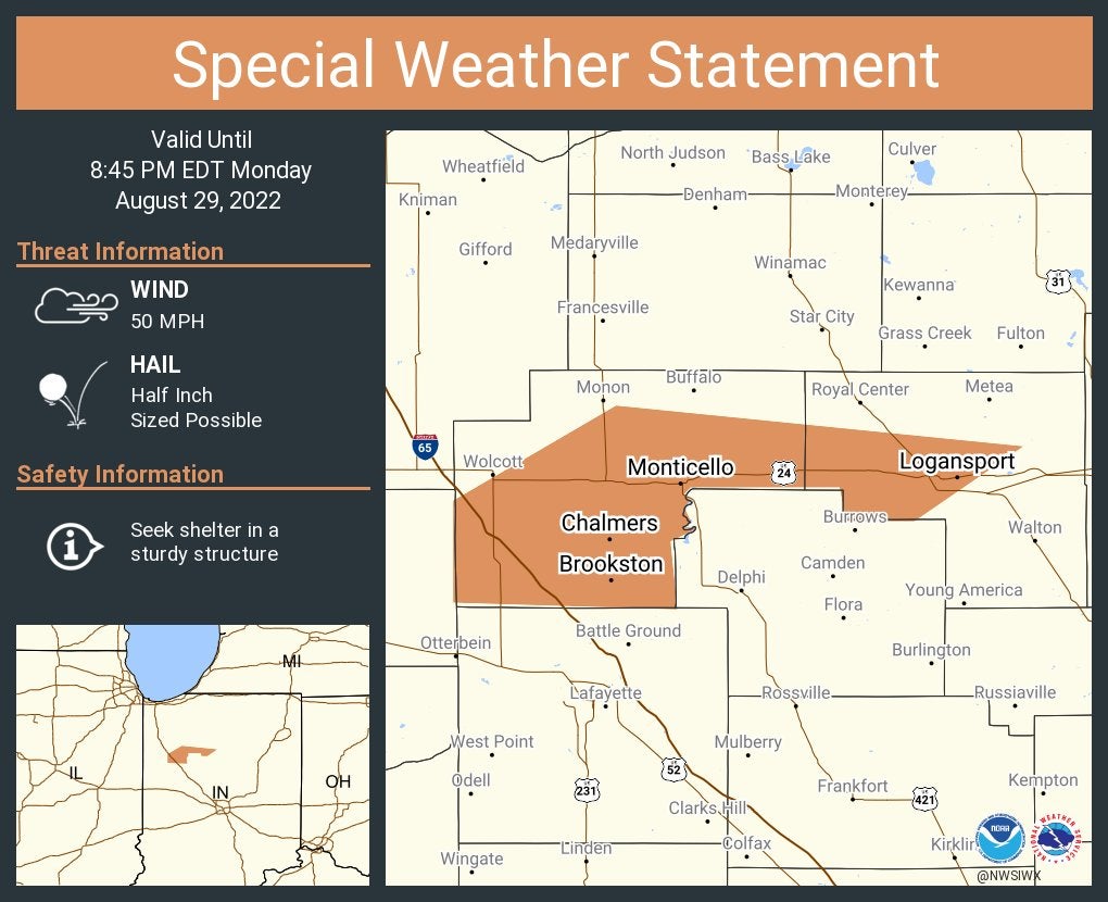
A special weather statement has been issued for Logansport, Monticello and Brookston until 8:45 p.m. EDT.
7:42 p.m.
Trees, limbs and power lines and poles were downed in Peru, especially along state roads 19 and 24, the Miami County emergency manager told the weather service. That damage happened about 4:25 p.m. EDT. A few structures lost their roofs.
7:20 p.m.
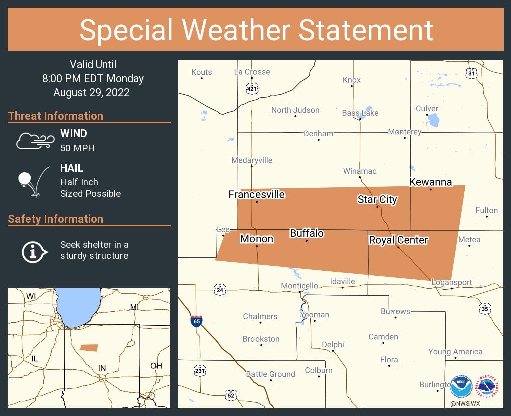
A special weather statement has been issued for Monon, Francesville and Royal Center until 8 p.m. EDT.
7:18 p.m.
7 p.m.
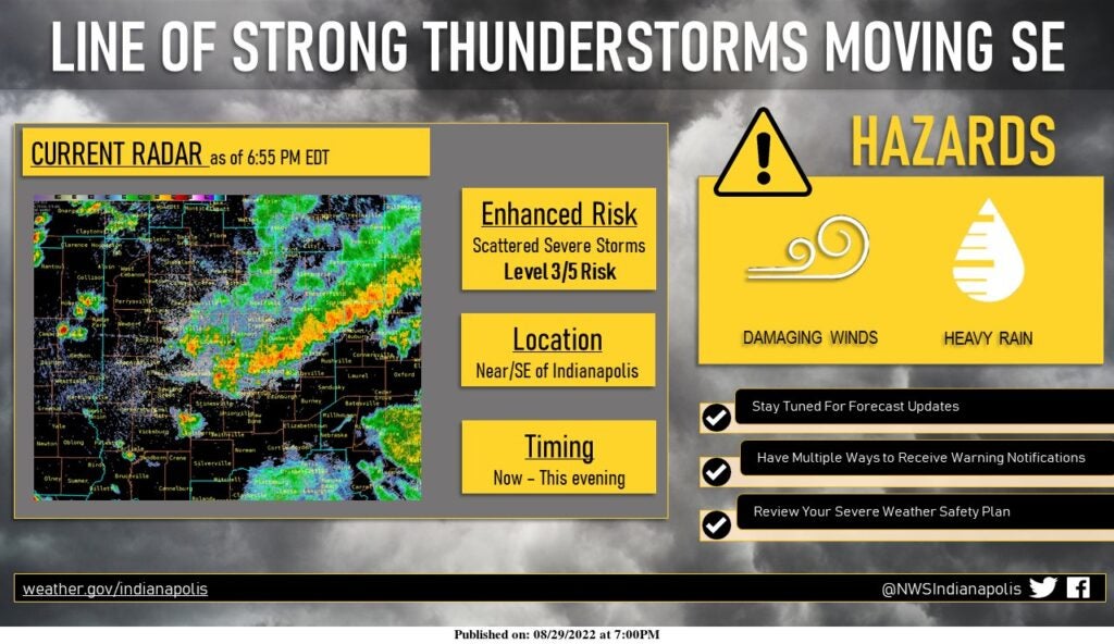
From the National Weather Service at Indianapolis: A line of strong thunderstorms is moving southeast across central and southeastern portions of central Indiana. Wind gusts from 35-50 mph are expected, with isolated higher gusts possible, along with heavy rain. Additional strong to severe storms are possible later Monday night.
6:50 p.m.
Winds damaged houses in Wabash County about 3 miles north-northeast of the unincorporated community of Disko, Indiana, the public told the weather service.
6:45 p.m.
A special weather statement has been issued for Franklin, Shelbyville and New Castle until 7:15 p.m. EDT.

6:11 p.m.
A special weather statement has been issued for Fort Branch, Haubstadt and Owensville until 5:45 p.m. CDT.

6:10 p.m.
Storms knocked trees down across U.S. 27 in Richmond, according to a public report to the National Weather Service.
6:07 p.m.
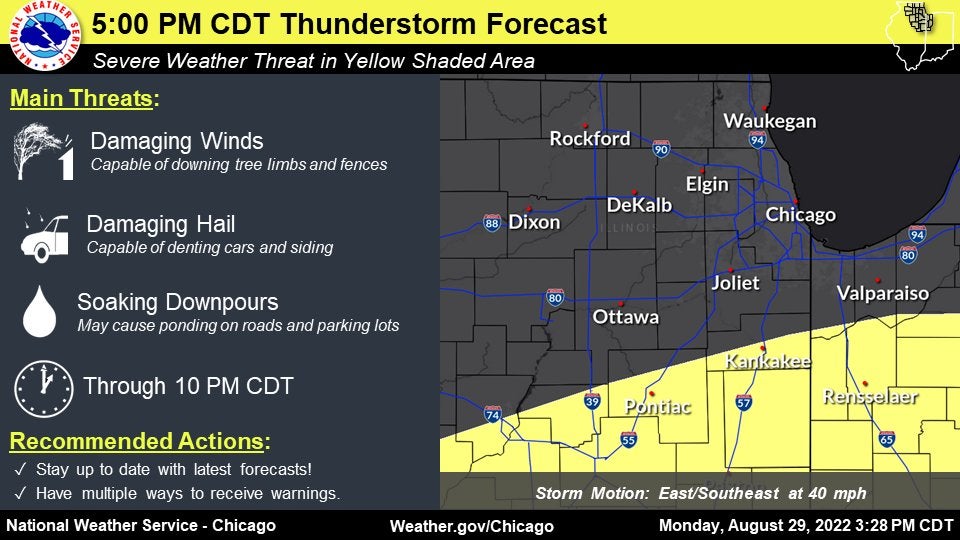
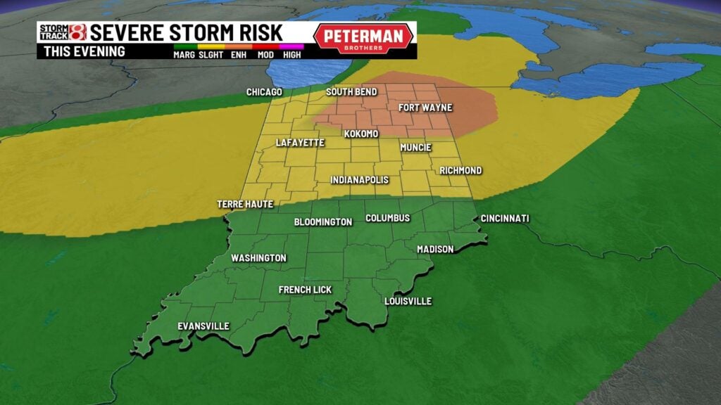
From the National Weather Service at Chicago: Thunderstorms will redevelop in the yellow shaded area this evening with a continued threat for severe weather through 10 p.n. CDT. Have multiple ways to get warnings if you live in the yellow shaded area! Elsewhere, a few showers cannot be ruled out tonight.
6:01 p.m.
A person was trapped when a tree fell on a vehicle at 3:55 p.m. EDT in Fulton County about 2 miles south-southwest of Fulton, the public told the weather service.
6 p.m.
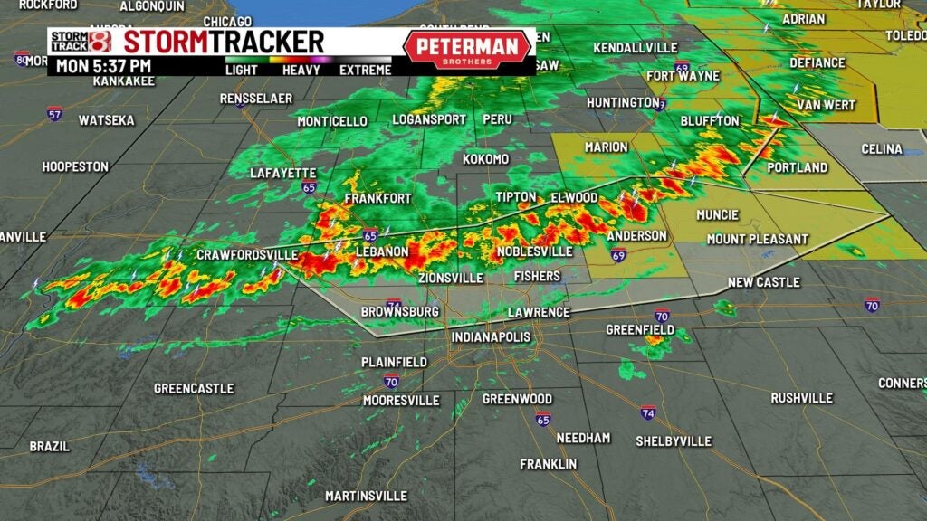
From Storm Track 8 meteorologist Ryan Morse: “And … here comes the showers and storms through Indianapolis.”

5:46 p.m.
A person received minor injuries in a large tree fell on a car at 3:30 p.m. EDT in St. Joseph County about 2 miles east-southeast of the unincorporated community of Lydick, Indiana.
5:39 p.m.
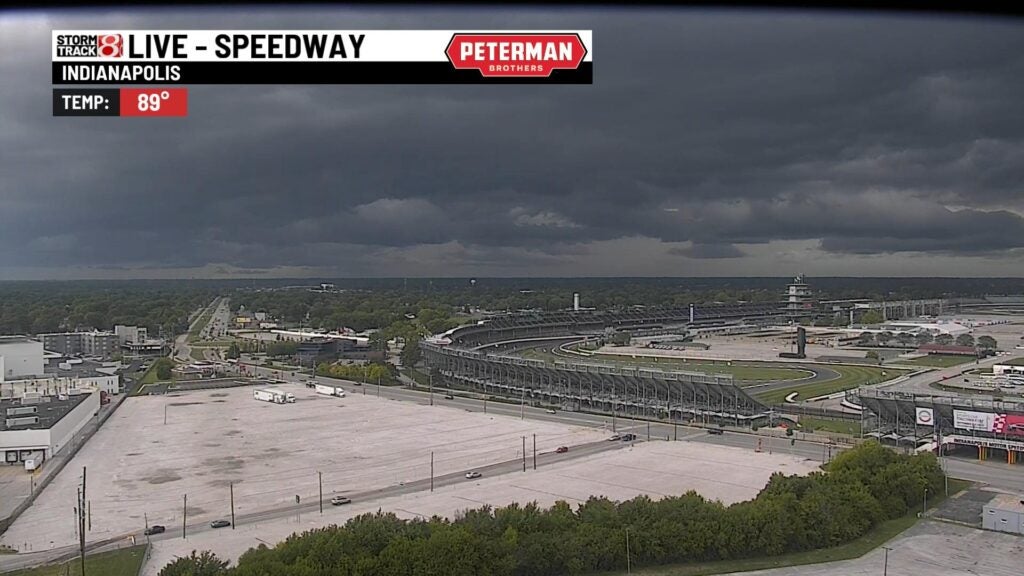
From Storm Track 8: Showers and storms are continuing to move toward Interstate 70 in a gradually weakening state. The Indianapolis Motor Speedway camera is showing the gust front ahead of the actual line of activity.
5:15 p.m.
A trained weather spotter reported an outdoor movie theater’s screen was half “torn out” at 4:43 p.m. EST Monday near Garrett in northern Indiana. The owner of the Auburn Garrett Drive-in Theater, north of the city of Garrett, says, as a result, its 2022 season is done.
5:32 p.m.
The Associated Press says utilities reported more than 140,000 customers across Michigan and Indiana have lost power as severe thunderstorms packing winds as high as 60 mph raked the region. Consumers Energy reported more than 111,000 Michigan customers without service just after 5 p.m., Indiana Michigan Power Co. had more than 15,000 outages across the two states, Northern Indiana Public Service Co. said nearly 12,000 of its customers had no power, and Kankakee Valley REMC said 3,800 of its members were affected. The National Weather Service says tree branches and power lines fell while winds gusted as high as 58 mph at Battle Creek Executive Airport in Michigan and 60 mph in Huntington, Indiana, southwest of Fort Wayne.
5:22 p.m.
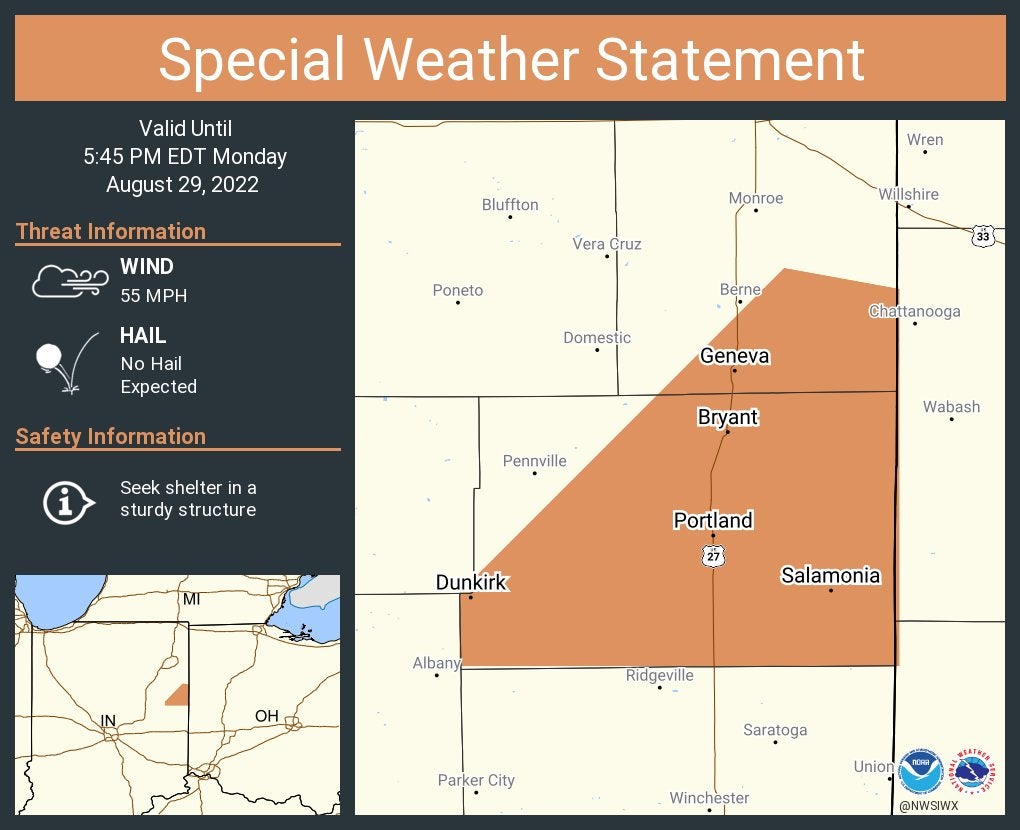
A special weather statement has been issued for Portland, Dunkirk and Redkey until 5:45 p.m. EDT.
5:17 p.m.
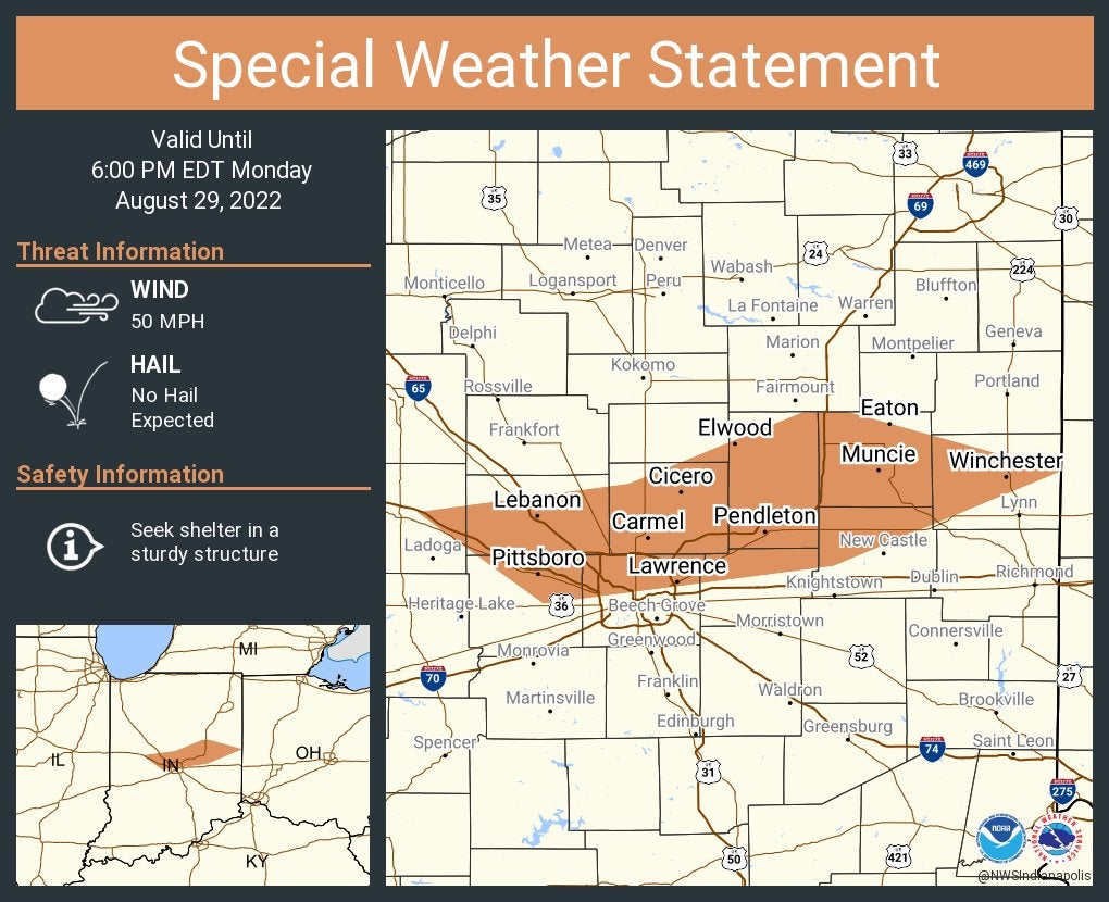
A special weather statement has been issued for Carmel, Fishers and Muncie until 6 p.m. EDT
5:12 p.m.
Tree branches with a 4-inch diameter fell on a house and on Canal Street east of Eben Street in New Haven in Allen County, according to an amateur radio report to the weather service.
5:07 p.m.
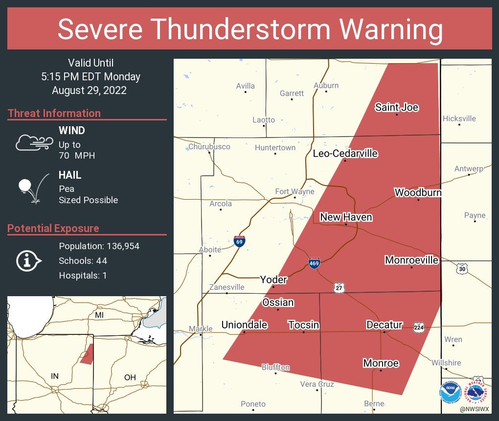
Severe thunderstorm warning continues for New Haven, Decatur and Leo-Cedarville until 5:15 p.m. EDT. This storm will contain wind gusts to 70 mph.
5:02 p.m.
Clinton County 911 activated tornado sirens after a trained weather spotter saw significant rotation south of Frankfort.
4:58 p.m.
From the National Weather Service at Indianapolis: A line of strong thunderstorms is moving SE across central Indiana. Strong winds are pushing out ahead of the line with 40-50mph wind gusts reported recently. Localized flooding will also be possible this afternoon into tonight.

4:55 p.m.
The Huntington County emergency manager reports a stoplight and multiple trees were downed at 4:40 p.m. EDT as storms with 50 mph winds moved through.
4:46 p.m.
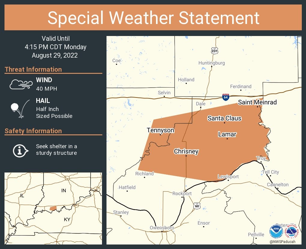
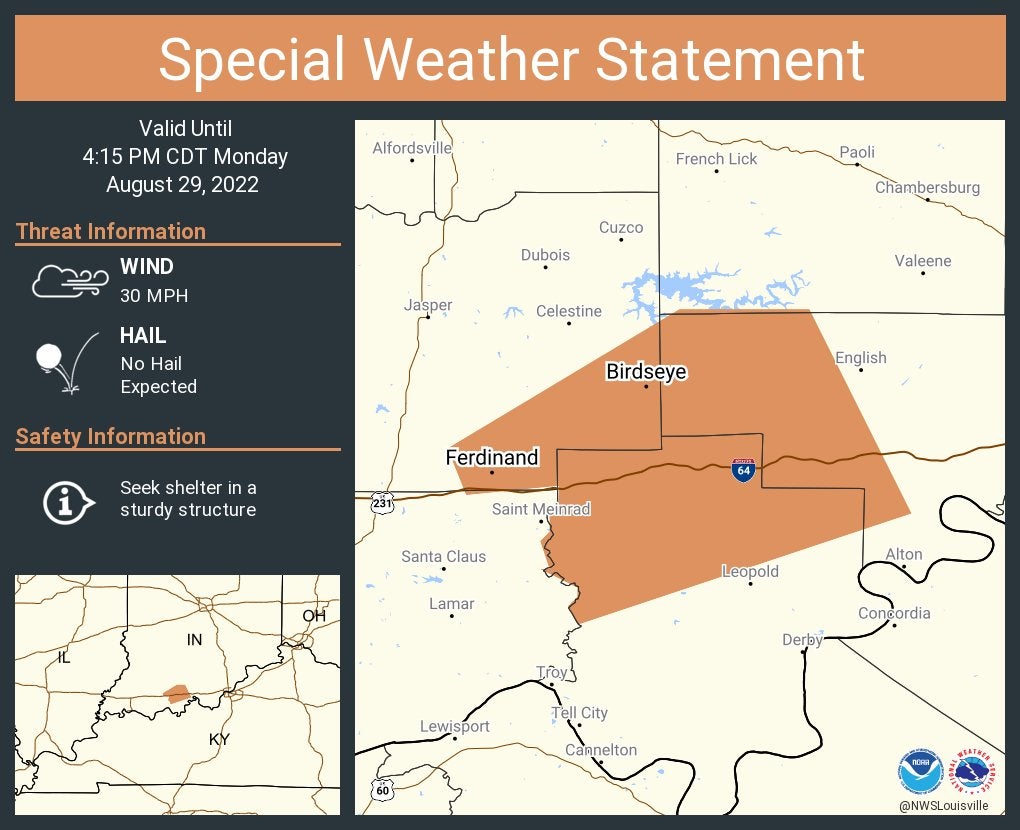
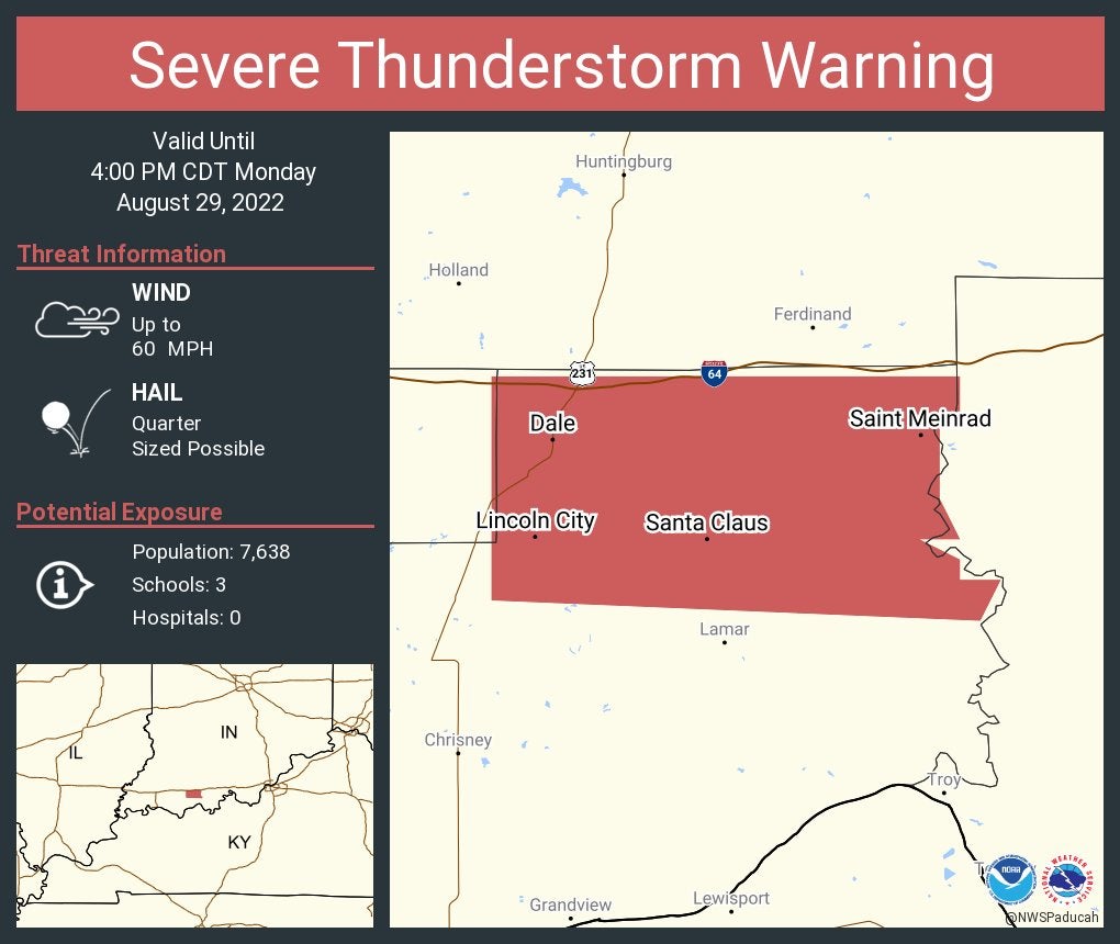
A special weather statement has been issued for Santa Claus, Saint Meinrad and Chrisney until 4:15 p.m. CDT.
4:45 p.m.
A special weather statement has been issued for Anderson, Noblesville and Westfield until 5:30 p.m. EDT.

A special weather statement has been issued for Ferdinand and Birdseye until 4:15 p.m. CDT.
4:44 p.m.
Several large pine trees were snapped about 4:35 p.m. Monday in Whitley County 4 miles west-southwest of Columbia City.
4:43 p.m.
Indiana Michigan power reports more than 3,300 power outages in and around South Bend.
4:41 p.m.
Duke Energy has 3,961 customers with power outages, with more than 1,000+ without power around Kokomo, another 1,000+ around Rochester, and another 1,000 in southern Indiana, where a storm moved through within the past hour.
4:40 p.m.
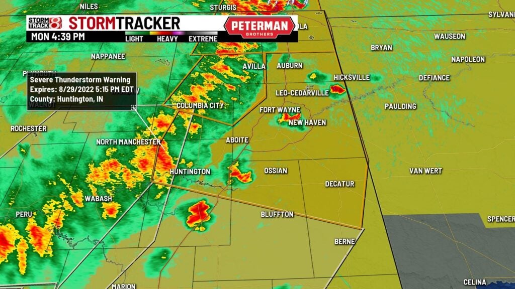
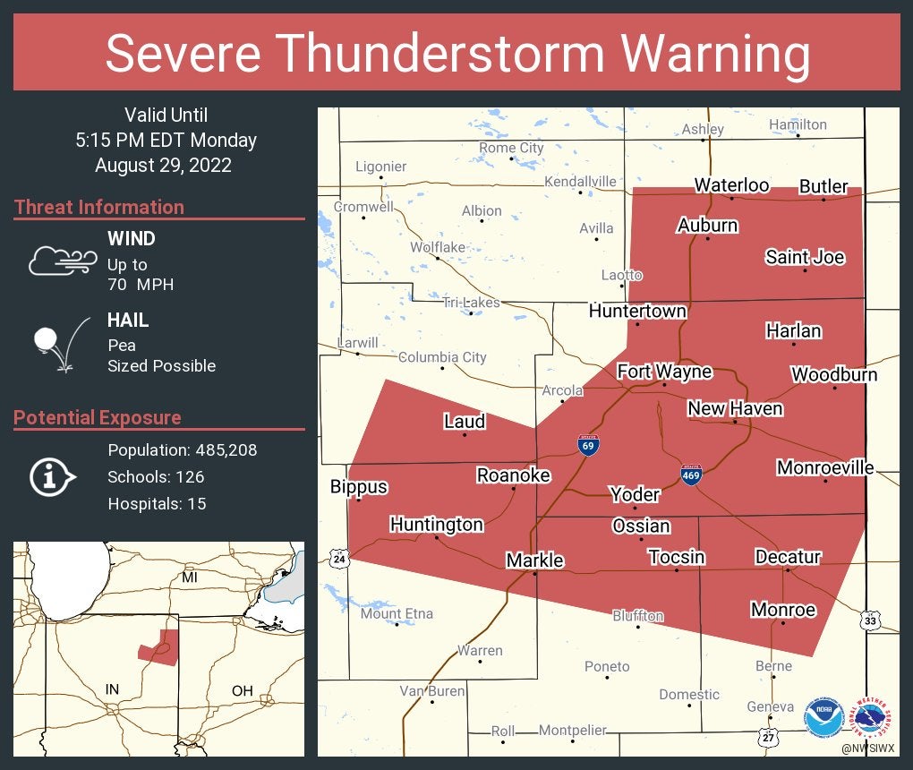
From Storm Track 8: A severe thunderstorm warning is in effect for portions of northern Huntington and Wells counties until 5:15 p.m. EDT. These storms will contain considerable wind gusts up to 70 mph. This line of storms in general have a history of producing wind damage.
4:34 p.m.
Severe thunderstorm warning including Fort Wayne, Huntington and New Haven until 5:15 p.m. EDT. This storm will contain wind gusts to 70 mph.
A National Weather Service employee reported a gust of 81 mph on a home weather state at 1:42 p.m. CDT Monday. Damage from winds was spread across Lake County in the communities of Lowell, Dyer, St. John and Hammond.
4:25 p.m.
A National Weather Service employee reported trees downed and blocking streets at 4:10 p.m. in Winona Lake.
4:24 p.m.
A National Weather Service employee reported wind gusts from 45-50 mph, with downed small branches from 1-3 inches in diameter, at 3:55 p.m. in Monoquet in Kosciusko County.
4:22 p.m.
News reports said a tree at 3:45 p.m. EDT Monday fell on a house at Ewing and Bayless streets in Plymouth.
4:23 p.m.
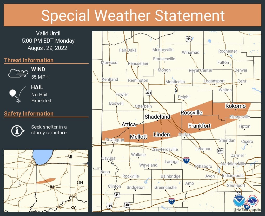
A special weather statement has been issued for Kokomo, Frankfort and Attica until 5 p.m. EDT.
Severe thunderstorm warning including Santa Claus, Dale and Saint Meinrad until 4 p.m. CDT.
4:19 p.m.
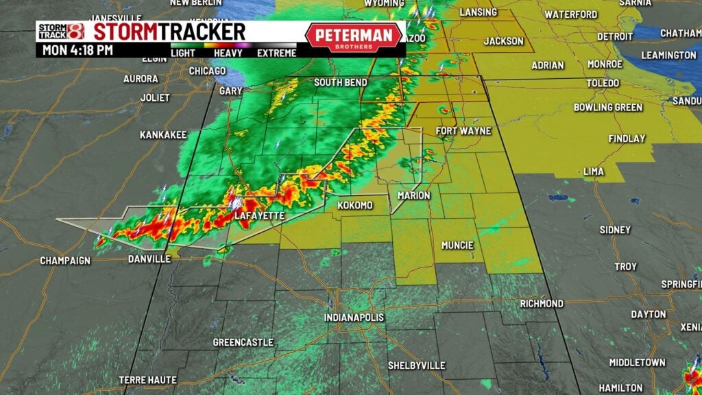
From Storm Track 8: We have a line of storms that are mostly just below severe limits at this time through Lafayette to north of Kokomo. A threat for strong to severe storms remains with us over the next few hours with damaging winds being the primary threat.
4:15 p.m.
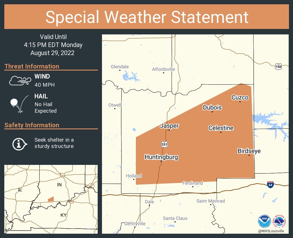
A special weather statement has been issued for Jasper, Huntingburg and Ferdinand until 4:45 p.m. EDT.

4:14 p.m.
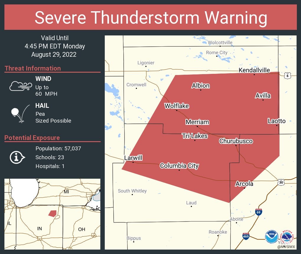
Severe thunderstorm warning including Kendallville, Columbia City and Avilla until 4:45 p.m. EDT.
4:13 p.m.
A trained weather spotter told the National Weather Service of extensive damage happening around 2:20 p.m.CDT Monday along State Road 10 and surrounding areas from Demotte to Wheatfield. Healthy trees were snapped at their bases. At least seven free-standing power poles were snapped in an open field. A metal roof was torn off a farm building and spread across a field. The spotter measured a winder gust of 78 mph before their equipment failed.
4:11 p.m.
The public reported small branches downed at 1:40 p.m. CDT in Lowell.
4:08 p.m.
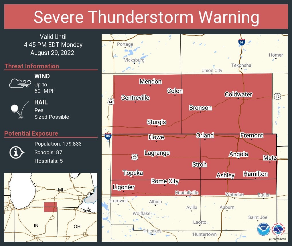
Severe thunderstorm warning including Sturgis and Coldwater, Michigan, and Angola, Indiana, until 4:45 p.m. EDT.
4:06 p.m.
4:05 p.m.
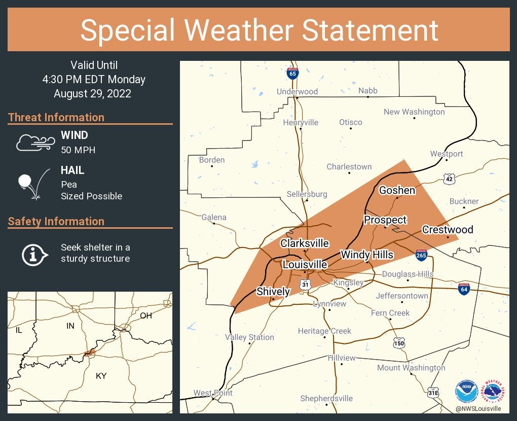
A special weather statement has been issued for Louisville, Kentucky and Jeffersonville and New Albany, Indiana, until 4:30 p.m. EDT.
4:02 p.m.
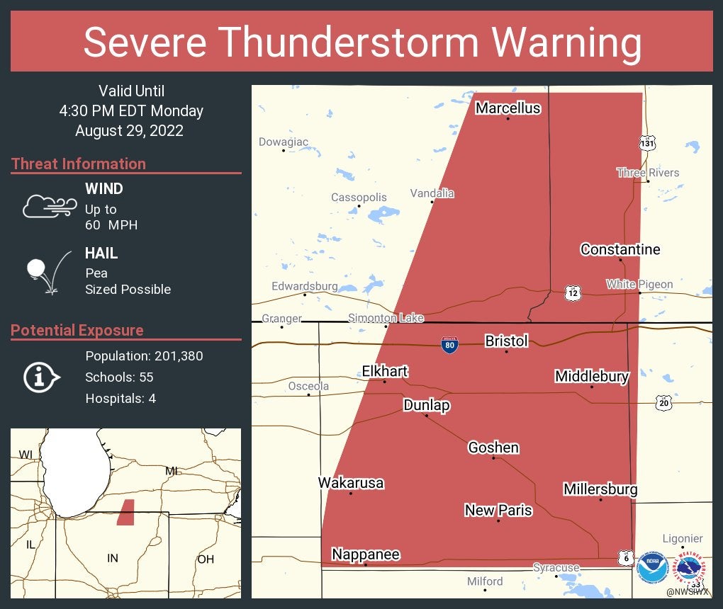
Severe thunderstorm warning continues for Elkhart, Goshen and Nappanee until 4:30 p.m. EDT.
3:55 p.m.
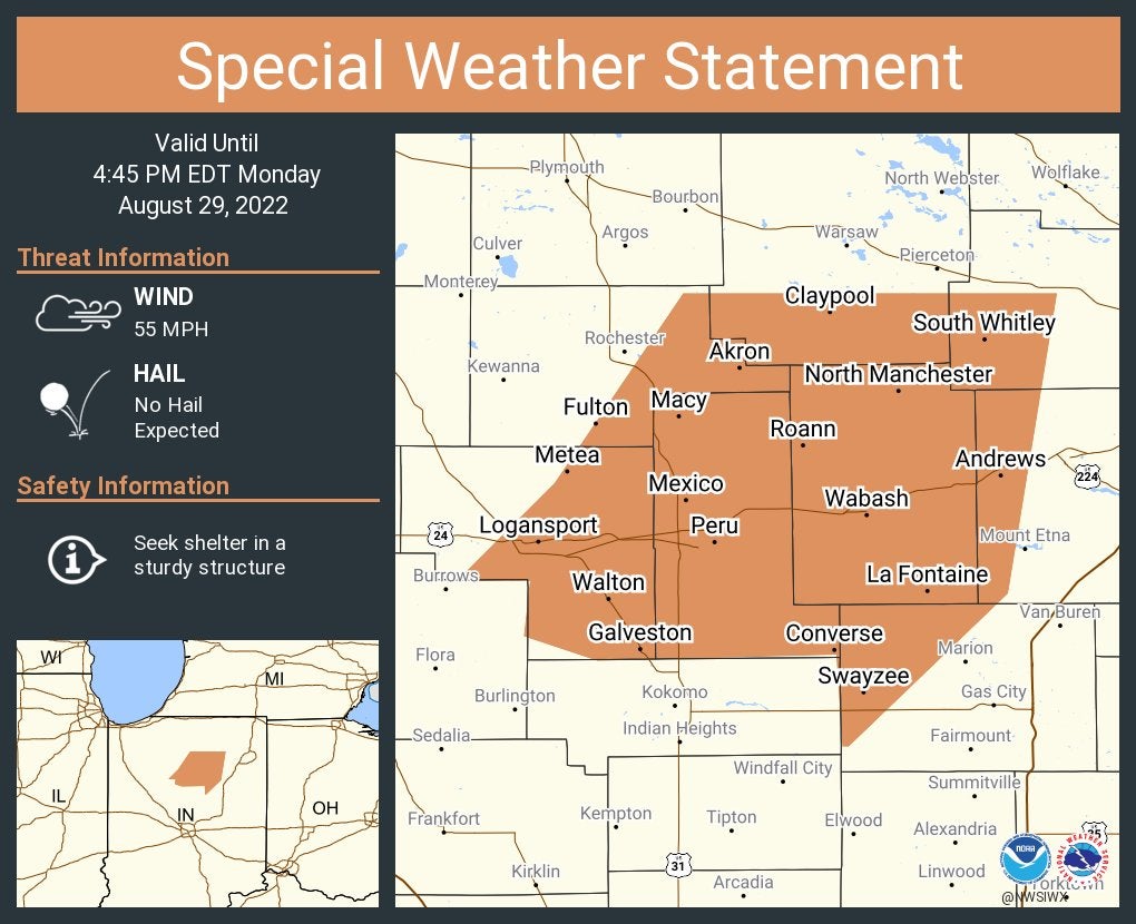
A special weather statement has been issued for Logansport, Peru and Wabash until 4:45 p.m. EDT.
3:53 p.m.
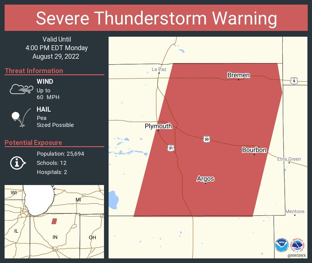
Severe thunderstorm warning continues for Plymouth, Bremen and Bourbon until 4 p.m. EDT.
3:50 p.m.
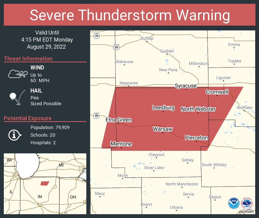
Severe thunderstorm warning including Warsaw, Winona Lake and Syracuse until 4:15 p.m. EDT.
3:47 p.m.
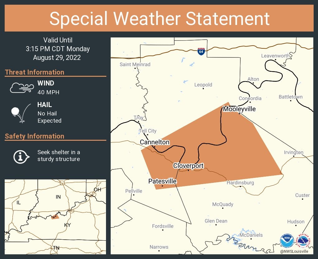
A special weather statement has been issued for Cannelton, Indiana, and Cloverport and Hawesville, Kentucky, until 3:15 p.m. CDT.
3:44 p.m.
From the National Weather Service at Indianapolis: A line of severe thunderstorms moving ESE is approaching NW portions of central Indiana. These storms have a history of producing damaging winds with the greatest risk highlighted by the yellow triangle. Localized flooding will also be possible this afternoon into tonight.

A special weather statement has been issued for Jasper, Huntingburg and Dubois until 4:15 p.m. EDT.
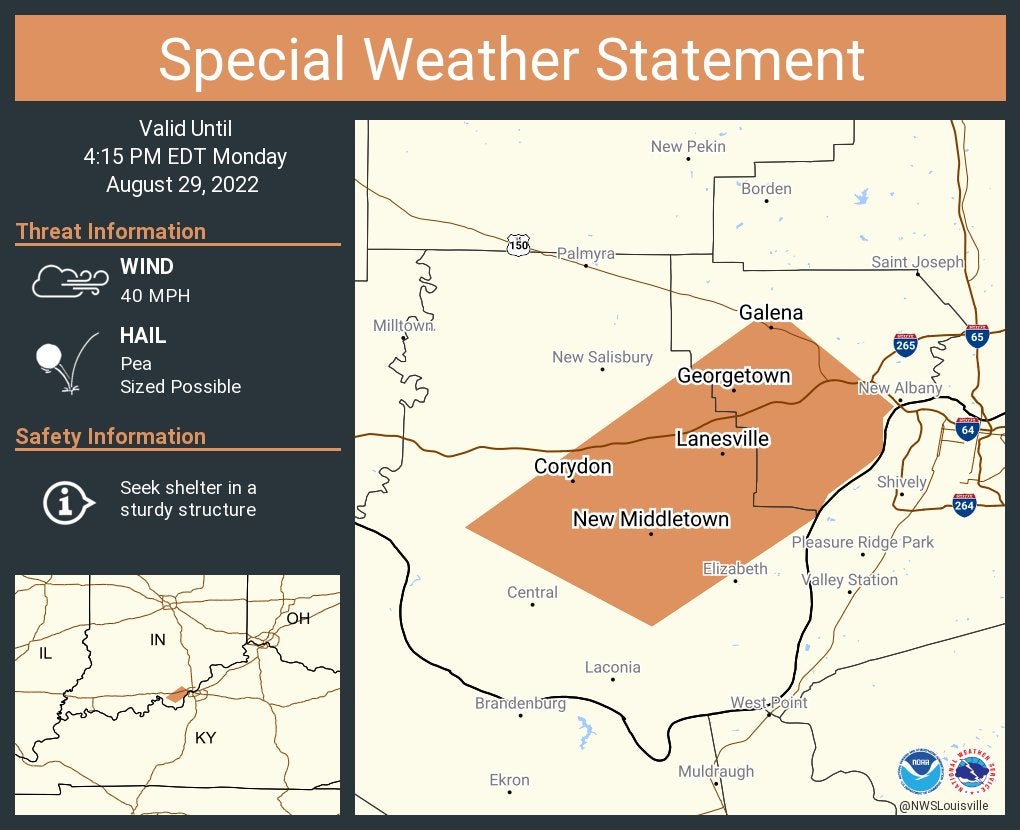
A special weather statement has been issued for Corydon, Georgetown and Galena until 4:15 p.m. EDT.
3:37 p.m.
Severe thunderstorm warning including South Bend, Elkhart and Mishawaka until 4:30 p.m. EDT.

3:36 p.m.
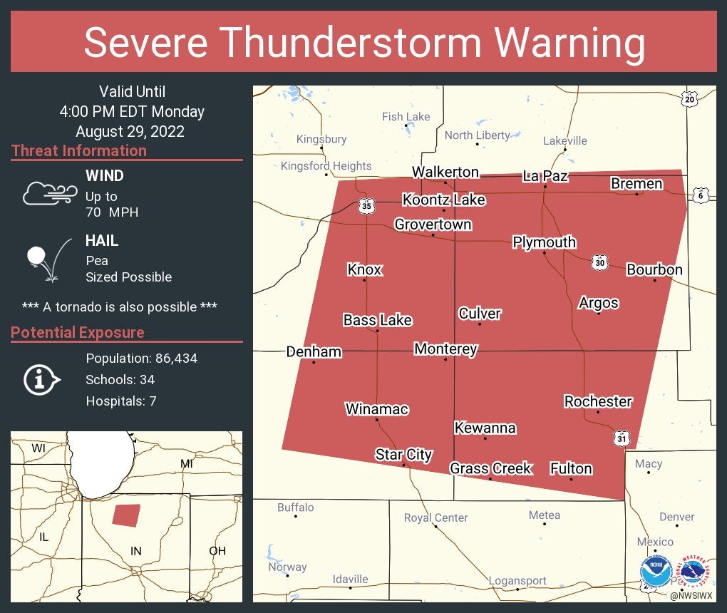
Severe thunderstorm warning continues for Plymouth, Rochester and Bremen until 4 p.m. EDT. This storm will contain wind gusts to 70 mph.
3:31 p.m.
A special weather statement has been issued for Fowler, Otterbein and Oxford until 4:15 p.m. EDT.

3:30 p.m.
From the National Weather Service at Indianapolis” A line of severe thunderstorms moving ESE is approaching NW portions of central Indiana. These storms have a history of producing damaging winds with the greatest risk highlighted by the yellow triangle. Localized flooding will also be possible this afternoon into tonight.

3:27 p.m.
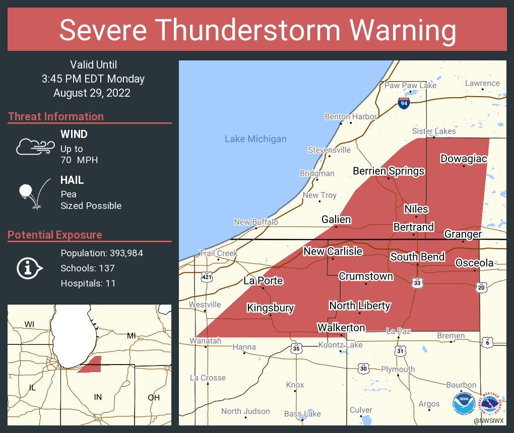
Severe thunderstorm warning continues for South Bend, Mishawaka and La Porte until 3:45 p.m. EDT. This storm will contain wind gusts to 70 mph.
3:16 p.m.
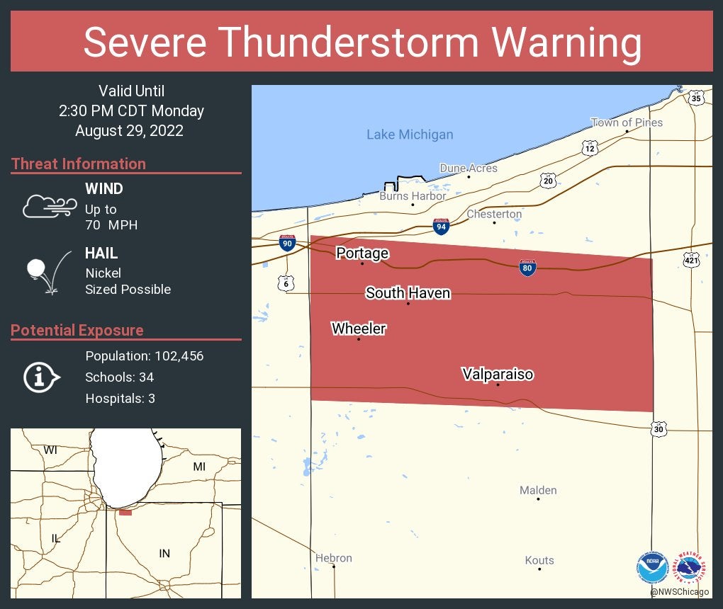
Severe thunderstorm warning continues for Valparaiso until 2:30 p.m. CDT. This storm will contain wind gusts to 70 mph.

3:14 p.m.
Severe thunderstorm warning continues for Plymouth, Rochester and Bremen until 3 p.m. CDT. This destructive storm will contain wind gusts to 80 mph.

3:11 p.m.
From the National Weather Service in Chicago: Damaging wind threat now extends from Valparaiso, Indiana, to Melvin, Indiana, with the worst from Kouts to Wheatfield. Move indoors if you hear thunder.
An amateur radio operator reported dime-sized hail at 2 p.m. in northeast Valparaiso.
3:06 p.m.
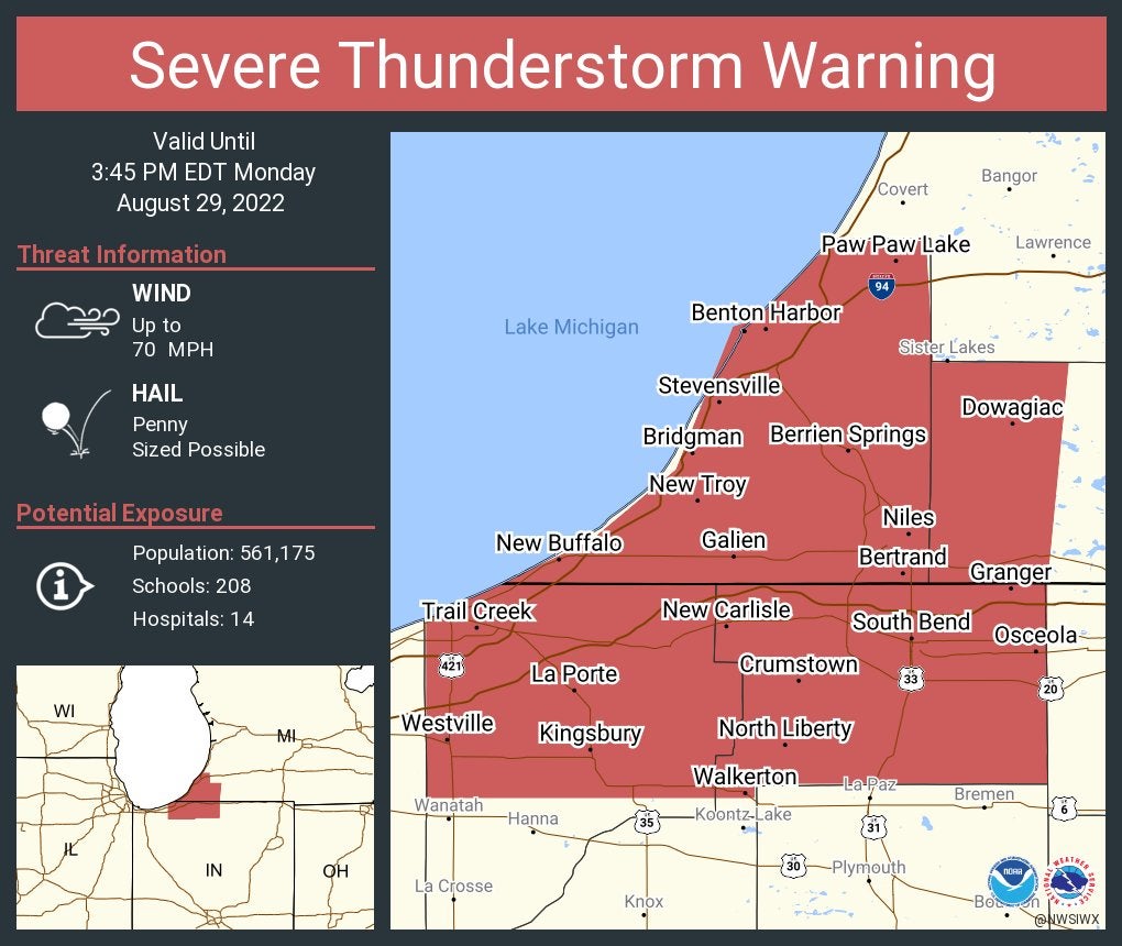
Severe thunderstorm warning continues for South Bend, Mishawaka and Michigan City until 3:45 p.m. EDT. This storm will contain wind gusts to 70 mph.
Severe thunderstorm warning continues for Portage, Valparaiso and South Haven until 2:30 p.m. CDT. This storm will contain wind gusts to 70 mph.
3:03 p.m.
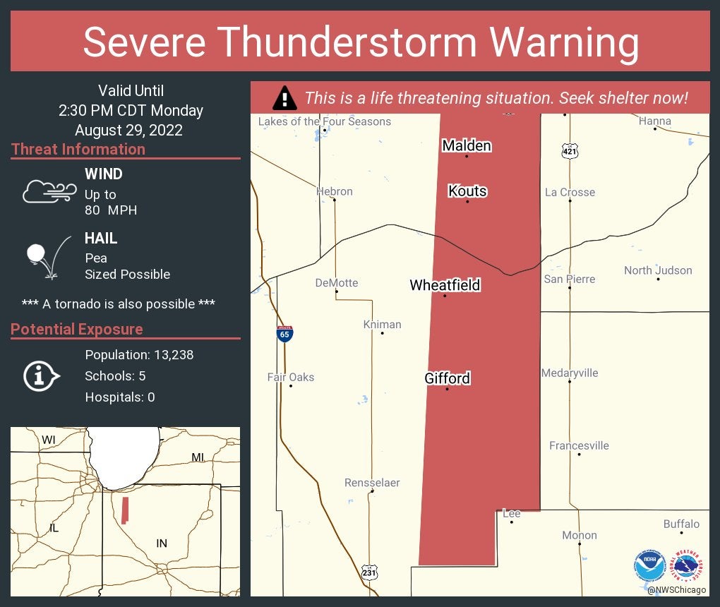
Severe thunderstorm warning continues for Kouts, Wheatfield and Malden until 2:30 p.m. CDT. This destructive storm will contain wind gusts to 80 mph.
3:01 p.m.
Severe thunderstorm warning continues for Rensselaer, Kentland and Remington until 2:30 p.m. CDT. This storm will contain wind gusts to 70 mph.

Storm watches issued
One severe thunderstorm watch was issued for areas mainly north of Interstate 70 until 8 p.m. EST, the National Weather Service says. Counties in the watch area are Adams, Allen, Blackford, Carroll, Cass, Clinton, Delaware, De Kalb, Elkhart, Fulton, Grant, Howard, Huntington, Jay, Kosciusko, Lagrange, LaPorte, Madison, Marshall, Miami, Noble, Pulaski, Randolph, St. Joseph, Starke, Steuben, Tippecanoe, Tipton, Warren, Wells, White and Whitley. This watch also includes parts of Michigan and Ohio.
The other severe thunderstorm watch was issued until 4 p.m. CDT for northwest Indiana and some Illinois counties. Indiana counties in that watch include Benton, Jasper, Lake, Newton and Porter.