


Tracking Monday night’s storms, cooler air ahead
INDIANAPOLIS (WISH) — We are continuing to monitor storm chances for our Monday evening and night with strong to severe storms possible.
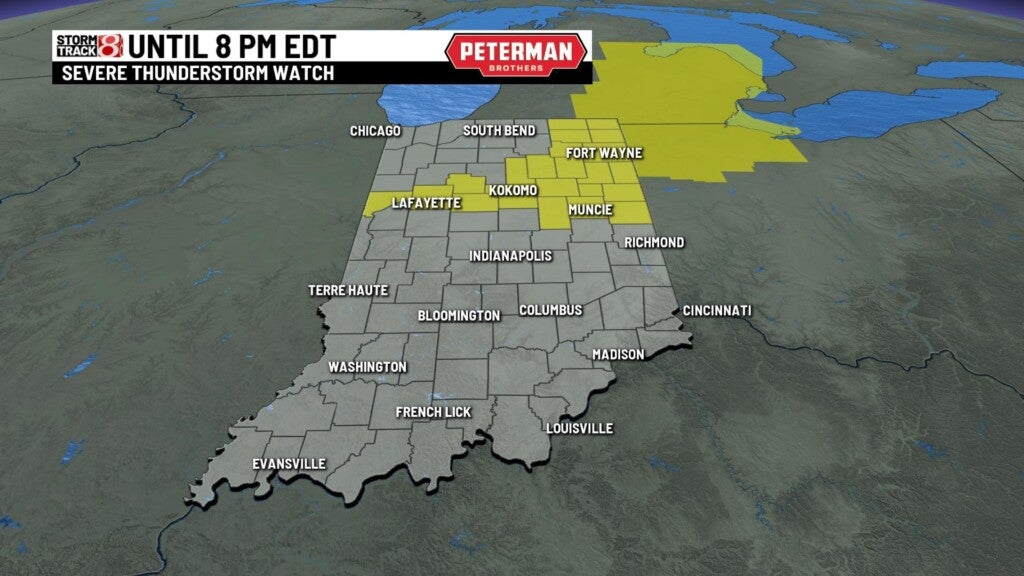
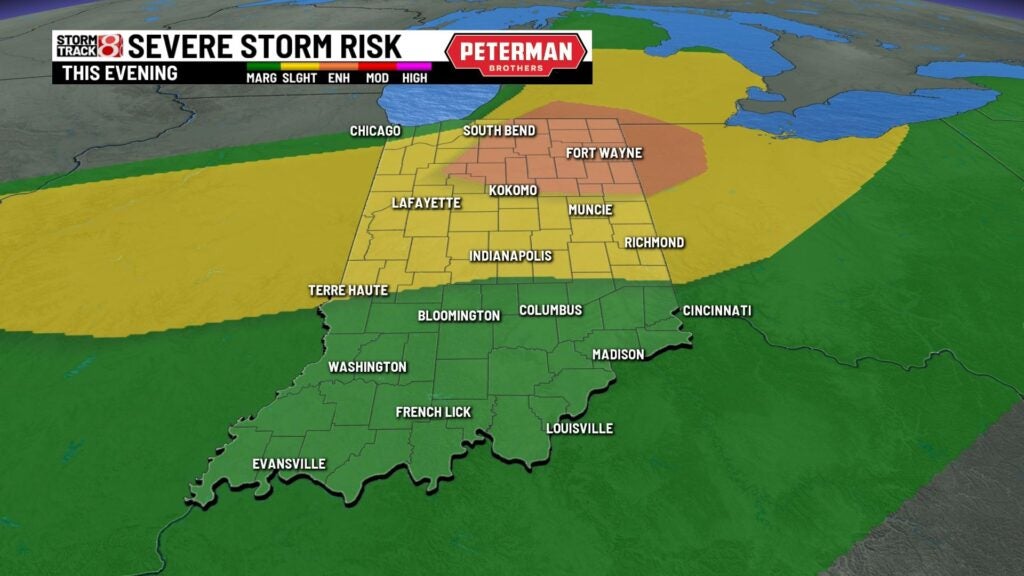
A ***Severe Thunderstorm Watch*** remains in effect until 8 PM EDT for part of the northern half of Indiana.
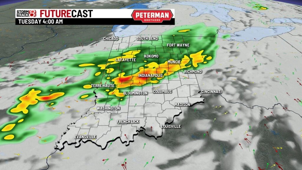
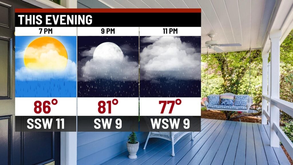
Monday night: Scattered rain and storms are expected tonight and into early Tuesday.
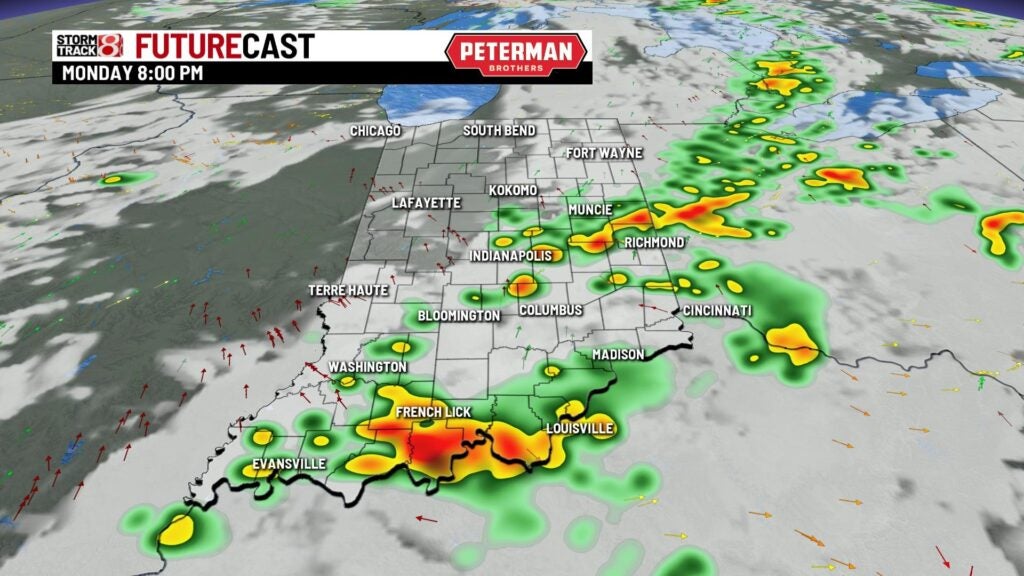
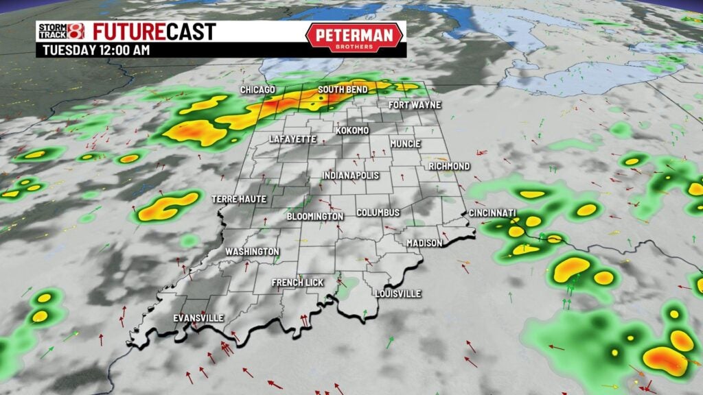
There remains a threat for severe weather as there is an Enhanced Risk (level 3/5) in northeastern Indiana. A Slight Risk (level 2/5) is in place from a Terre Haute-Shelbyville line and points north. Main concern is damaging winds, and there could also be localized flooding issues.
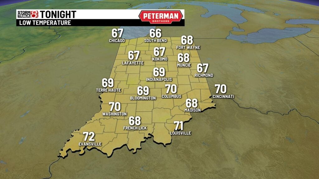
Expect a mild and muggy night with lows only falling into the upper 60s.
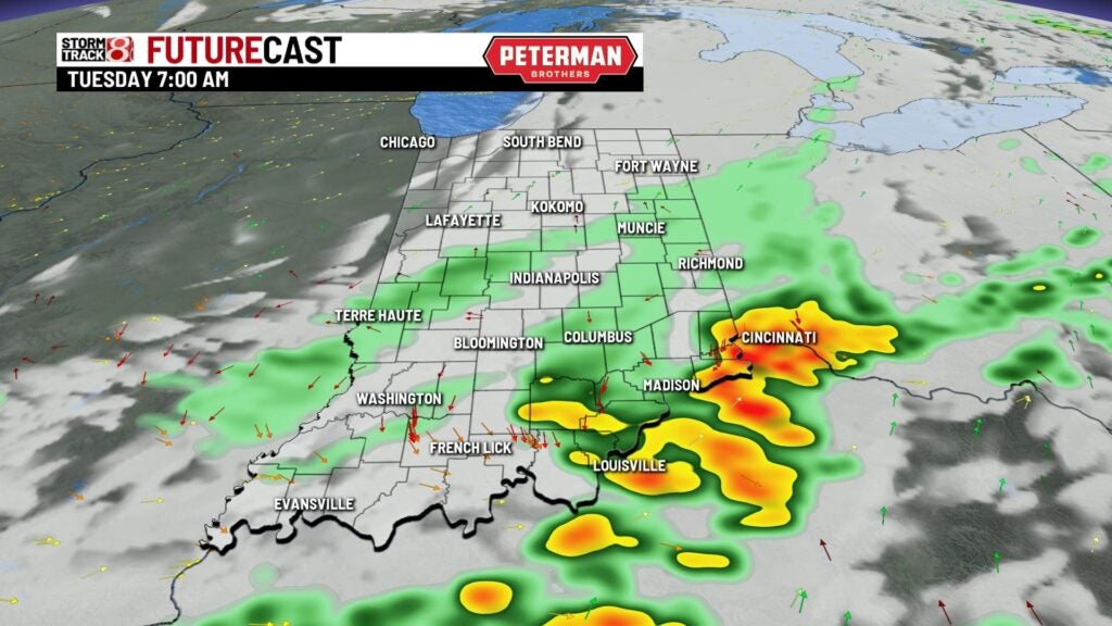
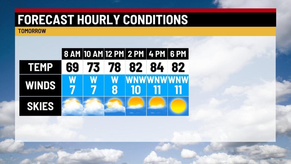
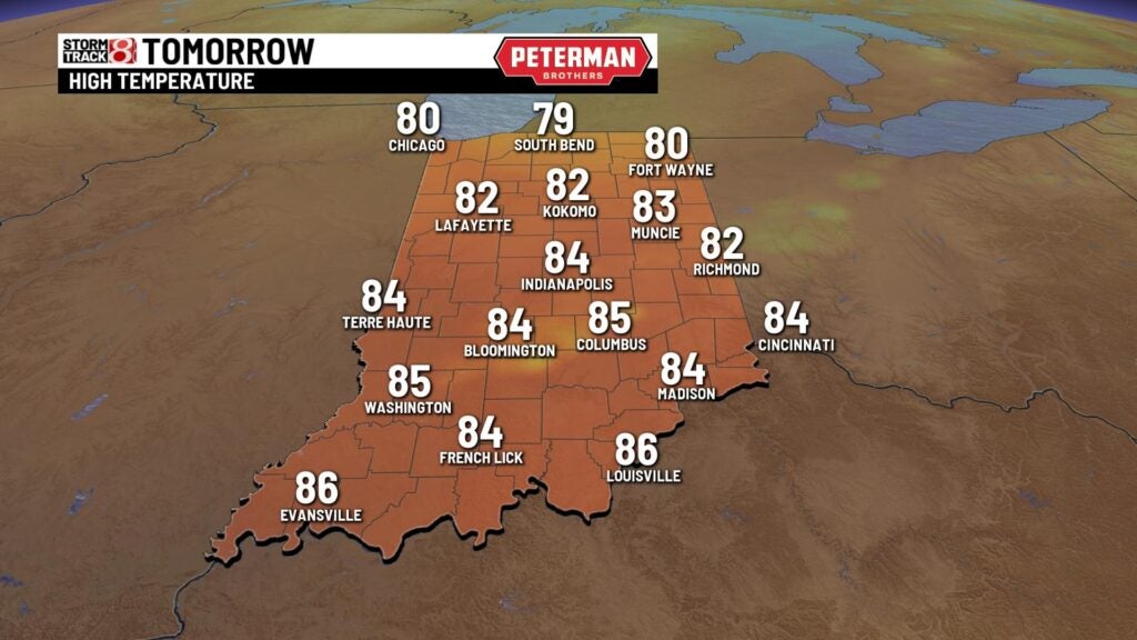
Tuesday: Scattered rain and storms will be around to start our Tuesday before we mostly dry out by the lunch hour. A few lingering showers may develop before the evening commute.
Highs are set to be slightly cooler with numbers in the low to mid 80s. Humidity values will be high to start the day, but by the time we get to Tuesday night, much more comfortable air will swing in.
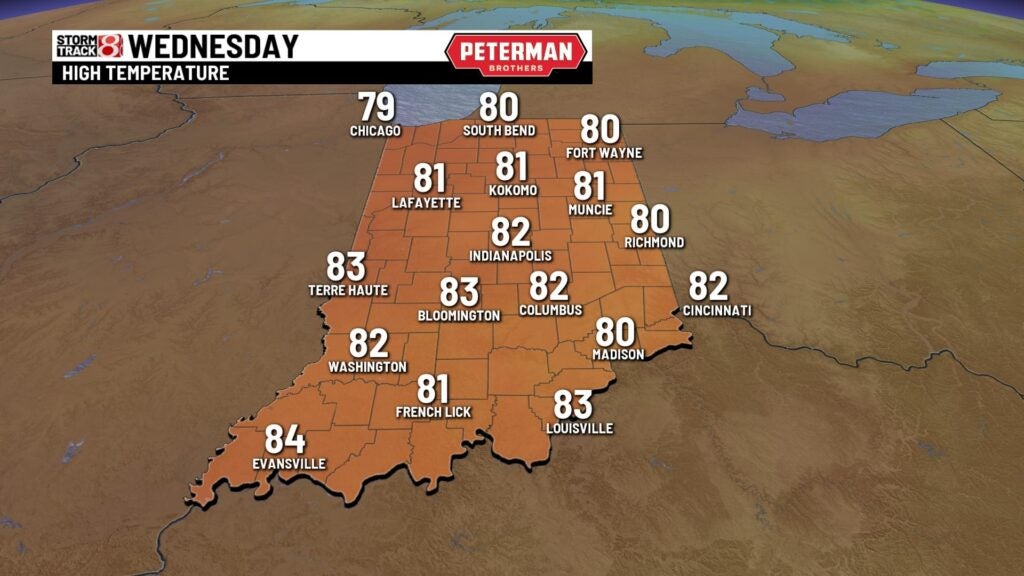
Wednesday: The cooling trend rolls on into our Wednesday as we get to enjoy a humid-free day with lots of sunshine. Highs will top out in the low 80s.
8-Day Forecast: The second half of the workweek will feature the start of another warming trend. This warming trend will lead way to a quick return of summer heat and humidity for Labor Day weekend with dry conditions.
