


Preparing for some wintry precipitation on Sunday

TONIGHT
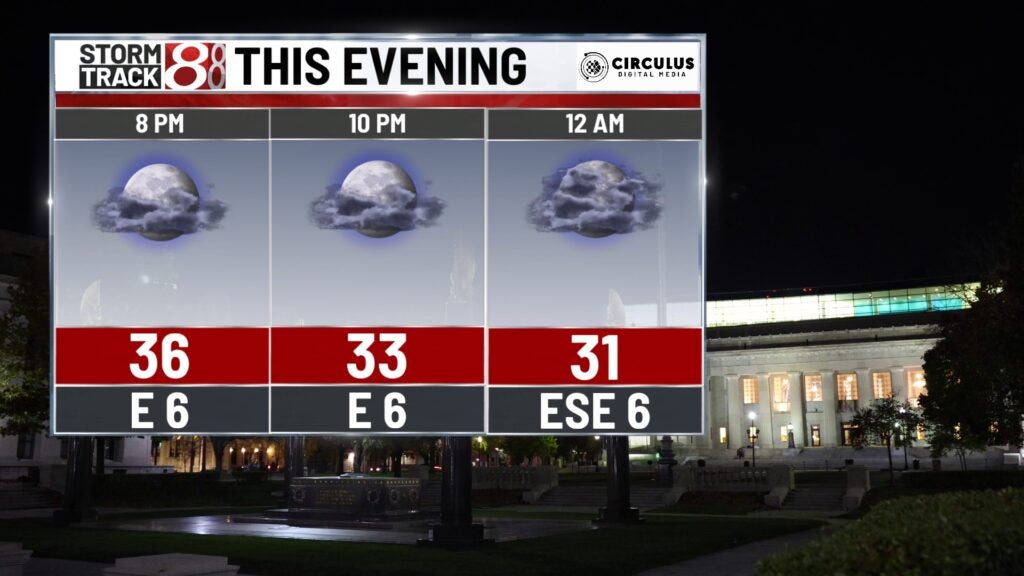
Saturday night should be another chilly one with low temperatures well below freeing in Indianapolis and beyond. We are preparing for a system out to our west to slam into our region tonight. This system will mostly be a rainy one for central Indiana but now might sneak in if you keep your eyes peeled. The further northwest you go off north, the more likely you are to see snow. Wind out of the southeast at 5 MPH.
TOMORROW
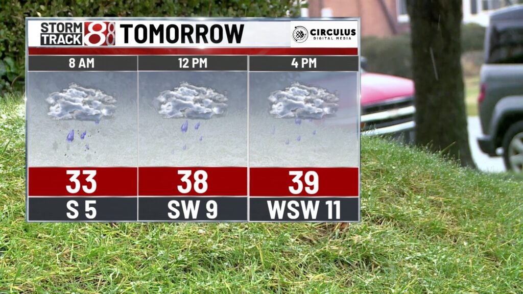
Sunday will be a day full of winter precipitation off north near towns like Lafeyette, South Bend, and Gary. Further south in central Indiana, the precipitation will start first as a mix then become just rain in the later morning hours. Down in southern parts of the state, the form of precipitation is purely rain. Wind out of the west at 10-15 MPH. Temperatures will remain cool under a cloudy day, high temperatures in the 40s south and 30s off north. Travel will likely be impacted but not too poorly. Most of this snow is expected to melt, even off northwest. However, anytime roads become slippery we inevitably see tons of accidents in central Indiana. So be careful if you plan on heading out on the roads tomorrow.
TOMORROW NIGHT
Sunday Night evening will be where the clouds and precipitation move out. It will be an even colder evening as skies clear out in the evening. As a result, temperatures will drop to the mid 20s tomorrow night. Wind out of the west at 10-15 MPH.
8 DAY
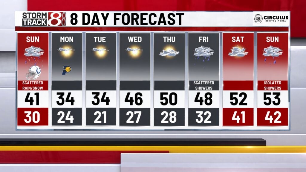
After some sunny days back-to-back, temperatures will rebound back into the mid 40s. Clouds will make their way back into the skies by Thursday or Friday of next week. We could even see some precipitation sneak in as well as we make our way towards the end of the week.