Monitoring severe storm potential Tuesday and Wednesday this week
INDIANAPOLIS (WISH) — Central Indiana welcomed a not-so-bad start to the workweek despite a few showers and heavier downpours in some locations.
However, remain weather aware the next two days for the chance of severe thunderstorms.
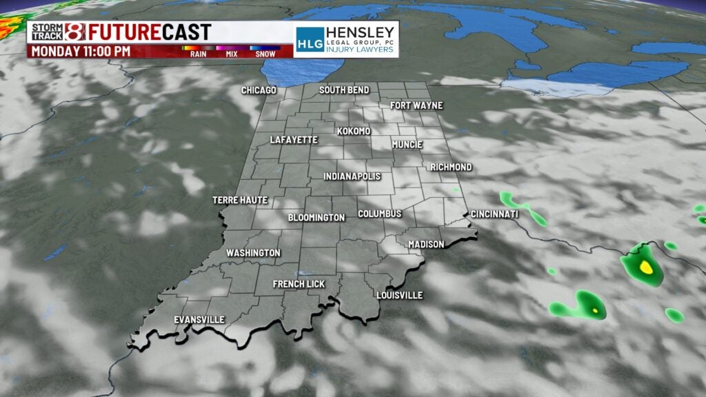
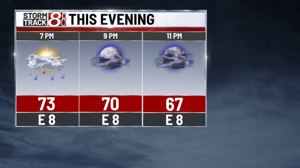
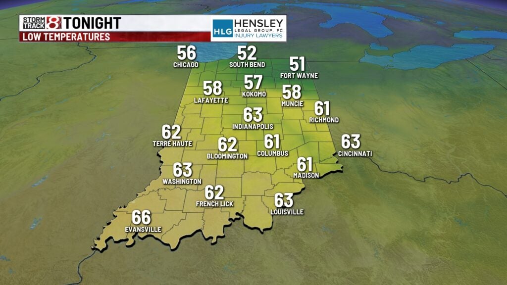
Monday night: A few showers will remain possible. Skies will turn mostly cloudy with lows down into the low 60s.
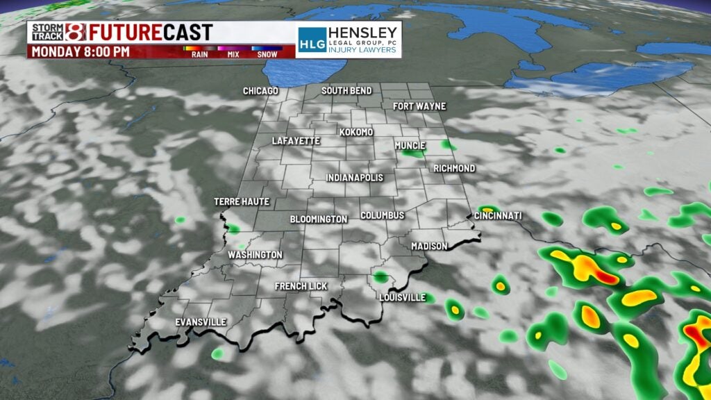
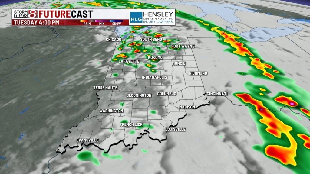
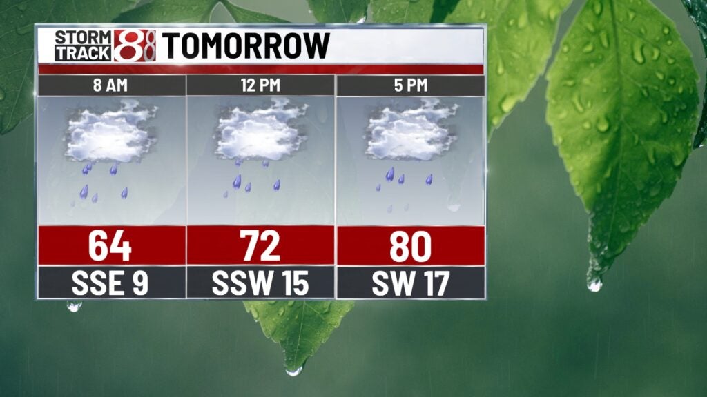
Tuesday: Expect an active day with on-and-off showers and storms. There will be two main waves of activity. The first round will come Tuesday morning and potentially last into early Tuesday afternoon.
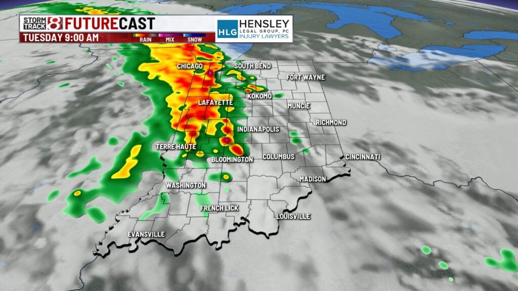
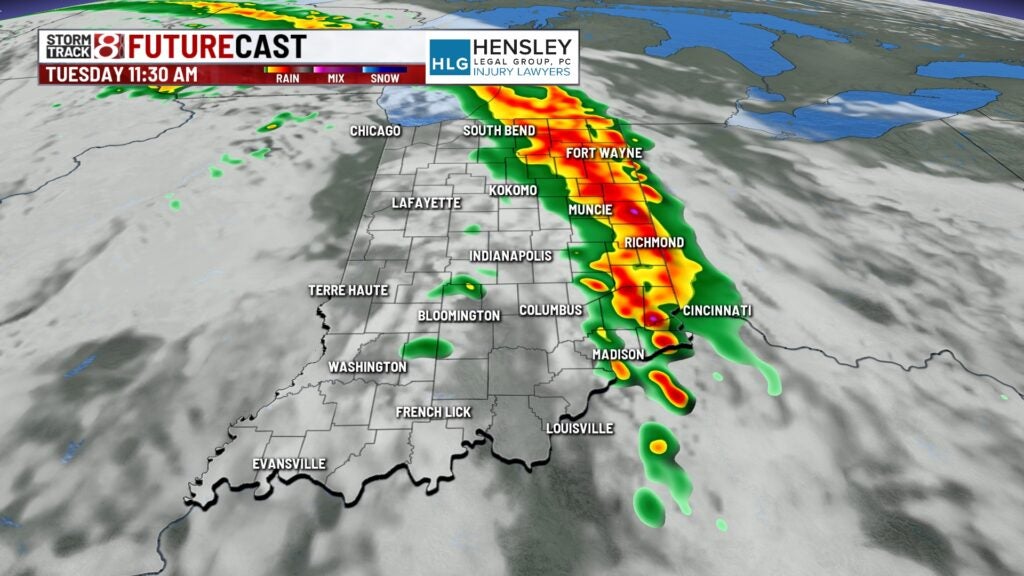
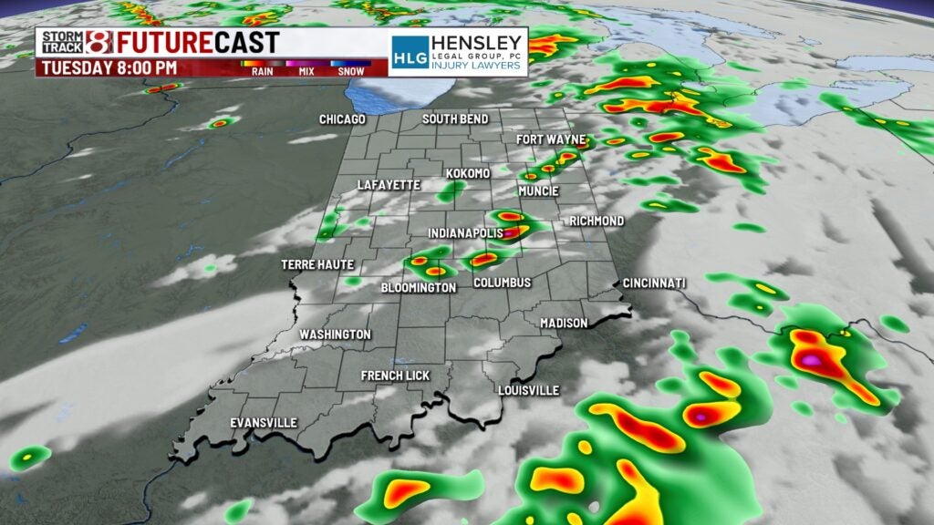
By the middle of Tuesday afternoon, the atmosphere will attempt to recharge and bring the redevelopment of showers and storms mainly after 2 p.m. EDT. From 2-9 p.m. EDT, watch for the possibility of strong to severe storms.
Much of Indiana on Tuesday will be under a Slight Risk (Level 2 of 5) with areas in northeastern Indiana in an Enhanced Risk (Level 3 of 5). The primary hazards will be large hail and damaging winds, with possible isolated tornadoes.
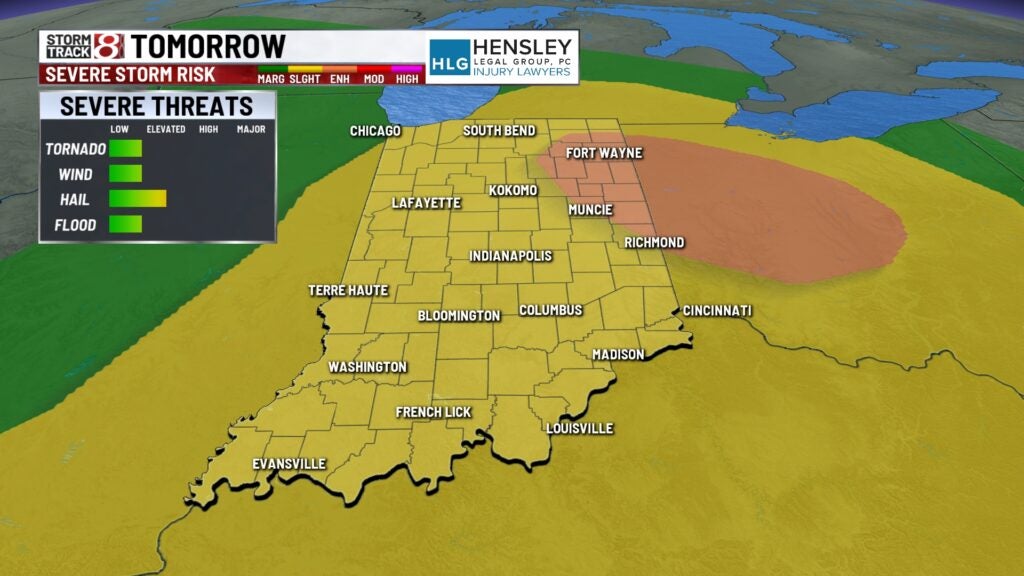
There are also two caveats to mention with Tuesday’s severe risk. If storms can sustain themselves, the potential exists for significant sized hail of 2-inches or larger in diameter. A strong tornado threat — EF-2 or higher, with winds of at least 111 mph — is also in place within the Enhanced Risk.
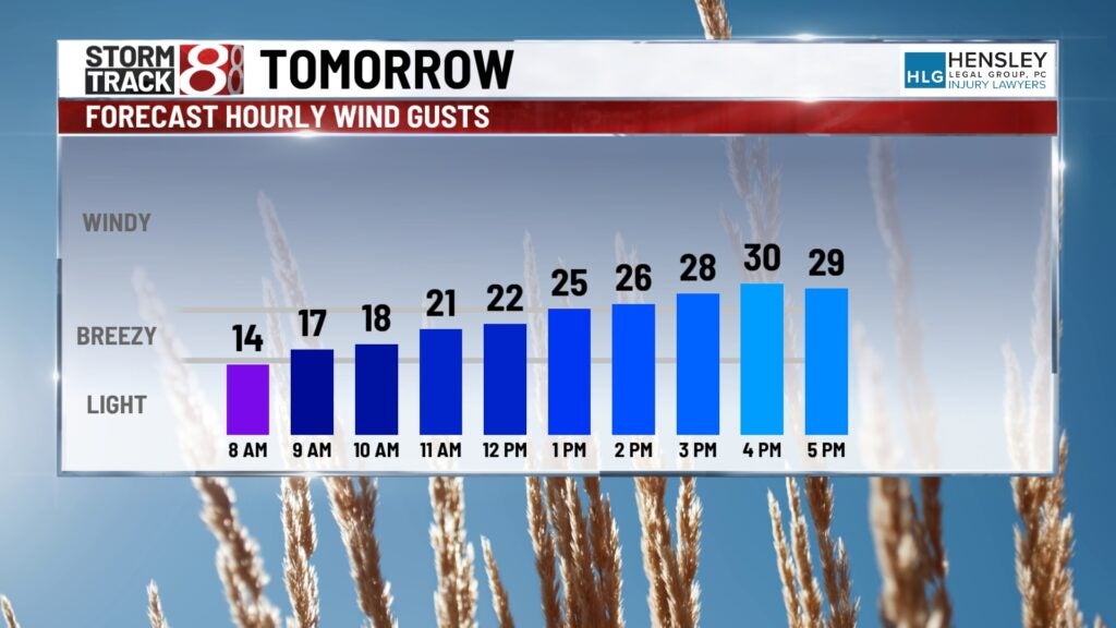
Highs in the upper 70s with breezy winds expected Tuesday.
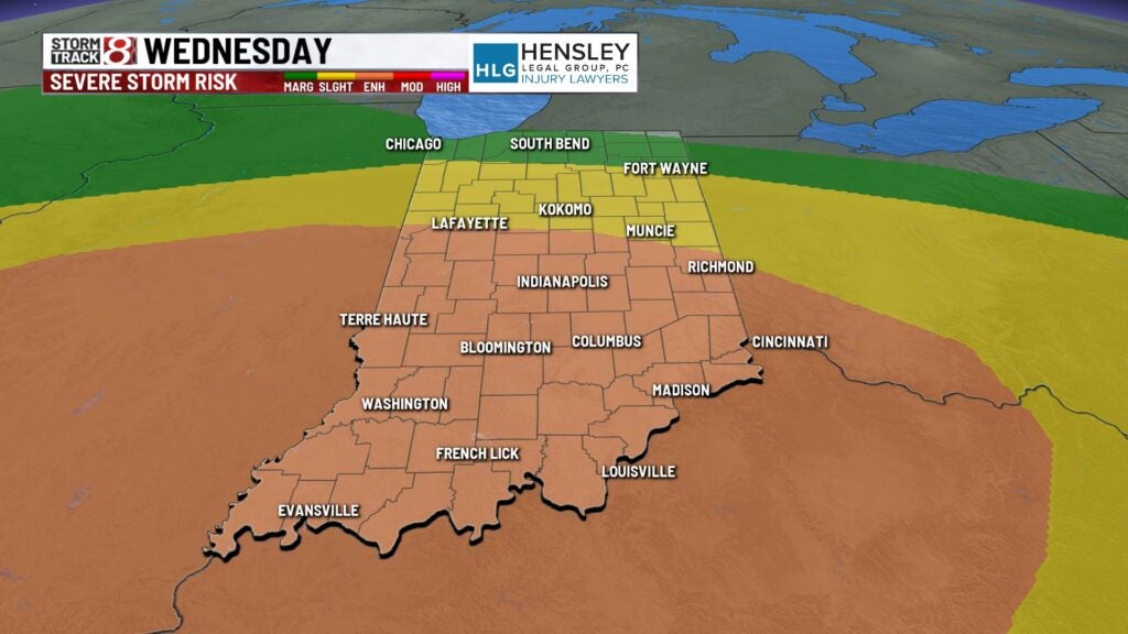
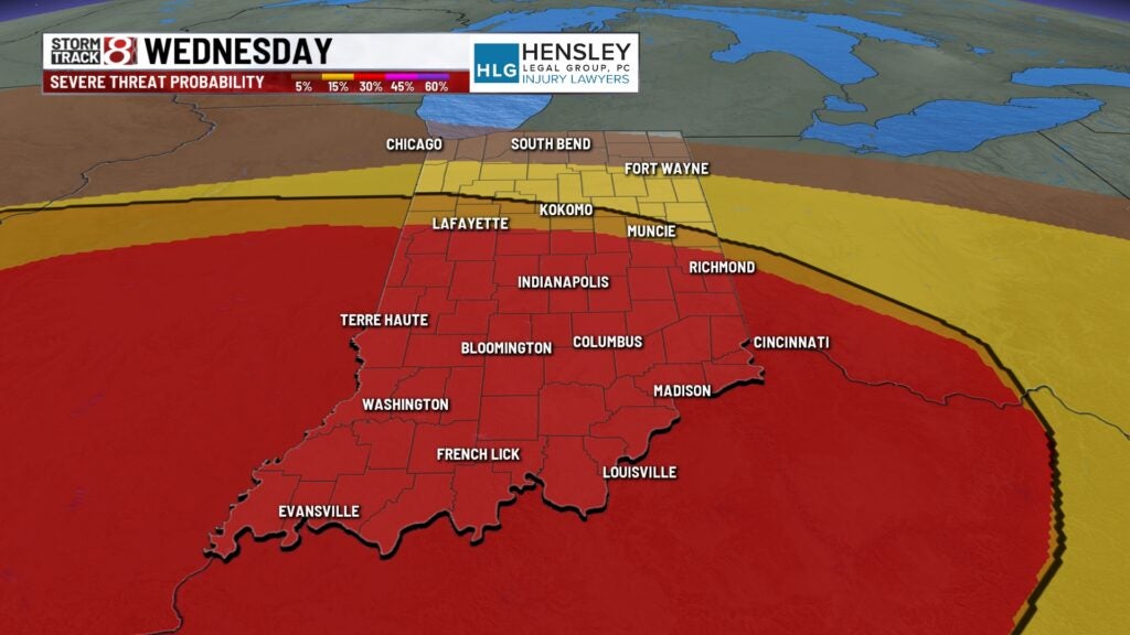
Wednesday: More in the way of active weather is ahead. Now, the day will start dry as opposed to Tuesday. By Wednesday afternoon, rain and storms will form and carry into Wednesday evening and possibly night.
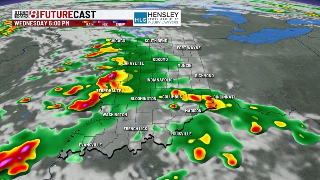
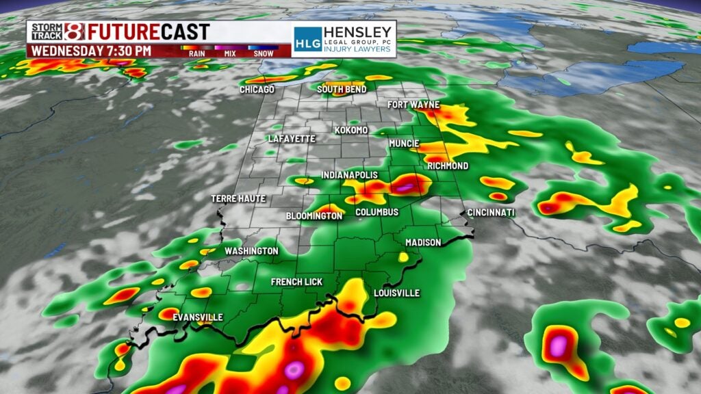
A higher risk of severe weather will be in place across central and southern Indiana, with an Enhanced Risk (Level 3 of 5). All hazards will once again be possible, with damaging winds and hail as the main threats, but a tornado threat could be on deck. Some of the storms could even be more intense and significant than a typical severe thunderstorm in the Enhanced Risk area.
Flooding may also become a concern in some spots. Matter of fact, expect up to 1 or 2 inches of rain from Tuesday through Wednesday, with locally higher amounts possible.
Uncertainty remained by Monday afternoon on how Wednesday will fully play out. Regardless, pay attention to the forecast.
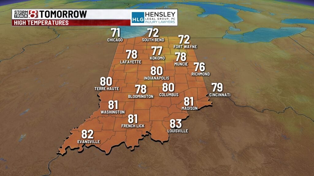
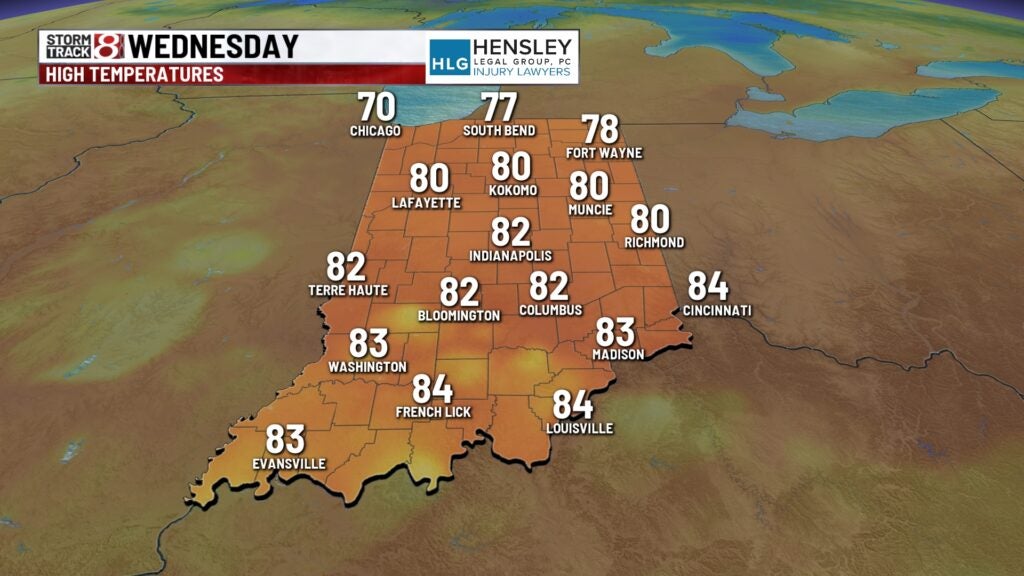
Highs look to get into the low 80s.
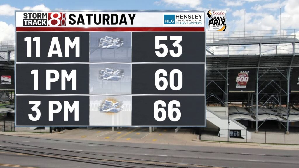
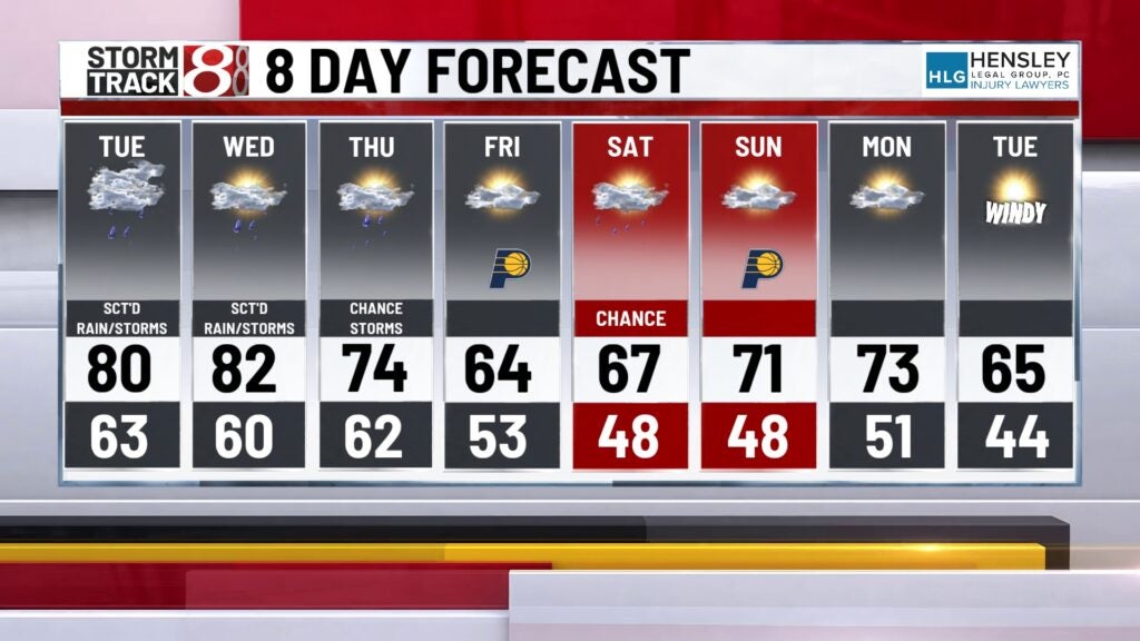
8-Day Forecast: Daily rain chances will stay in place through the end of the workweek and into the upcoming weekend. Temperatures will begin to cool down Thursday will have breezy winds in place. Highs will fall into the mid 60s by Friday. The air will try to warm up slowly during the weekend, with highs back in the 70s by Mother’s Day on Sunday. People planning to go to the Grand Prix of Indianapolis on Saturday at the Indianapolis Motor Speedway, there is a chance for a few showers in the afternoon hours.