Soggy & cooler weekend ahead
INDIANAPOLIS (WISH) — Wet weather with cooler temperatures will return for the weekend.
Saturday:
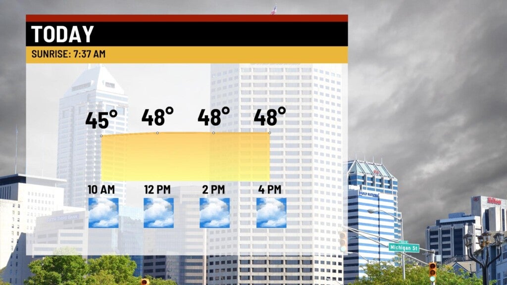
A cold front has sagged south of the Ohio River. Light showers have arrived across the central portions of the state Saturday morning. Expect those to break up a bit by late morning into the afternoon – leaving us with just isolated shower chances for the day.
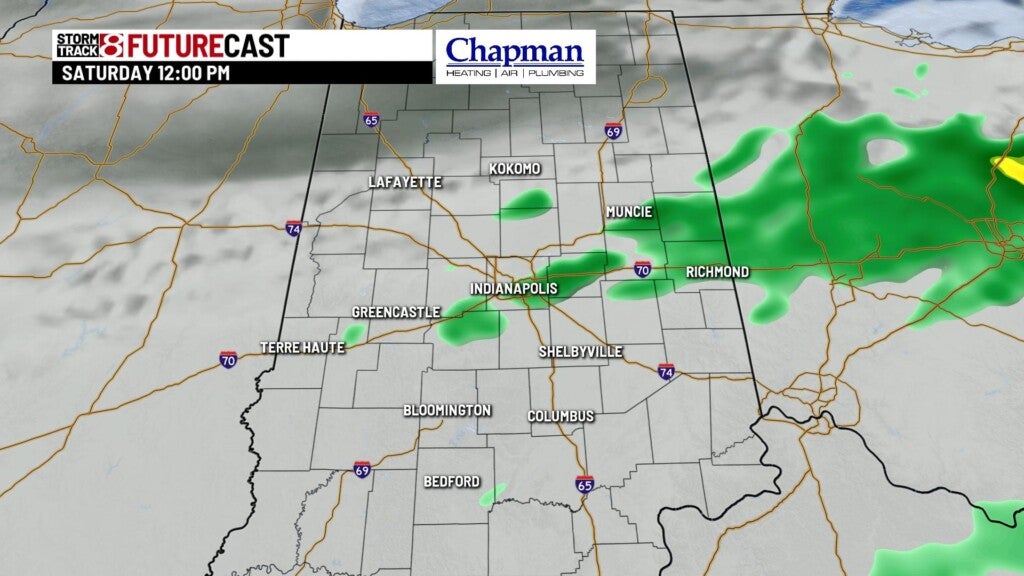
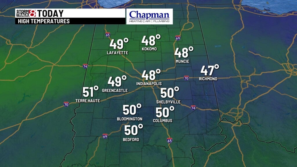
Temperatures will hold steady, in the upper 40s all day.
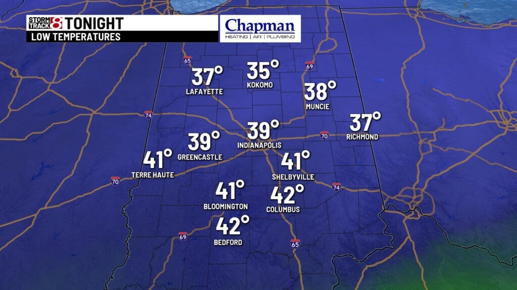
Saturday Night:
Upper level wave moving along the front will surge into the Midwest this evening, bringing widespread showers with the potential for heavy downpours across the area. With cooling temperatures, there could be a few snow showers mixing in for northeastern parts of the state through daybreak, Sunday.
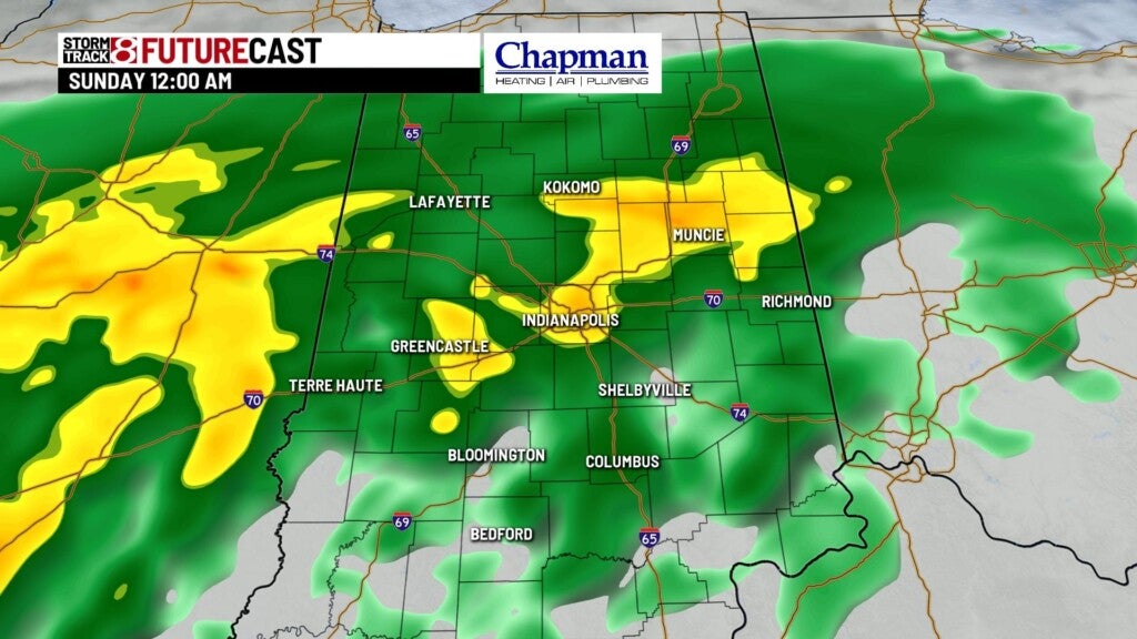
Lows fall to the upper 30s.
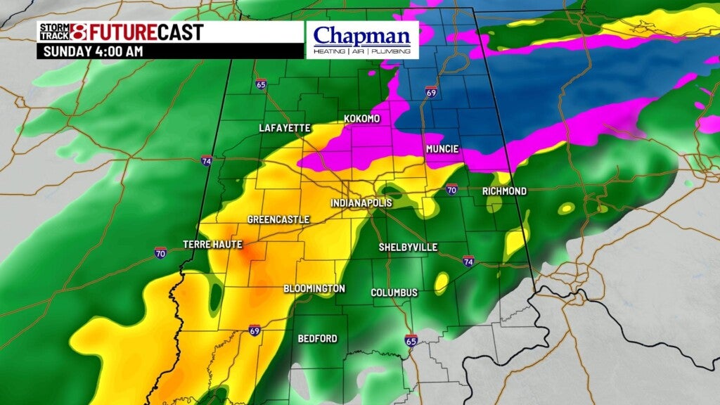
Sunday:
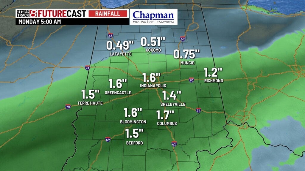
Very wet start to the day across the state. Rain should start to taper off from west to east heading into the afternoon.
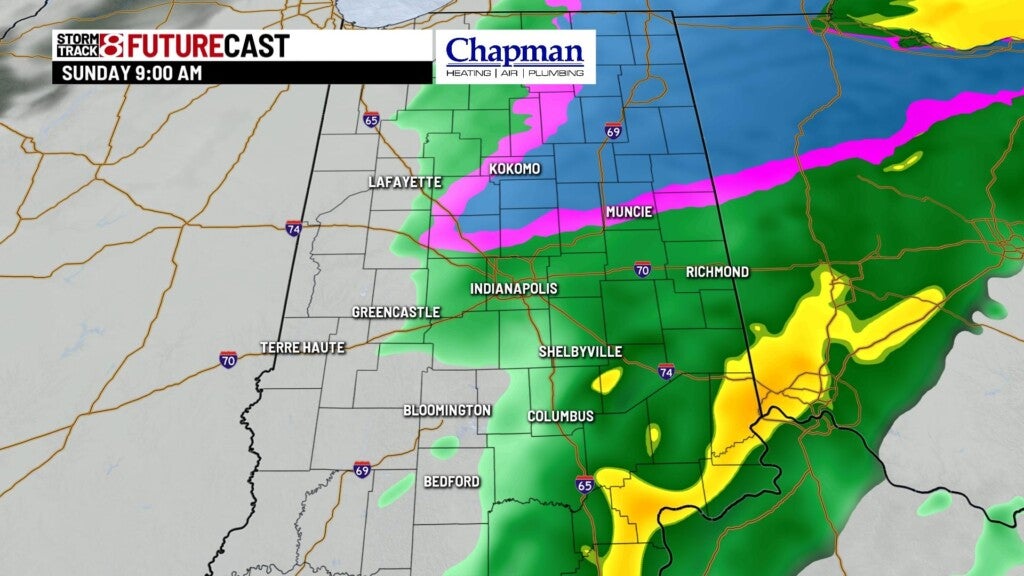
Total rainfall will likely exceed 1″ for areas along and south of I-70.
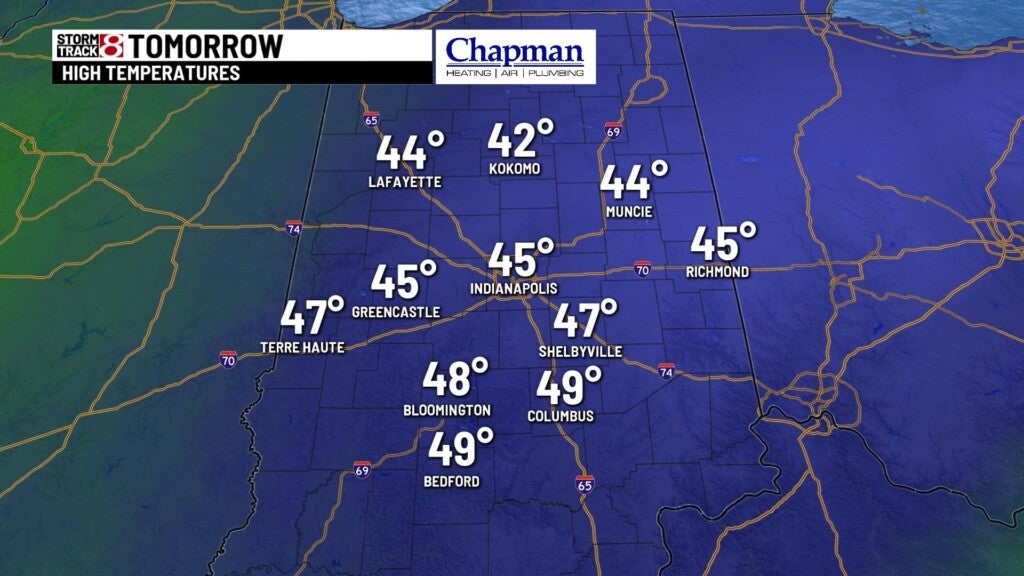
Highs top out in the middle 40s
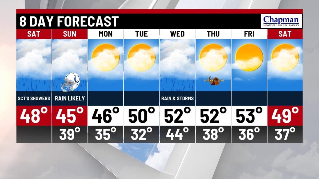
8 day forecast:
Seasonably cool temperatures to start the holiday week. Dry conditions for Monday and most of Tuesday. Next storm system arrives late Tuesday night into Wednesday, again bringing widespread rain and possibly a few thunderstorms as well. Thanksgiving looks dry with near normal temperatures that carry over into the holiday weekend.