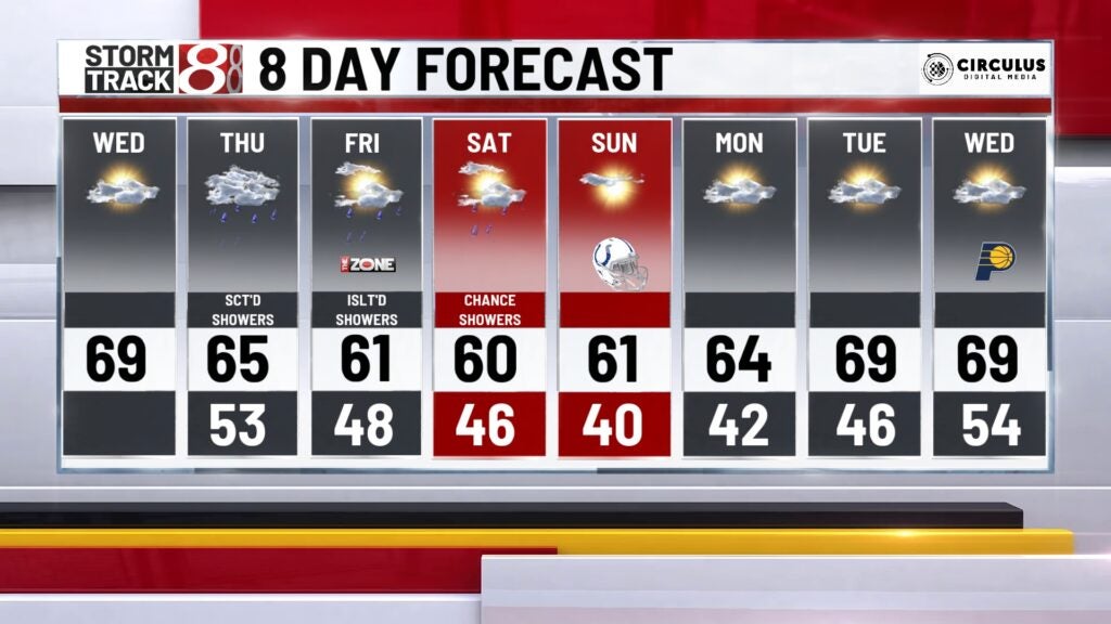
Dry Wednesday, shower chances rest of the week
INDIANAPOLIS (WISH) — We’ll see dry conditions on this Wednesday. Shower chances move into the state for the rest of the week. Today is going to be a great day!
TODAY: We’re starting this morning on the cooler side with temperatures into the 40s this morning. We had skies clear late yesterday. That is allowing for temperatures to drop this morning. Some locations are starting into the 30s this morning. Some spots may see a little patchy fog but not enough to cause any delays.
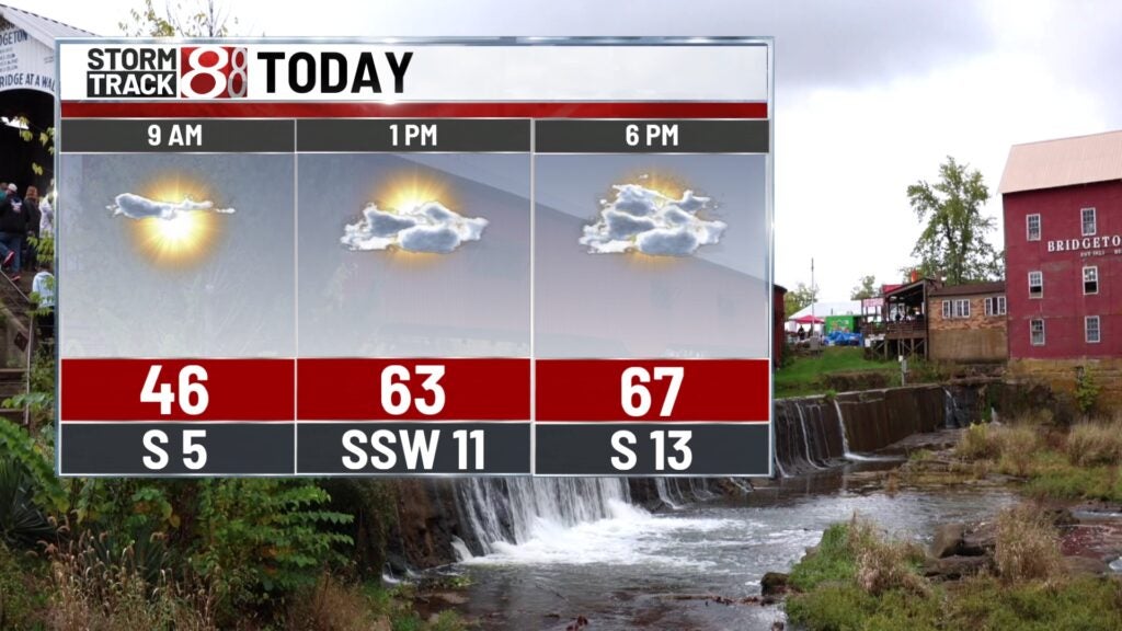
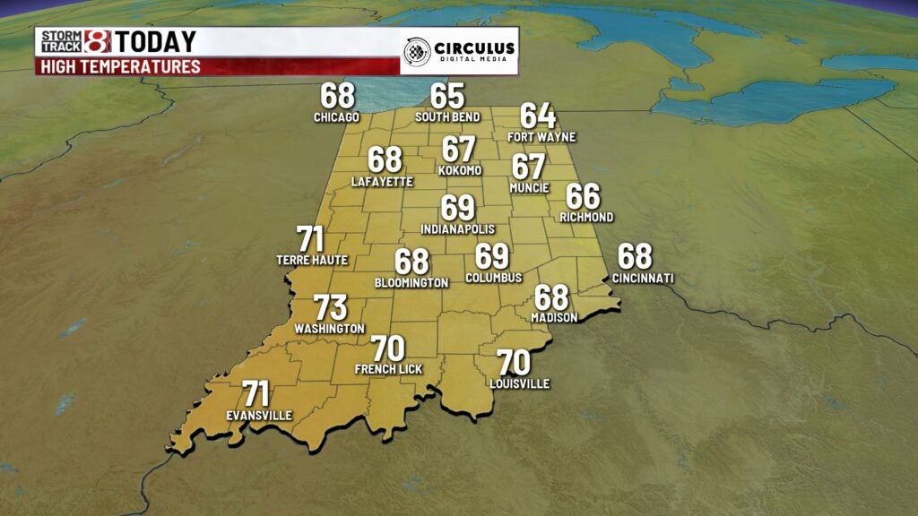
Despite the chilly start temperatures will warm above normal today. Normal high for this time of the year is 65. We will see highs today into the upper 60s near 70 this afternoon. Look for lots of sunshine through the day. It’s going to be a beautiful day to get out and enjoy any kind of outdoor activities.
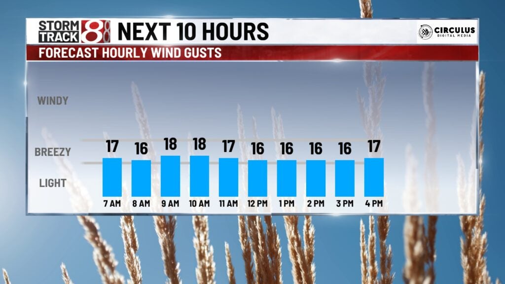
It will be a bit breezy at times. Winds will be out of the south at 10-20 miles per hour.
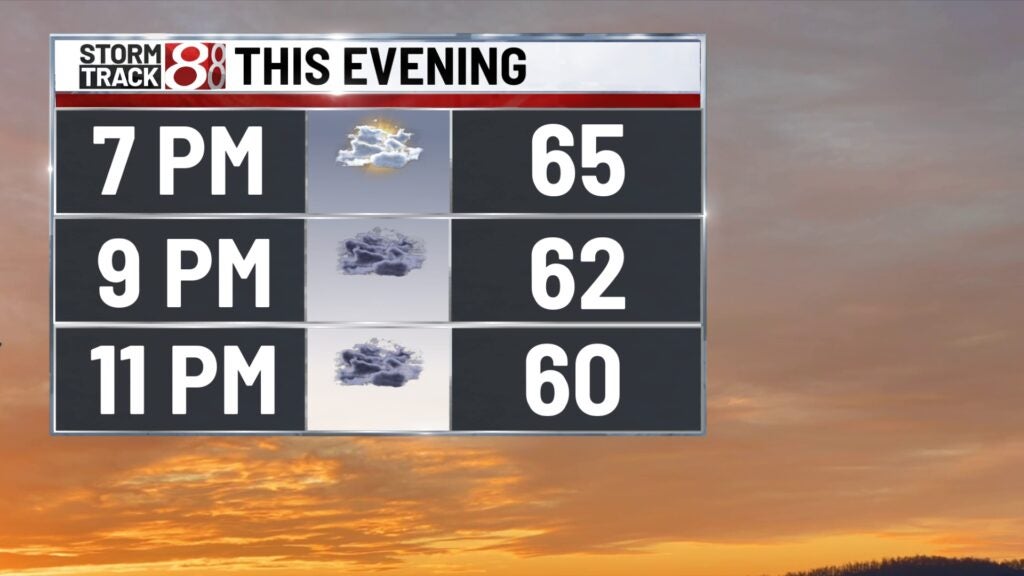
TONIGHT: Clouds begin to increase ahead of our next storm system. A few showers develop overnight but more so toward Daybreak. It will be mild with lows in the lower 50s.
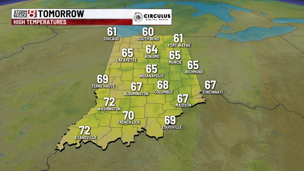
THURSDAY: A system moves across the state Thursday. This will bring us a good chance of showers across the state. It will remain breezy with winds out of the south at 10-15 miles per hour.
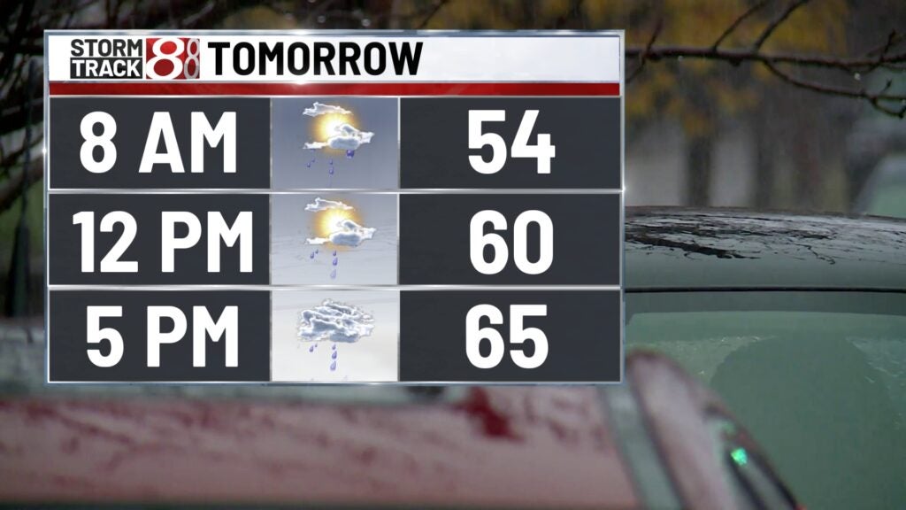
Highs climb into the middle 60s. Shower chances continue into Thursday evening. Temperatures drop into the 40s overnight.
FRIDAY: Clouds stick around for much of the day. We’ll see a chance for a few isolated showers on Friday. Highs drop a little below normal. Highs in the lower 60s.

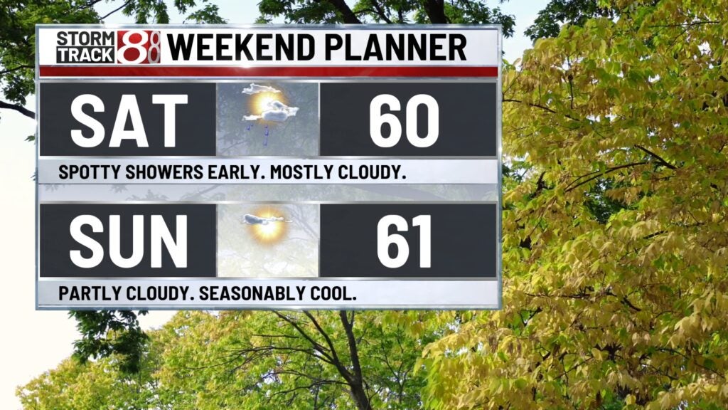
8DAY FORECAST: A few spotty showers may be possible early Saturday. Otherwise this weekend looks pretty nice. Temperatures drop a little below normal but we’re looking dry for the entire weekend. We’ll see temperatures moderate a little and warm heading into next week. Sunshine sticks around for the start of next week.