


Heavy snow moves in Saturday night
- APP USERS: Go online to see maps and graphics with this story
- Live blog: Winter storm warning, advisories for central Indiana
- Interactive radar | Latest forecast in weather blog | Closings and Delays | Storm Track 8 weather app
INDIANAPOLIS (WISH) — A complex system bringing rain and snow to the area should drop significant accumulations to parts of Indiana through Sunday afternoon.
Saturday:
Cloudy conditions for much of the day as large system makes its way into the Midwest. Expect the start of the precipitation to move in as early as late afternoon as a rain/snow mix.
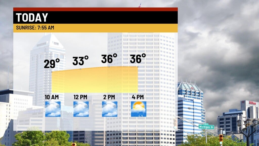

Highs top out in the upper 30s.

Saturday night:
Rain/snow mix will quickly change over to heavy snow along and north of the I-74 corridor. Expect several hours of steady snow showers in the northern half of the state. By mid overnight, some areas around the metro and points south will likely see a transition to a rain/snow mix, or even all rain. To the north, snow showers will continue.

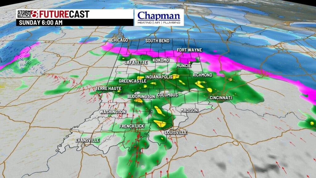
A Winter storm warning will be in effect for much of the northern half of the state Saturday night through Sunday afternoon. A winter weather advisory is in effect for much of the metro area and southeastern portions of the state.

In the warning area, 4″-6″ of snow can be expected, with even higher amounts possible up north including the northwestern Indiana, South Bend and Fort Wayne areas, where between 6″-10″ of snow will be possible.

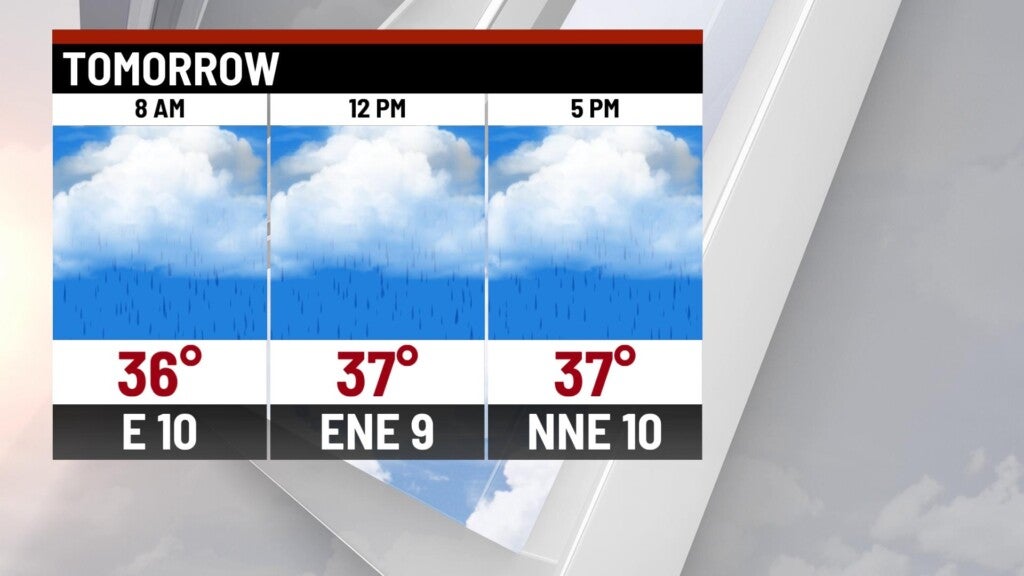
Sunday:
Snow showers should remain consistent Sunday morning in far northern Indiana, while downstate, most of the area will start the day off with rain or a rain/snow mix. Eventually, colder air dives in and changes everything back to all snow by late morning/early afternoon. Light additional accumulation is expected through the day.


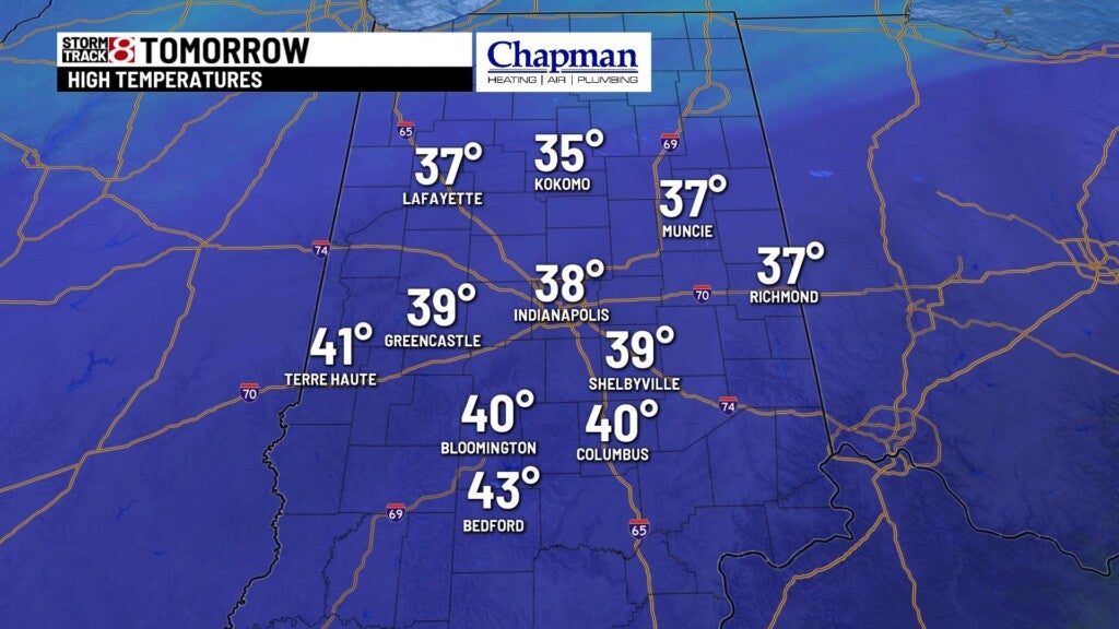
Highs top out in the upper 30s.
8 day forecast:
Scattered snow showers continue into Monday with little accumulation expected. Tuesday and Wednesday remain quiet and seasonable. Next system of interest arrives Thursday into Friday, bringing rain showers first, followed by another show of rain and snow showers to wrap up the work week.
