Saturday Evening Weather Advisory
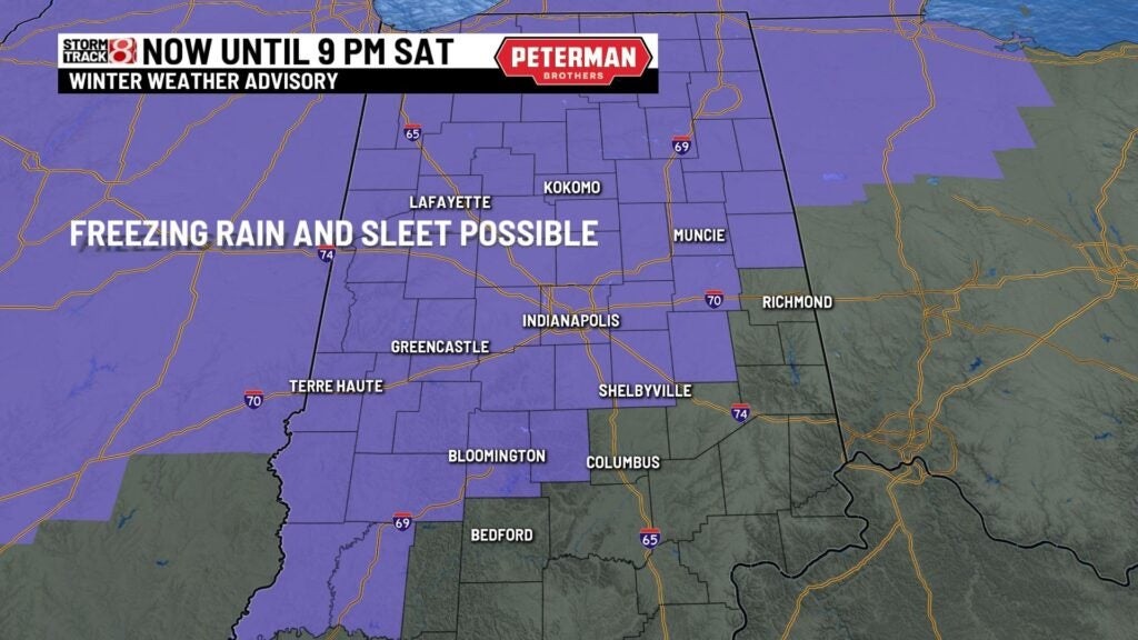
A Winter Weather Advisory is in effect until 9:00PM tonight. Rain will be freezing on contact with cold streets and sidewalks. Watch out for slippery driving and icy conditions until late tonight. After 9:00PM the freezing will change to rain showers as temperatures rise to about 35 by Sunday morning.
Tonight – Freezing rain changes to rain showers overnight. Temperatures below freezing rise to the mid 30s by Sunday morning.
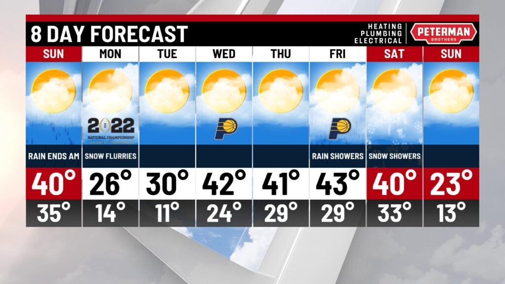
Sunday – Rain ends Sunday morning and then temperatures fall through the day. About 28 by Sunday afternoon.
Monday – Typical cold winter day with some snow flurries possible. Low 16 in the morning and high only 27 Monday afternoon.

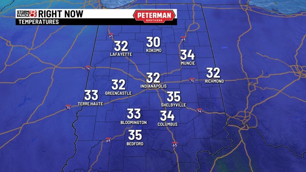
The air temperatures were part of the story Saturday afternoon and evening. Above freezing to the south of I-70 and below freezing north of I-70. The pavement temperatures were the determining factor for ice. Road and sidewalk temperatures were about 3-5 degrees colder statewide.
Saturday evening StormTracker indicated the ice and mixed precipitation mostly north of I-70 and just rain showers in the south half of the state.
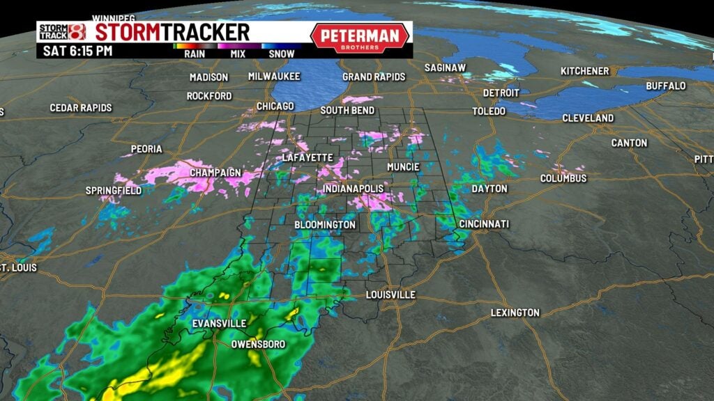
By later this evening the slightly warmer air and rain pushes into northern Indiana. Most of our streets and sidewalks will melt overnight.

The precipitation changes course moving from northwest to southeast so rain ends in central Indiana by mid morning Sunday.
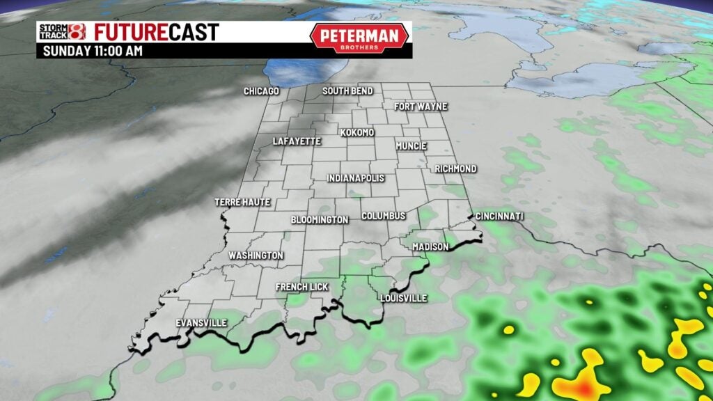
Unfortunately, the temperature reverses course Sunday also. Temps fall from the upper 30s in the morning down to the upper 20s by late afternoon.

8 Day Outlook – Very cold Tuesday and then a warm up back to the 40s the rest of the week. Next chance for precipitation should be rain showers on Friday.