


Storms return Sunday afternoon and evening
INDIANAPOLIS (WISH) — A few strong storms will be possible later this evening.
Today:
Upper level wave moving through this morning has provided some scattered showers and even a few thunderstorms. Those will slide to the north by mid morning. What’s left will be spotty showers and storms for much of the early to middle afternoon hours.
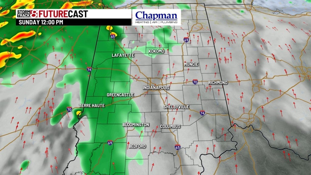

Highs top out in the upper 70s this afternoon.


Tonight:
Cold front marches through the state, bringing widespread showers and storms to the area. There is a slight risk for severe storms across much of the state. Time frame for severe weather will be between 7pm-2am.
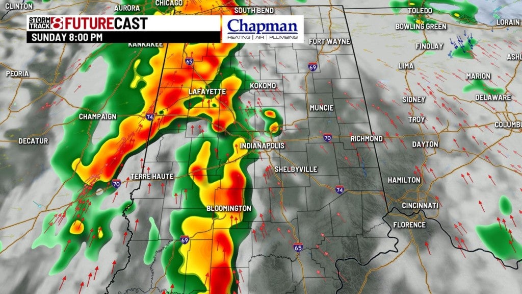

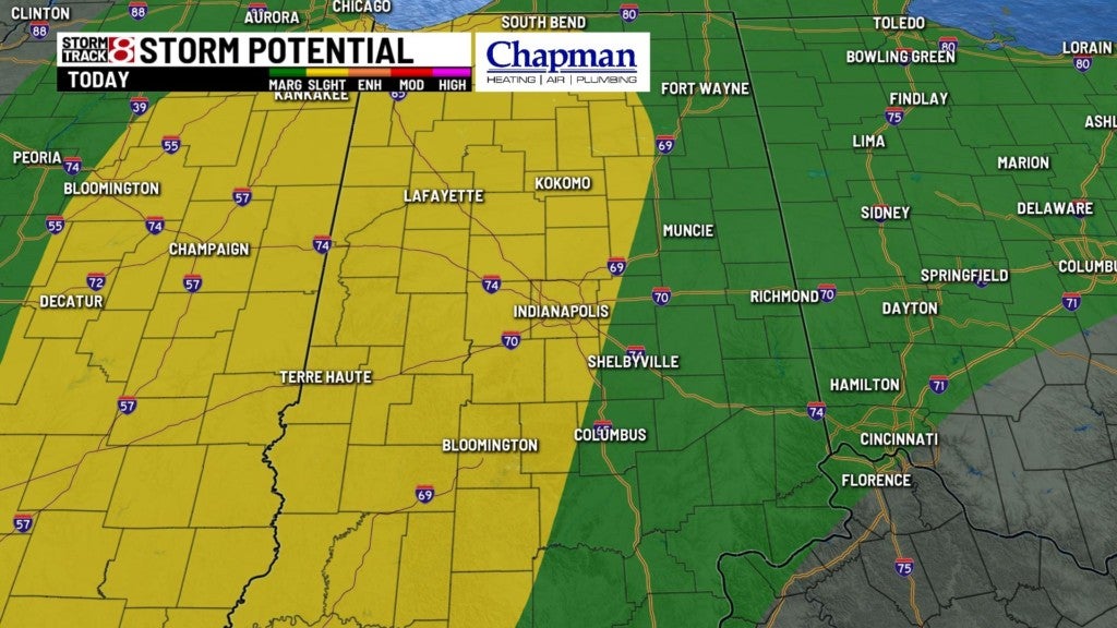
Biggest threats will be damaging wind with a few tornadoes possible.


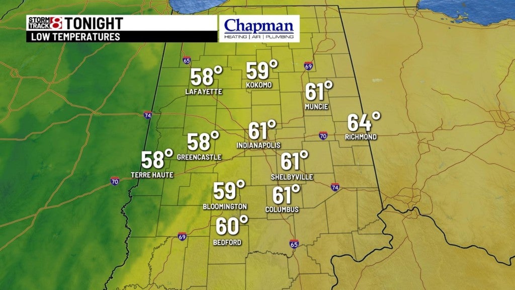
Lows fall to the lower 60s
Monday:
Upper level low will hang around the Midwest bringing cooler temperatures with occasional showers to kick off the work week.


Highs only hit the middle 60s.

Tropical Storm Arthur:
Our first named storm of the Atlantic season has arrived. Arthur is a Tropical storm with winds up to 40mph and about 260 miles off the coast of Georgia.

Arthur is not forecasted to intensify into a hurricane, and should stay off the coast of the United States.
8 day forecast:
With Arthur slowly moving northeast across the Atlantic, our weather pattern will be in log jam. Expect cloudy conditions with periodic rain chances Monday through Wednesday, with below normal temperatures. Once Arthur moves higher north over the Atlantic, our upper level low will move out, and high pressure will settle in for the end of the week with warmer temperatures and sunshine.
