Accumulating snow Wednesday and Thursday
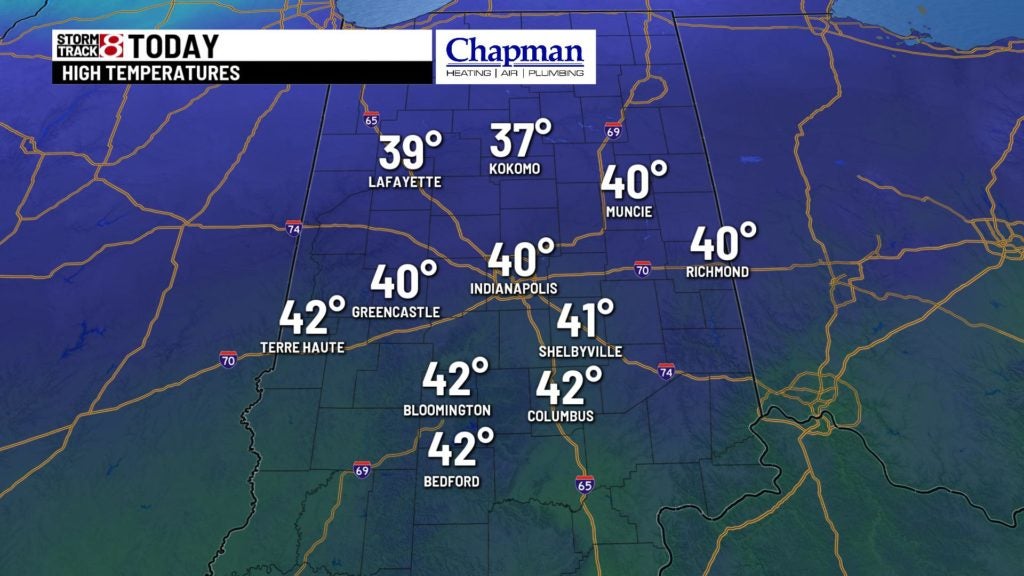
INDIANAPOLIS (WISH) — A chilly start to the morning with temperatures in the lower 30s and a cloudy sky. There could be a stray light mix south and southeast of the city but most will stay dry. Later Tuesday most should see a cloudy sky with a few breaks in the clouds
Highs top out in the upper 30s and lower 40s.
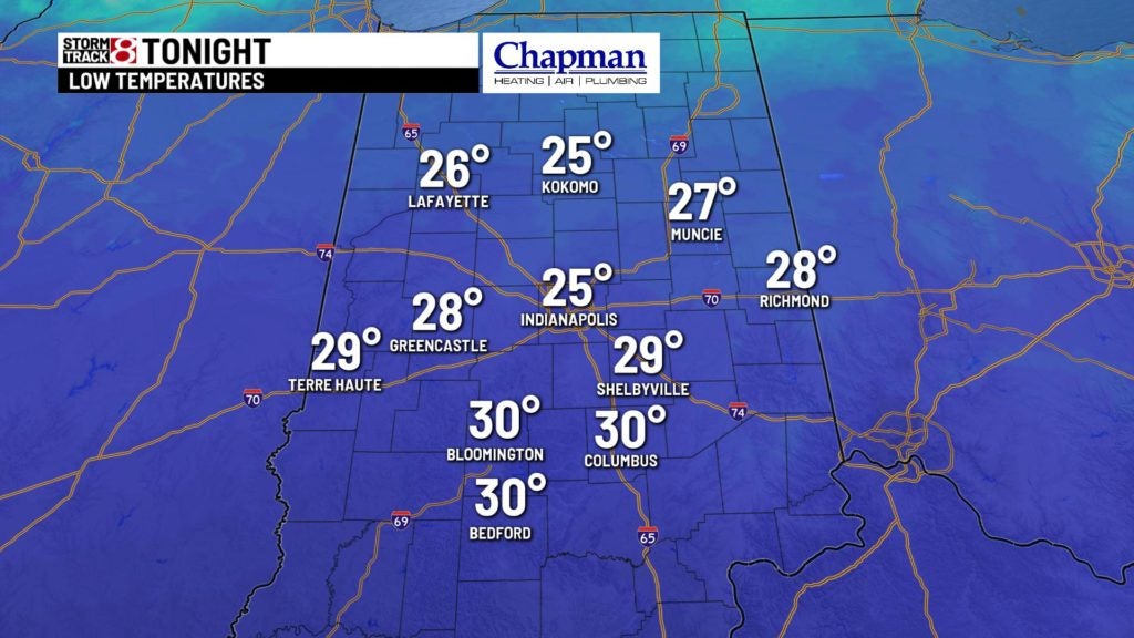
Tonight:
Quiet and chilly conditions under partly cloudy conditions. Lows fall to the middle to upper 20s.
Wednesday & Thursday:
Cloudy conditions will return to kick off our Wednesday. Another potent system will bring a chance for a wintry mix of rain and snow by late in the afternoon, but likely changes to all snow – especially north of I-70 by the evening hours. Snow should continue into the overnight and Thursday morning.

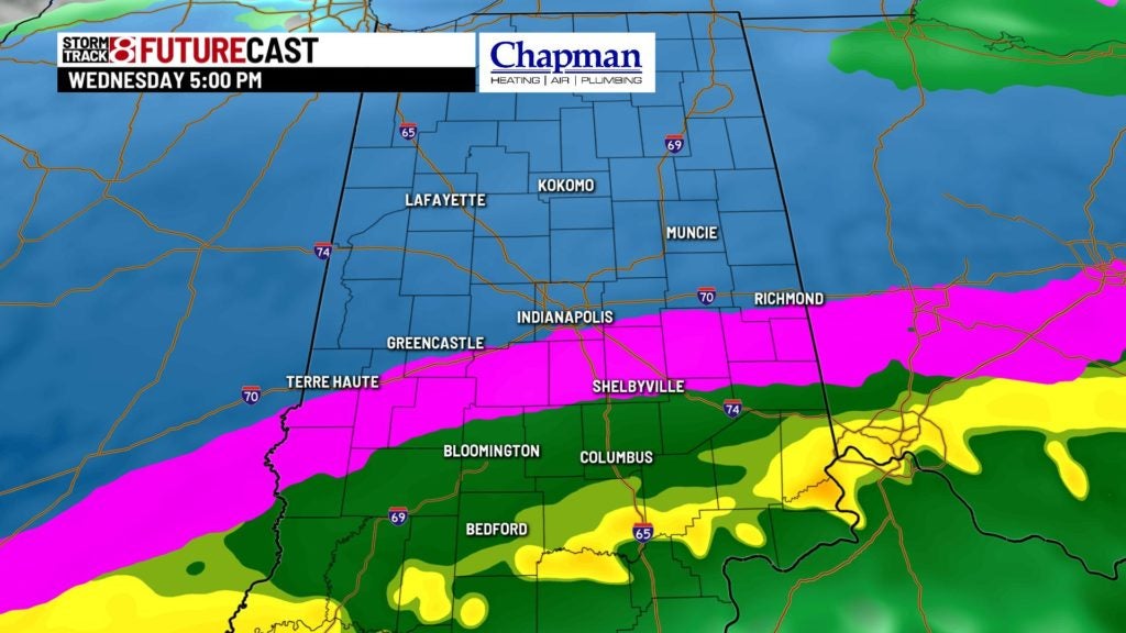
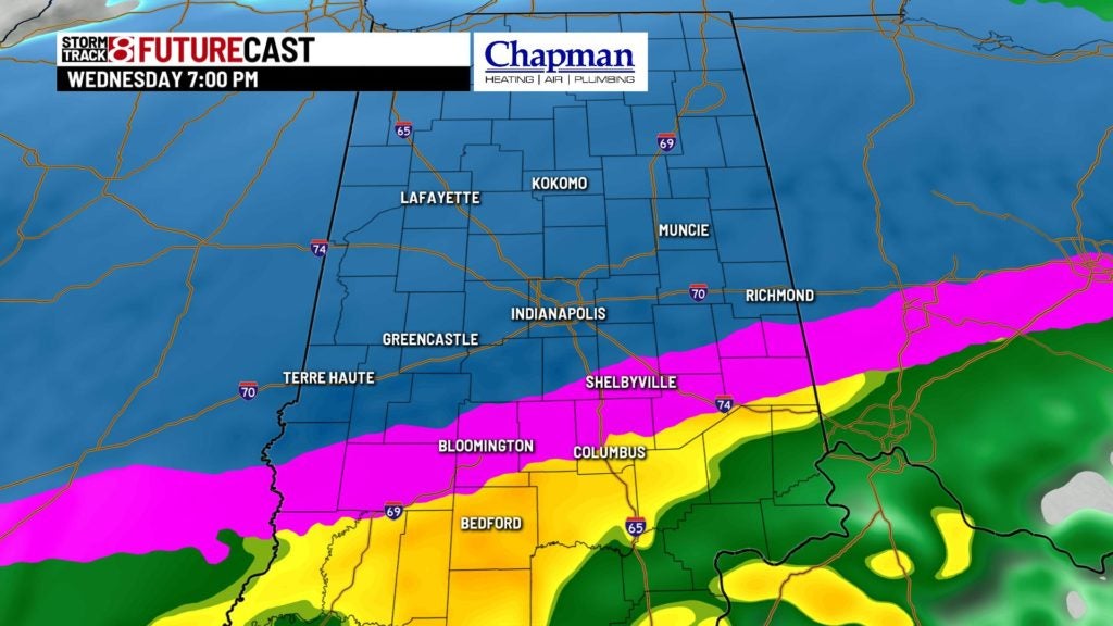
Some light snow accumulation will be possible around the Indy metro. Areas in northern portions of central Indiana could see several inches of snow before the snow moves out Thursday afternoon.

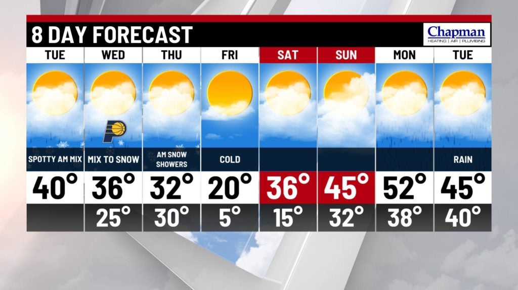
8 day forecast:
Much colder air moves in briefly on Friday, as highs only top out in the middle 20s. We’ll rebound quickly for the weekend, with highs in the 30s on Saturday, and back into the 40s on Sunday. We may even see highs get close to 50 on Monday and Tuesday.