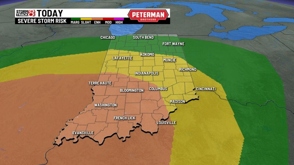
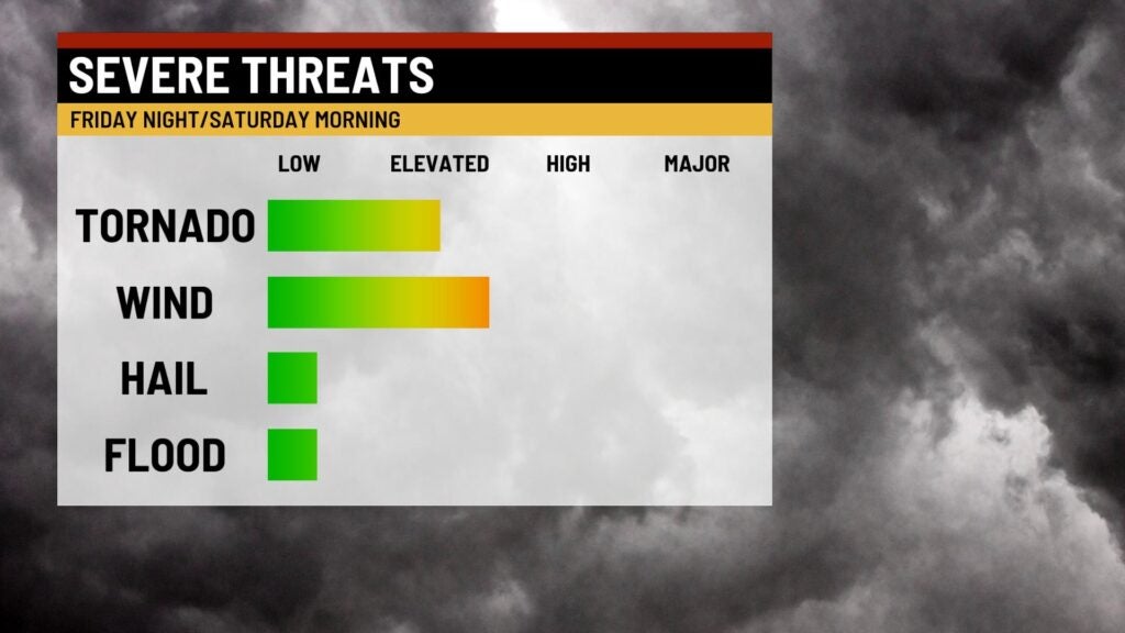
Severe weather threat Friday night
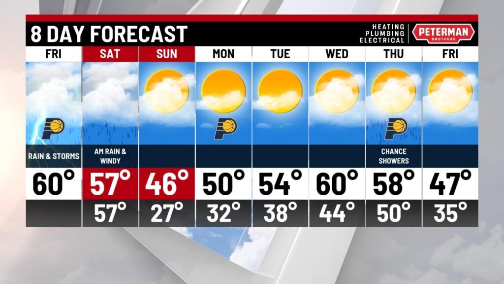
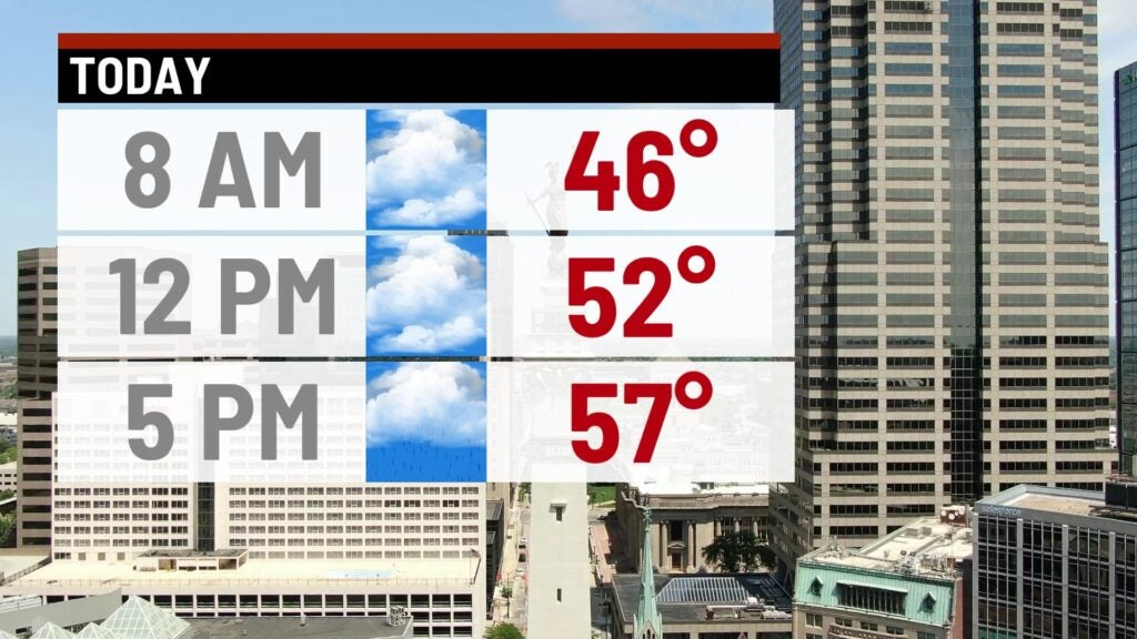
INDIANAPOLIS (WISH) – Foggy start to Friday morning for areas north and west of the city. It’s also a very mild start too with temperatures in the lower 40s. It should be a mostly cloudy day with highs climbing through the 50s during the afternoon.
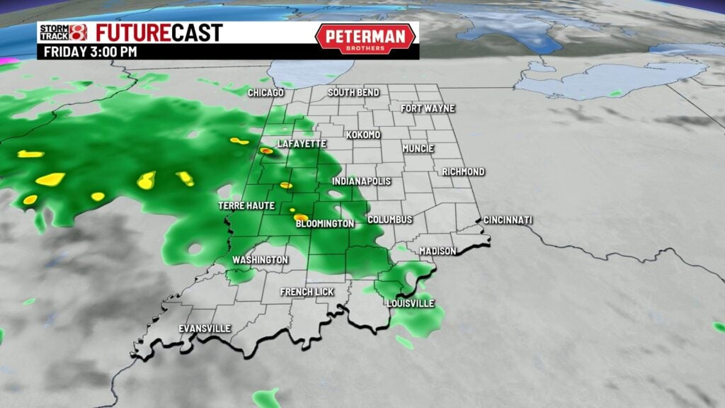
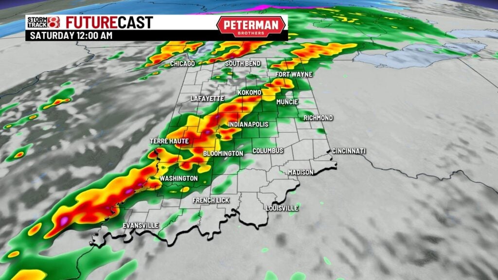
We have a fairly potent cold front that will pass through the state late Friday night which will bring in the threat of storm which could turn severe. Timing of the storms will be between 9 p.m.-6 a.m. Saturday morning. The main threats with the storms will be damaging winds, a few tornadoes and hail.

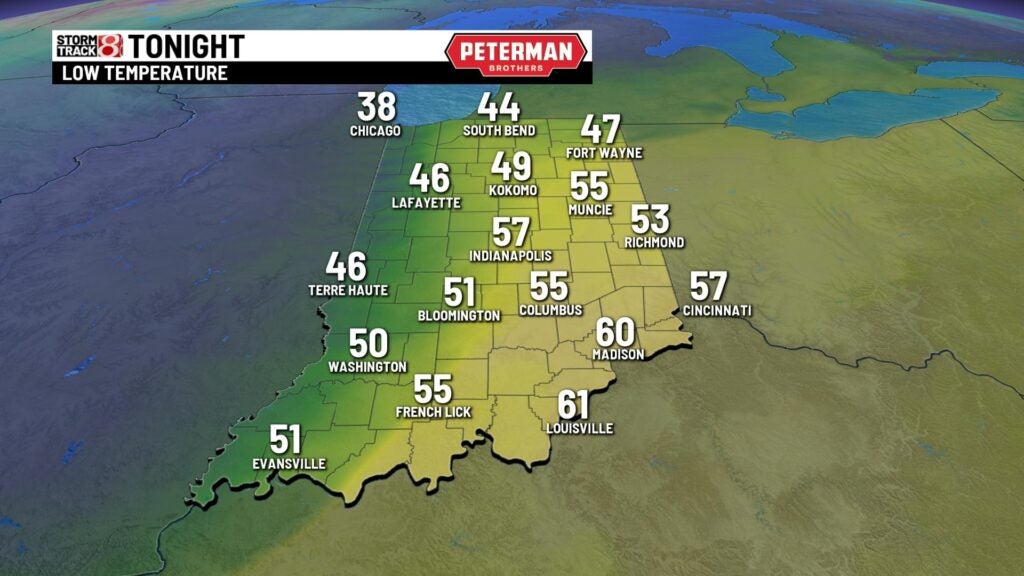
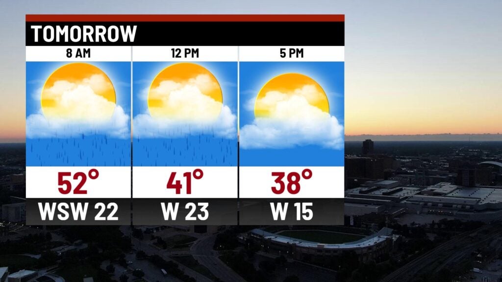
Showers will move out pre-daybreak Saturday and will usher in much colder air through the day with blustery winds along side with it! Highs will top out in the mid-30s during the day with mostly cloudy skies and blustery winds at 25-30 mph. It does get better Sunday with highs in the mid 40s with sunshine!
Very mild through the work week next week with highs in the lower 50s. Should see temperatures tick upwards through midweek with a lot of spots pretty close to 60°! The next chance for rain will arrive Thursday.