Major winter system to begin Thursday
INDIANAPOLIS (WISH) — One more quiet day is ahead for Wednesday before we deal with a potent weather system that will bring rain, snow, very high winds, and nail-biting cold.
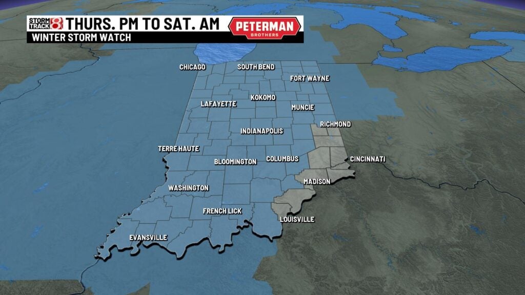
A Winter Storm Watch is in place for most of Indiana, and it will be in effect from late Thursday until early Saturday morning. There is the chance for upgrades to warnings over the next 24-36 hours. More details about this upcoming system can be found further below in the “UPCOMING WEATHER SYSTEM” section.
- What is a flash freeze? Why is it a concern?
- Purdue University launches Snowfall Climatology Toolbox
- Latest Storm Track 8 forecast
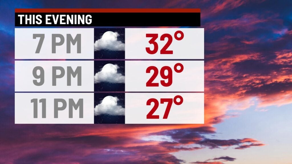
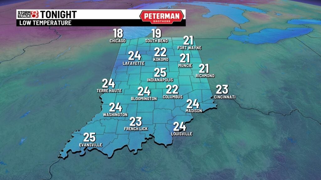
Tuesday night: We’re in for a mostly cloudy and chilly night with lows dipping into the low to mid 20s.
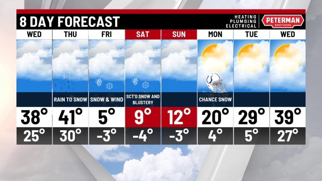
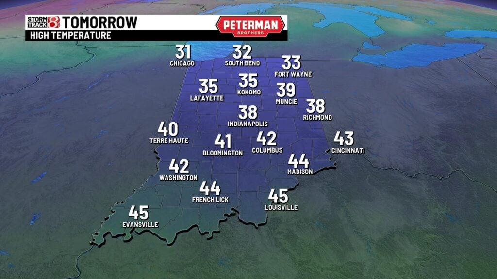
Wednesday: The final quiet day of the workweek will feature near average temperatures and mostly cloudy skies. Highs look to rise into the upper 30s to low 40s.
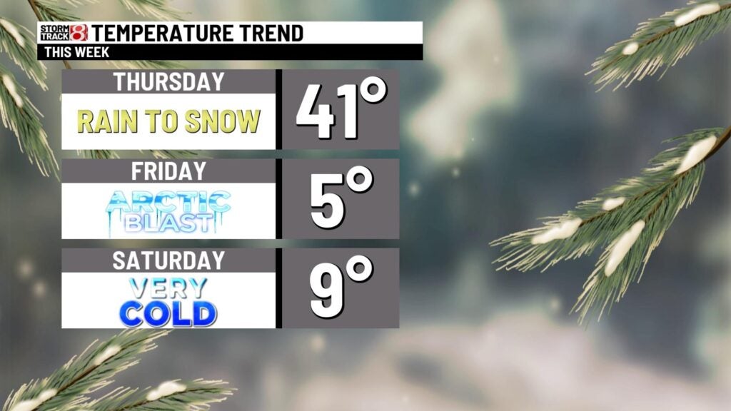
UPCOMING WEATHER SYSTEM: Thursday will feature the transition point toward a high-impact system that will usher in some snow accumulation, powerful wind gusts, and life-threatening cold. We look to bring in some rain to start before we changeover to snow as we progress into Thursday evening. Heavy snow is possible during the latter half of Thursday. By Friday morning, scattered snow showers will linger around before we move all precip by Friday night.
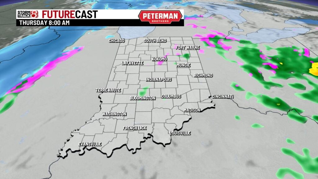
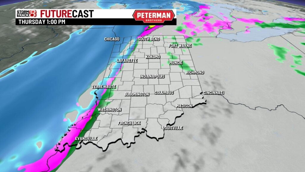
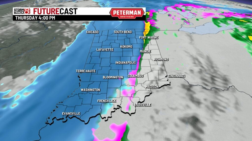
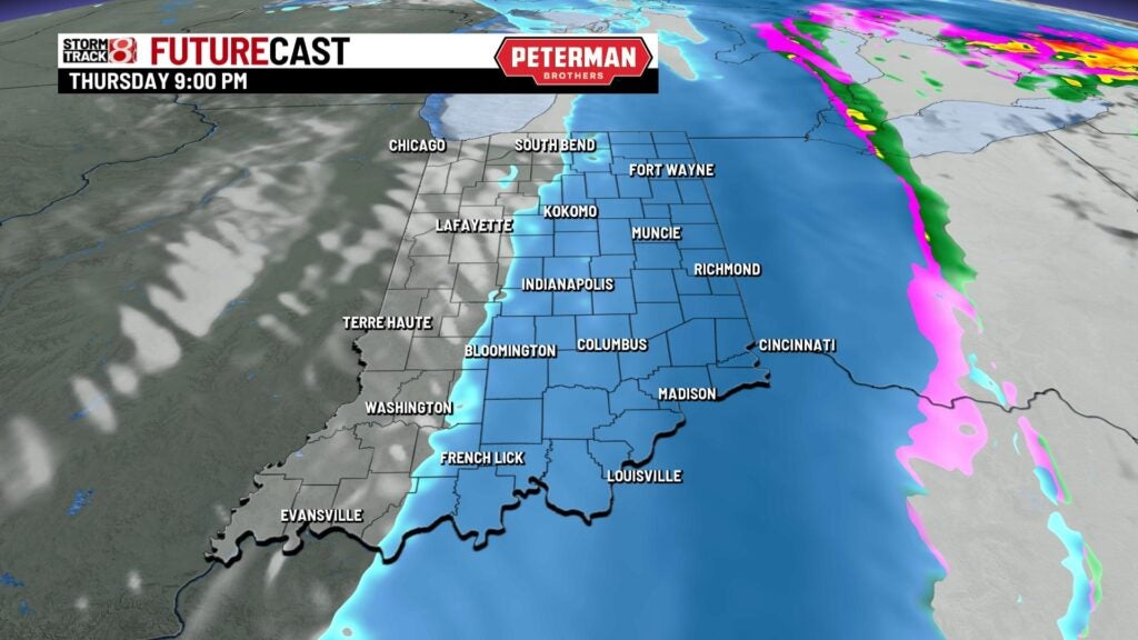
SNOW TOTAL POTENTIAL: We are currently thinking areas along interstate 70 and north toward Lafayette-Kokomo could see from 3 to 6 inches of snow. Higher snow amounts look to stay in far northern Indiana. The bulk of our snow looks to occur Thursday night.

DANGEROUS COLD AND WIND: Some of the bigger concerns that we have here in central Indiana is the drastic temperature change that is expected by Thursday night. We’re going to go from the 30s and 40s to the single digits in a matter of a couple hours. Wind gusts will also pick up substantially with gusts soaring toward 50-55 mph for Friday. This will lead way to a brutally cold and blustery Friday with wind chill values expected to be as low as 20 below zero to 30 below zero. High temperatures may fail to get out of the single digits for Friday and Saturday.

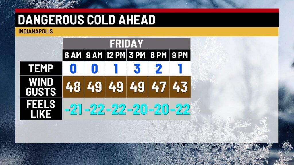
The wind will also create possible blizzard-like and whiteout conditions from the snow that is ongoing or has already fallen. This would create reduced visibilities. Blizzard warnings are actually not out of the question, and they could be issued.
FLASH FREEZE: Another concern that is important to note is we could see a “flash freeze” occur due to the rapid temperature drop Thursday night and damp pavement. Slick spots are likely by Friday, and with the high winds, will cause Friday to feature very hazardous conditions for traveling.
The bottom line is that no matter how much snow central Indiana sees, travel impacts are going to be heightened due to the aforementioned conditions above. Power outages are also possible as well.

8-Day Forecast: Christmas Eve on Saturday will stay very frigid with wind chill values once again as low as 20 below zero to 30 below zero. Christmas Day on Sunday is expected to be one of the coldest Christmas days on record.