Very cold to end the week
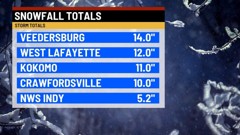
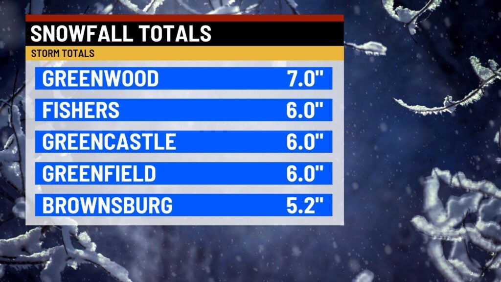
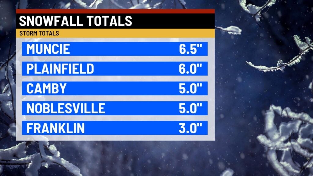
INDIANAPOLIS (WISH) — We are nearing the end of a winter storm in which several areas across the state picked up on fairly decent snow totals and ice accumulation. As we go into the weekend, bitter arctic air is set to lock into place.
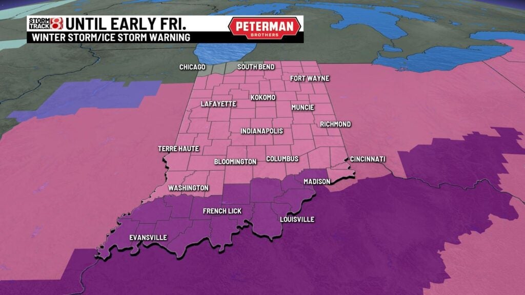
Winter Storm (pink) and Ice Storm (red-violet) Warnings remain in effect until early Friday morning.
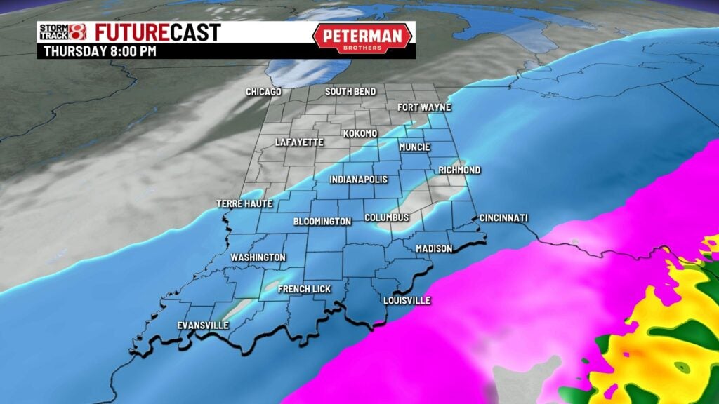
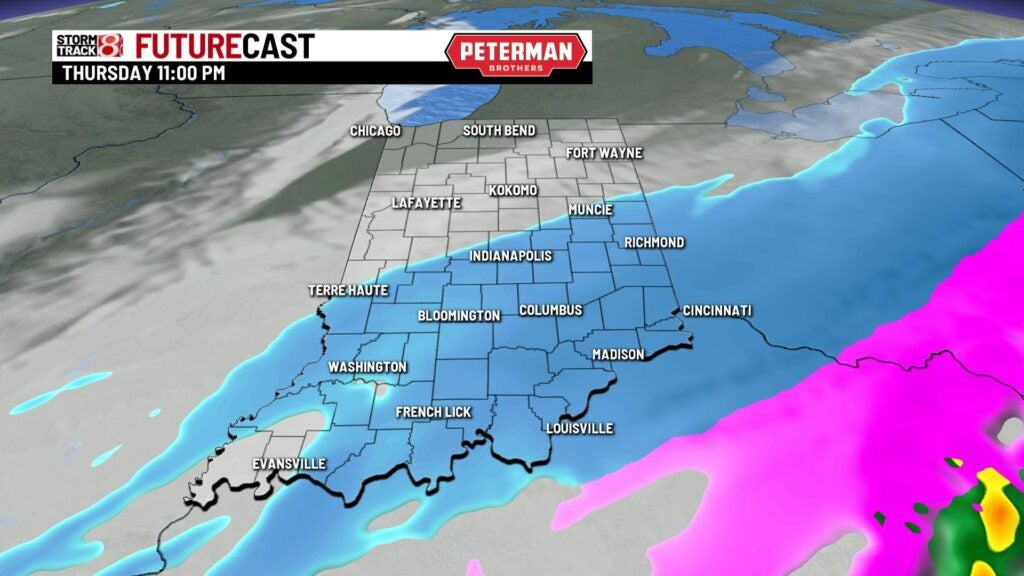
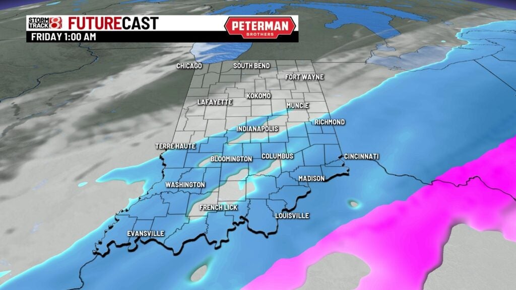
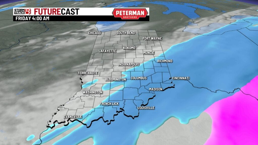
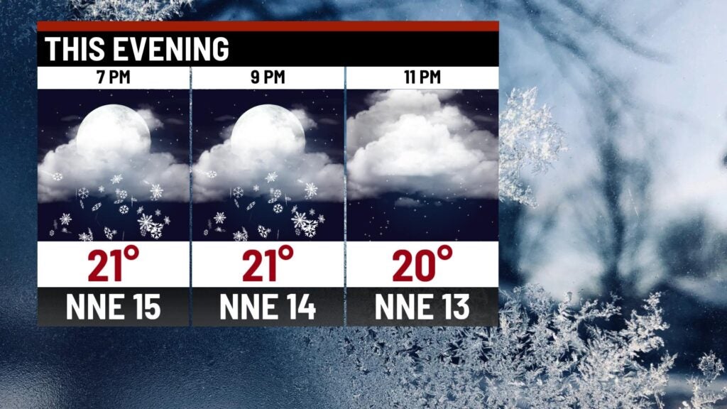
Thursday night: Moderate to heavy snowfall will continue into sunset before snowfall intensity decreases. Snow is set to eventually taper off completely by the overnight hours.
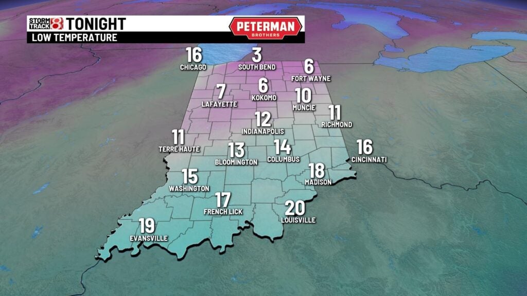
It will be quite cold tonight with numbers dipping into the single digits to mid teens.
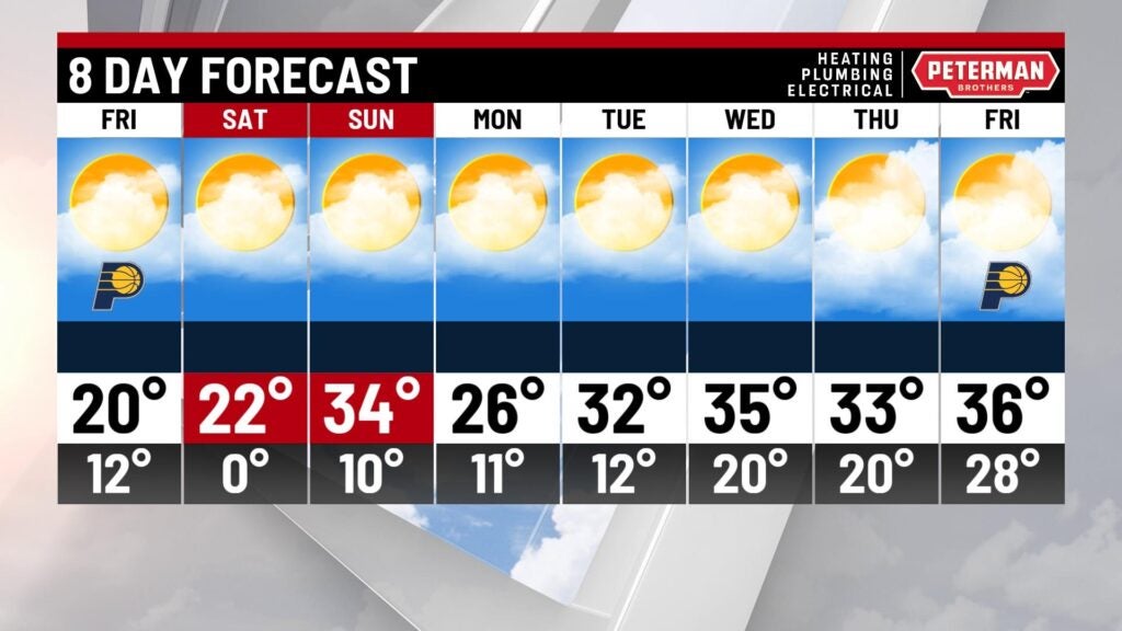
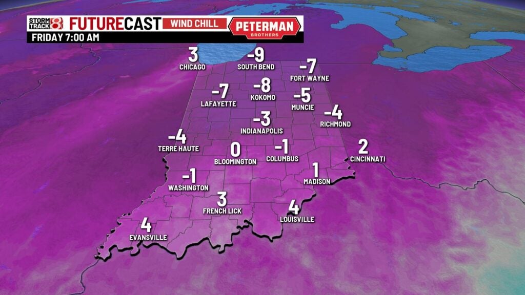
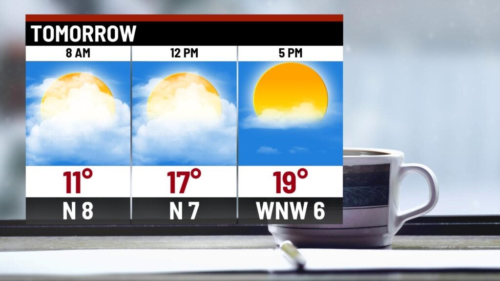
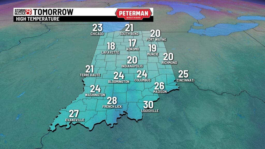
Friday: A frigid day will be on tap as we start off with some areas dealing with subzero wind chills. Clouds will decrease, making way for some afternoon sunshine. However, the sun won’t help much as temperatures only warm into the upper teens to low 20s. With how cold it will be, travel may still be difficult in some areas due to the recent snow and ice.
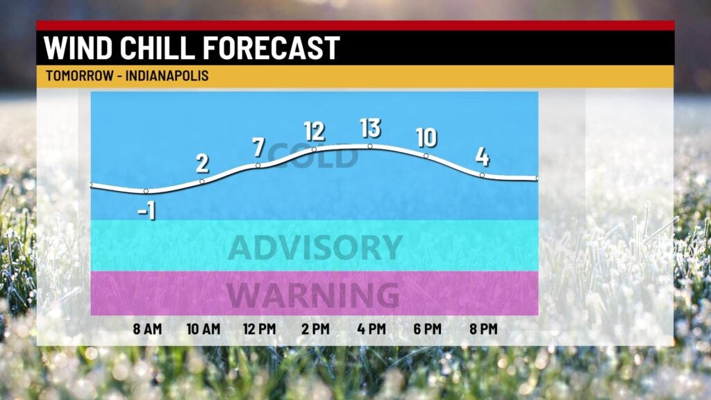
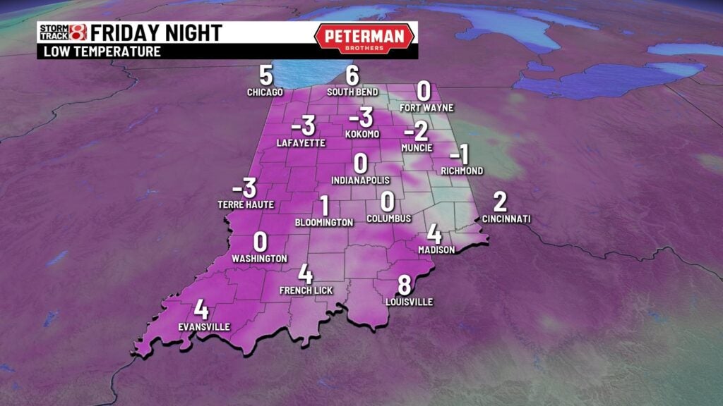
Friday night: Prepare for a freezing cold night as some locations tap into the negative single digits for the lows. Wind chill values will once again slip below zero overnight into early Saturday.
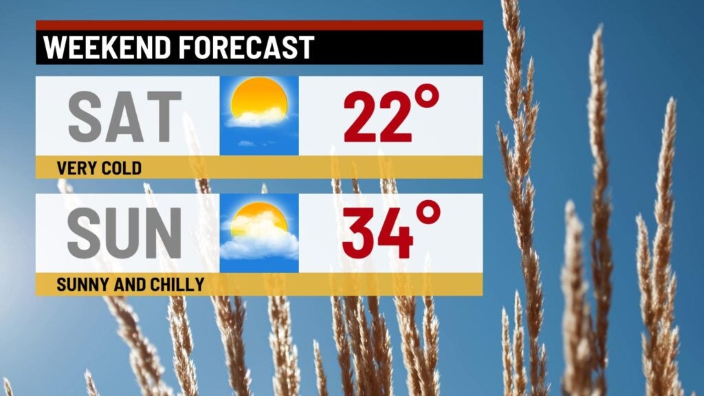
Weekend: Well below average temperatures stick around for our Saturday. Skies will remain bright as temperatures only manage to sneak into the upper teens to mid 20s. We look to then return to the 30s by Sunday.
8-Day Forecast: Extended dry time looks to stay with us through next week. Highs will quickly slip back into the 20s to start the new workweek. Then, near average numbers settle into the forecast for the remainder of the week.