Very cold night, then near-normal temps to follow
INDIANAPOLIS (WISH) — We worked in a fairly brisk Friday as we are coming off the heels of a winter storm. This arctic air will stick around going into the weekend before we see a return to near-average temperatures.
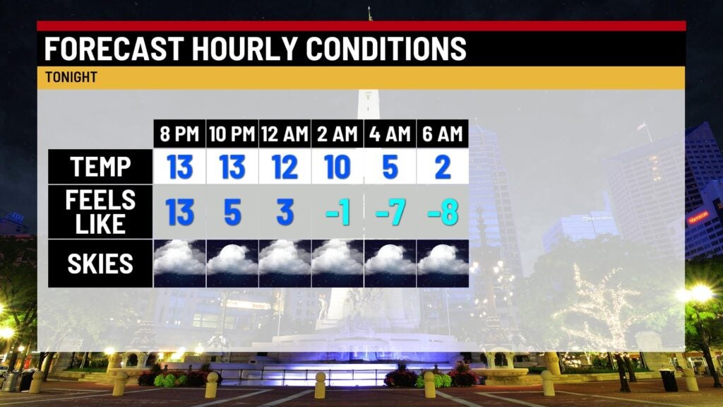
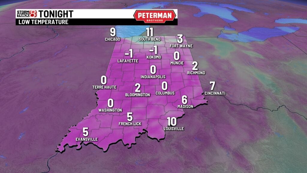
Friday night: Prepare for a bitterly cold night under partly cloudy skies. We can’t rule out flurries after sunset, but better snow chances will reside in northern Indiana.
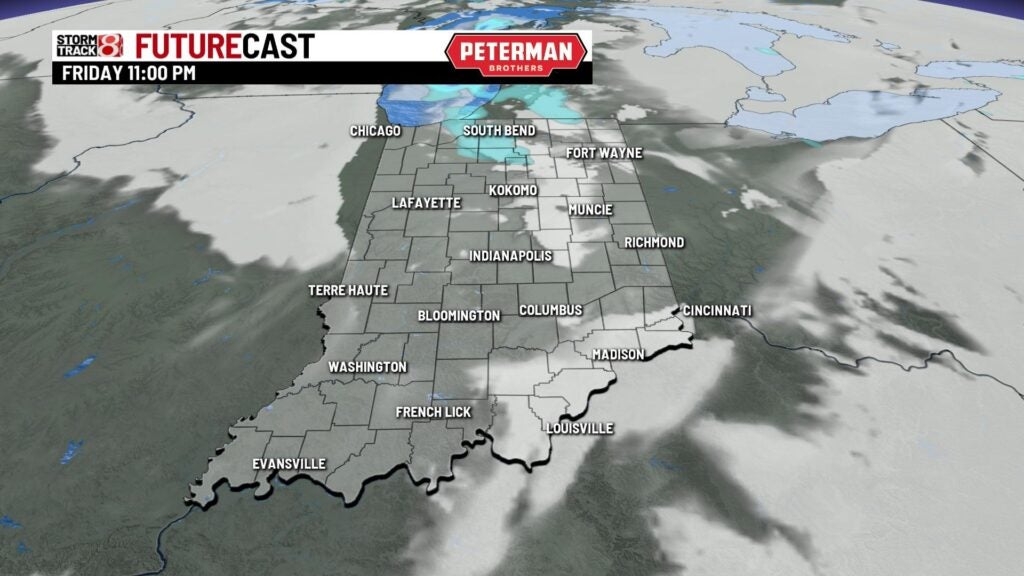
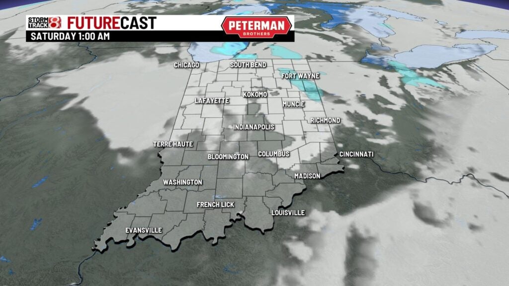
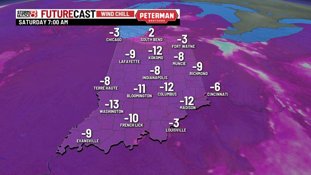
Lows will drop into the single digits with some areas even falling below zero. Wind chill values are expected to be in the range of -5 to -15 degrees by the wake-up call Saturday morning.
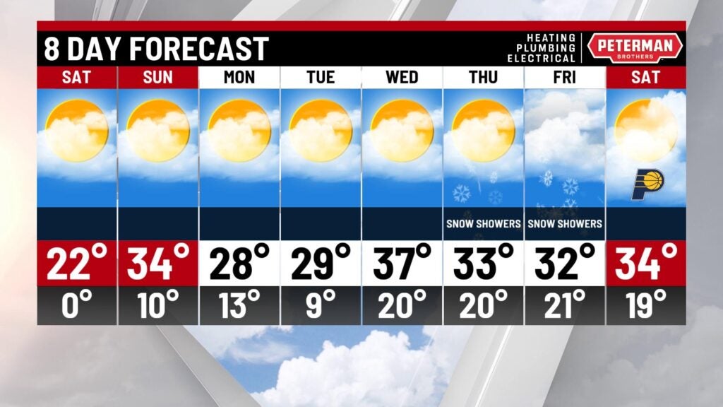
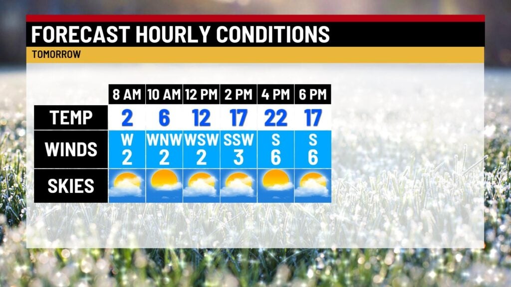
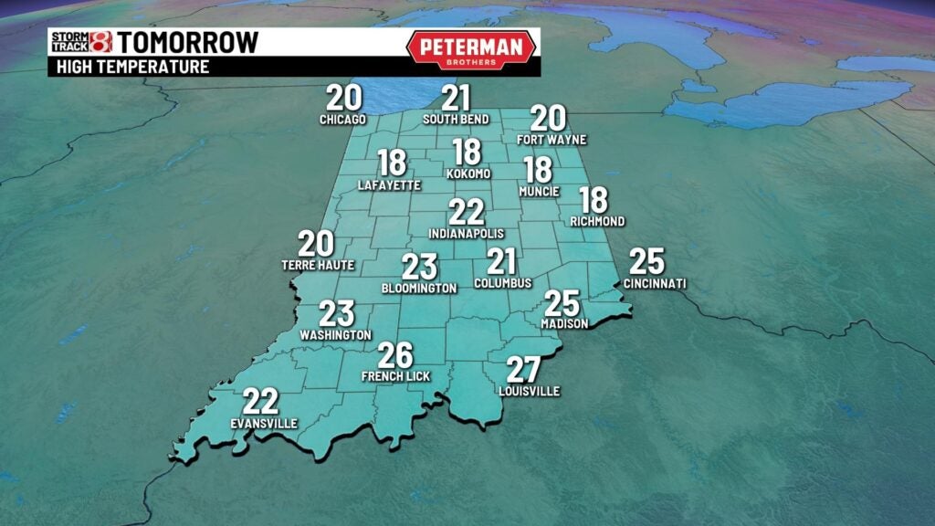
Saturday: We will hang onto the frigid air for our Saturday despite lots of sunshine making its way into the picture. Highs are set to once again struggle to get into the 20s.
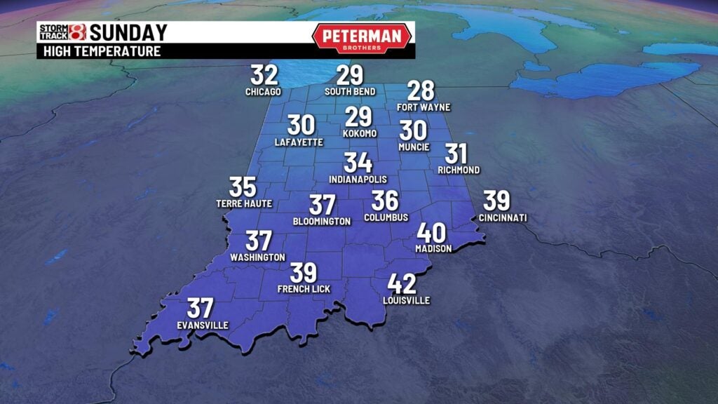
Sunday: The arctic air mass will subside a little bit after a frigid start to Sunday. Near-normal temperatures look to make a return with numbers rising into the low to mid 30s under partly cloudy skies.
8-Day Forecast: Slight colder conditions move in for the first half of next week with highs in the upper 20s. Highs will then creep back into the 30s for the remainder of the week. We look to stay quiet until the latter half of next week with a chance for snow.