


Sweltering week ahead
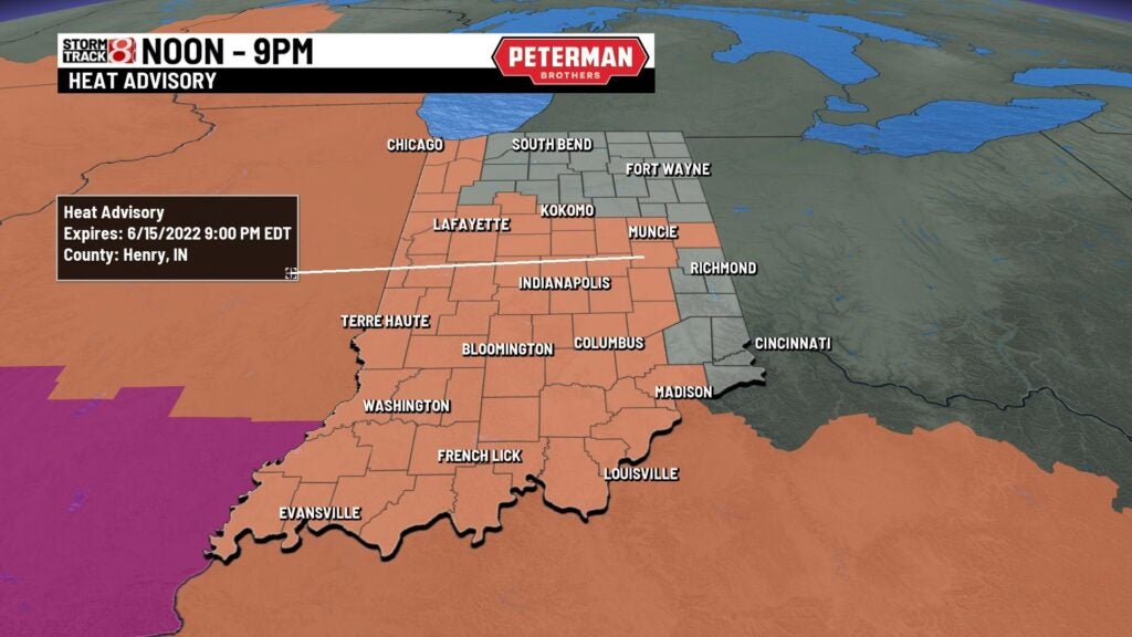
A very warm and humid start to a potential record breaking week of heat! Temperatures will start in the lower 70s with high humidity. We have a heat Advisory in play until 9pm for central parts of the state since feel like reading will touch the triple digits. This afternoon highs will soar to the lower 90s around the state with sunshine then storm chances will increase through the afternoon. We could see a stronger to severe storm later this afteroon with damaging winds, hail and isolated tornado and some heavy rain. There is a slight risk across the state. Lows tonight will cool to the mid 70s.


Tuesday will get even hotter with highs climbing to the upper 90s with high humidity making it feel well into the triple digits. We could be flirting with record breaking heat through mid week. We’ll see sunshine during the day. Highs remain sweltering Wednesday with highs in the mid to upper 90s with feel like temperatures in the triple digits with sunshine!
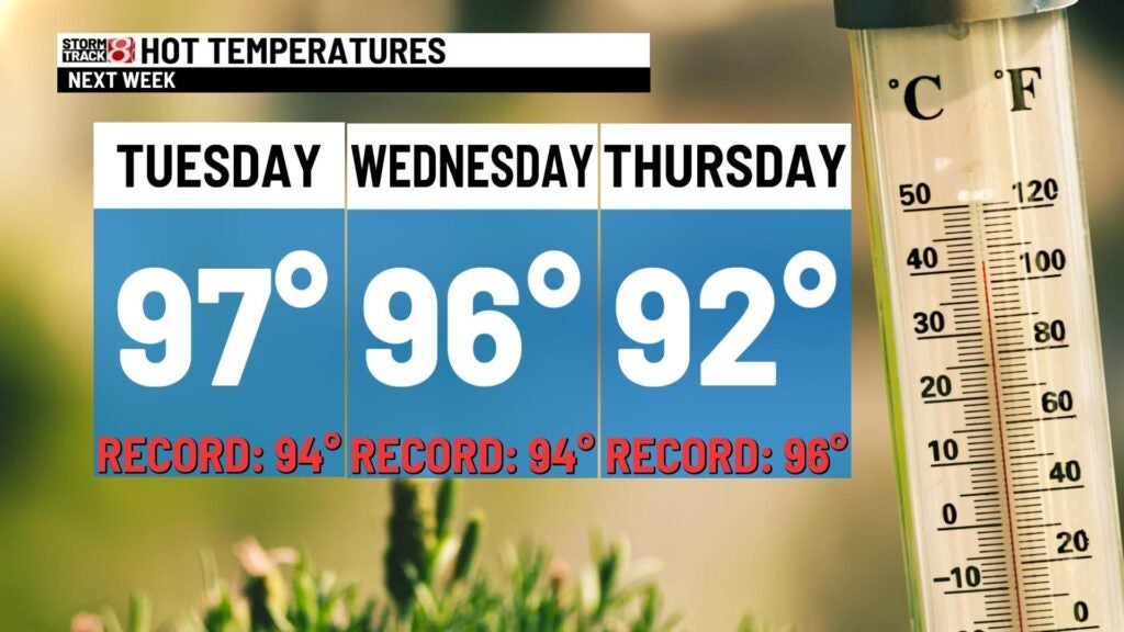

Thursday temperatures cool off a bit but not by much much, highs will still be in the lower 90s with highs humidity. We’ll factor in rain chances during the afternoon. Temperatures will continue to cool through the end of the week with highs Friday topping out in the mid 80s with sunshine.


Dry and a more manageable weekend temperature wise with highs in the mid 80s with dry conditions both Saturday and Sunday. Highs will remain in the mid 80s Sunday for Father’s Day. Still pretty toasty early next week with highs in the mid 80s.
